Sullivan's Island in Charleston County, South Carolina — The American South (South Atlantic)
Fort Moultrie Torpedo Storehouse
— Fort Sumter National Monument —
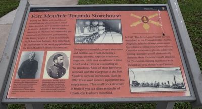
During the 1880s, with its defenses crumbling and obsolete, the United States needed a new system to defend its shores. A Board of Fortifications convened in 1885 and recommended the construction of massive gun batteries, like Battery Jasper, as well as minefields in 29 American harbors. The minefields in Charleston Harbor were supplied from the Fort Moultrie Military Reservation.
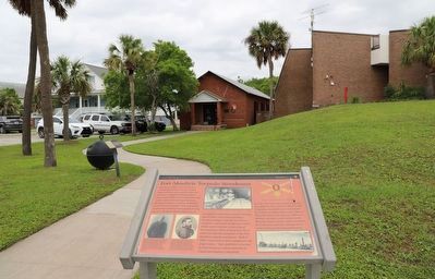
To support a minefield, several structures and facilities were built including a mining casemate, torpedo storehouse, magazine, cable tank storehouse, a mine wharf, and a tramway connecting all the structures. Most of them have been removed with the exception of the Fort Moultrie torpedo storehouse. Built in 1902, it was used to store equipment and empty mines. This small brick structure in front of you is a silent reminder of Charleston Harbor's minefield.
In 1917, The Army Mine Planter Service was added to the Coastal Artillery Corps. Originally, minefields were maintained by civilians working under Army officers. Once the mines were placed, soldiers in mining casemates could electronically detonate them if enemy vessels attacked. In Charleston, mining casemates were located at Forts Moultrie and Sumter.
Erected by National Park Service, U.S. Department of the Interior.
Topics. This historical marker is listed in these topic lists: Forts and Castles • Waterways & Vessels. A significant historical year for this entry is 1885.
Location. 32° 45.606′ N, 79° 51.475′ W. Marker is on Sullivan's Island, South Carolina, in Charleston County. Marker is at the intersection of Middle Street and Osceola Avenue, on the left when traveling east on Middle Street. Touch for map. Marker is at or near this postal address: 1214 Middle St, Sullivans Island SC 29482, United States of America. Touch for directions.
Other nearby markers. At least 8 other markers are within walking distance of this marker. Station Hospital (a few steps from this marker); a different marker also named Fort Moultrie Torpedo Storehouse (within shouting distance of this marker); Defending Charleston (within shouting distance of this marker); Northwest Bastionet (within shouting distance of this marker); Oceola / Patapsco Dead (within shouting distance of this marker); Powder Magazine (within shouting distance of this marker); Grave of General William Moultrie (within shouting distance of this marker); Traverse c.1820 (within shouting distance of this marker). Touch for a list and map of all markers in Sullivan's Island.
Also see . . . Fort Moultrie. National Park Service (Submitted on June 4, 2023.)
Credits. This page was last revised on June 4, 2023. It was originally submitted on May 22, 2023, by Dave W of Co, Colorado. This page has been viewed 64 times since then and 14 times this year. Photos: 1, 2. submitted on May 22, 2023, by Dave W of Co, Colorado. • Bernard Fisher was the editor who published this page.

