Fayetteville in Washington County, Arkansas — The American South (West South Central)
Fayetteville National Cemetery
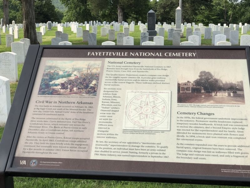
The first battle in Arkansas occurred on February 16, 1862, at Big Sugar Creek just south of the Missouri border. The next day, Union Gen. Samuel Curtis' Army of the Southwest continued its southward march.
The invasion culminated in the Battle of Pea Ridge three weeks later. Curtis defeated Gen. Earl Van Dorn's Confederate forces, which retreated east across the Mississippi River. The Battle at Prairie Grove in early December, also a Confederate defeat, left northern Arkansas firmly in Union control.
After the victory at Prairie Grove, federal troops occupied Fayetteville. In April 1863, Confederate troops attacked the city. They held the town briefly while the engagement continued, but eventually were forced to retreat. Except for a few months in summer 1863, Union forces occupied Fayetteville throughout the war.
National Cemetery
The US Army established Fayetteville National Cemetery in 1867. Remains were brought here from the battlefields of Pea Ridge, Prairie Grove, Cane Hill, and Fayetteville.
The Quartermaster Department created a compass-rose design for the roughly square cemetery lot. A circular grass walkway enclosed the burial sections and six interior walks provided access to the central flagpole. These walkways defined distinct burial sections.
Six sections were designated for soldiers from Arkansas, Illinois, Indiana, Iowa, Kansas, Missouri, Wisconsin, and for “Indian” soldiers. Diamond-shaped areas near the center were set aside for monuments. Officers were interred in triangular sections within the interior walkways.
By law, the secretary of war appointed a “meritorious and trustworthy” superintendent to manage the cemetery. To qualify for the position, an individual must have been an army enlisted man disabled in service. Josiah Nutting, formerly a private in the 19th Maine Infantry, was named superintendent in September 1867.
Cemetery Changes
In the 1870s, the federal government undertook improvements to the cemetery. Permanent marble headstones replaced temporary wooden headboards. A brick wall was constructed to enclose the cemetery, and a Second Empire-style lodge was erected for the superintendent and his family. Areas intended for monuments were planted with flowers and shrubs. In 1894, a brick-and-iron rostrum was completed for ceremonial events.
As the cemetery expanded over the years to provide additional burial space, original features have been removed. The compass-rose design was lost as walkways filled with graves. The lodge and rostrum were razed, and only a fragment of the boundary wall exists.
[Captions (left to right)]
• An 1889 lithograph depicting the Battle of Pea Ridge, March 6-8, 1862.Library of Congress
• Quartermaster Department sketch plan for cemetery, 1869. National Archives and Records Administration
• The cemetery in 1903. The lodge, rostrum, and most of the wall were removed in the late twentieth century. National Archives and Records Administration
Erected by U.S. Department of Veterans Affairs, National Cemetery Administration.
Topics. This historical marker is listed in these topic lists: Architecture • Cemeteries & Burial Sites • War, US Revolutionary. A significant historical date for this entry is February 16, 1862.
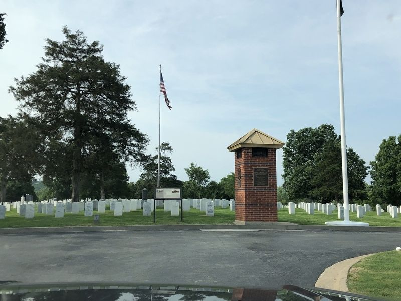
Location. 36° 3.166′ N, 94° 10.069′ W. Marker is in Fayetteville, Arkansas, in Washington County. Marker can be reached from the intersection of South Government Avenue and South Lt Col Leroy Pond Avenue. Marker is on the circular drive. Touch for map. Marker is at or near this postal address: 1000 S Lt Col Leroy Pond Ave, Fayetteville AR 72701, United States of America. Touch for directions.
Other nearby markers. At least 8 other markers are within walking distance of this marker. First Marine Division Memorial (a few steps from this marker); Pearl Harbor Memorial (a few steps from this marker); The Chosin Few (within shouting distance of this marker); Revolutionary War Soldier Memorial (within shouting distance of this marker); Oaks Cemetery (about 400 feet away, measured in a direct line); Lynching in America / Racial Terrorism in Washington County (about 500 feet away); Fayetteville Female Seminary (approx. 0.7 miles away); Evergreen Cemetery (approx. 0.7 miles away). Touch for a list and map of all markers in Fayetteville.
Credits. This page was last revised on May 23, 2023. It was originally submitted on May 23, 2023, by Duane and Tracy Marsteller of Murfreesboro, Tennessee. This page has been viewed 70 times since then and 19 times this year. Photos: 1, 2. submitted on May 23, 2023, by Duane and Tracy Marsteller of Murfreesboro, Tennessee.

