Near Critz in Patrick County, Virginia — The American South (Mid-Atlantic)
Reynolds Homestead
September 9, 2009
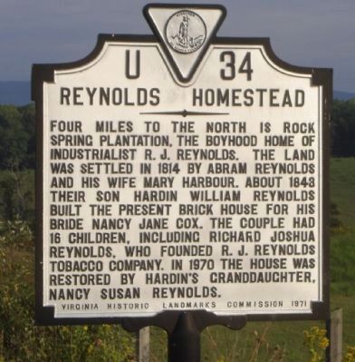
1. Reynolds Homestead Marker
Four miles to the north is Rock Spring Plantation, the boyhood home of industrialist R. J. Reynolds. The land was settled in 1814 by Abram Reynolds and his wife Mary Harbour. About 1843 their son Hardin William Reynolds built the present brick house for his bride Nancy Jane Cox. The couple had 16 children, including Richard Joshua Reynolds, who founded R.J. Reynolds Tobacco Company. In 1970 the house was restored by Hardin's granddaughter, Nancy Susan Reynolds.
Erected 1971 by Virginia Historic Landmarks Commission. (Marker Number U-34.)
Topics and series. This historical marker is listed in these topic lists: Industry & Commerce • Settlements & Settlers. In addition, it is included in the National Historic Landmarks, and the Virginia Department of Historic Resources (DHR) series lists. A significant historical year for this entry is 1814.
Location. 36° 35.963′ N, 80° 9.444′ W. Marker is near Critz, Virginia, in Patrick County. It is at the intersection of JEB Stuart Highway (U.S. 58) and Abram Penn Highway (County Route 626), on the right when traveling north on JEB Stuart Highway. Touch for map. Marker is in
this page online

Regionally, this marker is in Southern Virginia and in the Blue Ridge Highlands. It is also in the American South, specifically in the Upper South, in Appalachia, and specifically in Southern Appalachia. Globally, it is in North America, the Western Hemisphere, the Western World, and the Anglosphere. Historically, it finds itself in what was once the territory of the Mississippian Culture, one of the original Thirteen Colonies, one of the Confederate States of America, and the Antebellum South.
Other nearby markers. At least 8 other markers are within 6 miles of this marker, measured as the crow flies: A different marker also named The Reynolds Homestead (approx. 3.1 miles away); Rock Spring Plantation (approx. 3.1 miles away); Creamery & Ice House (approx. 3.1 miles away); Plantation Kitchen (approx. 3.1 miles away); Historic Home (approx. 3.1 miles away); Family Cemetery (approx. 3.1 miles away); Tobacco Barn (approx. 3.2 miles away); Frontier Fort (approx. 5.7 miles away). Touch for a list and map of all markers in Critz.
Also see . . . Reynolds Family Homestead.
Photographed by J. J. Prats, May 27, 2013
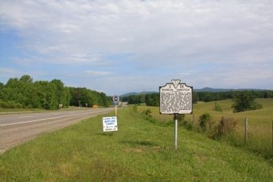
2. Reynolds Homestead Marker
Photographed by J. J. Prats, May 27, 2013
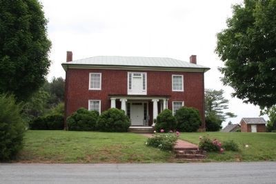
3. Rock Spring
The plantation is open to the public and there is no admission charge.
Photographed by J. J. Prats, May 27, 2013
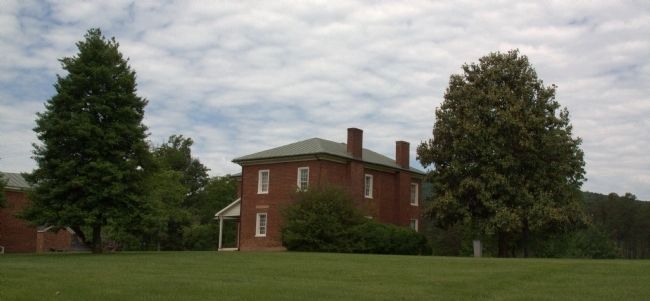
4. Rear View of the Reynolds Home

Photographed by Devry Becker Jones (CC0), July 2, 2026
5. National Historic Landmark plaque for the Reynolds Homestead
Credits. This page was last revised on February 17, 2022. It was originally submitted on September 12, 2009, by Craig Swain of Leesburg, Virginia. This page has been viewed 1,531 times since then and 44 times this year. Photos: 1. submitted on September 12, 2009, by Craig Swain of Leesburg, Virginia. 2, 3, 4. submitted on June 9, 2013, by J. J. Prats of Powell, Ohio. 5. submitted on July 6, 2026, by Devry Becker Jones of Washington, District of Columbia.
