Floydale near Hamer in Dillon County, South Carolina — The American South (South Atlantic)
Kentyre Presbyterian Church
Photographed by Dave W, May 25, 2023
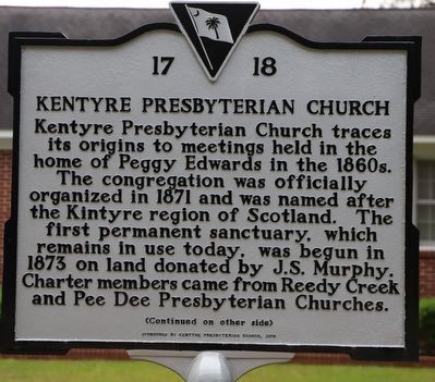
1. Kentyre Presbyterian Church Marker, Side One
Kentyre Presbyterian Church traces its origins to meetings held in the home of Peggy Edwards in the 1860s. The congregation was officially organized in 1871 and was named after the Kintyre region of Scotland. The first permanent sanctuary, which remains in use today, was begun in 1873 on land donated by J.S. Murphy. Charter members came from Reedy Creek and Pee Dee Presbyterian Churches.
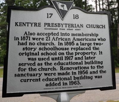
Also accepted into membership in 1871 were 21 African Americans who had no church. In 1895 a large two-story schoolhouse replaced the original school on the property. It was used until 1917 and later served as the educational building for the church. Renovations to the sanctuary were made in 1956 and the current educational building was added in 1963.
Erected 2018 by Kentyre Presbyterian Church. (Marker Number 17-18.)
Topics. This historical marker is listed in these topic lists: African Americans • Education • Religion & Religious Structures. A significant historical year for this entry is 1871.
Location. 34° 27.323′ N, 79° 18.517′ W. Marker is near Hamer, South Carolina, in Dillon County. It is in Floydale. It is at
this page online

Regionally, this marker is in the Pee Dee. It is also in the American South and specifically in the Deep South. Globally, it is in North America, the Western Hemisphere, the Western World, and the Anglosphere. Historically, it finds itself in what was once the territory of the Mississippian Culture, one of the original Thirteen Colonies, one of the Confederate States of America, and the Antebellum South.
Other nearby markers. At least 8 other markers are within 5 miles of this marker, measured as the crow flies: Main Street Methodist Church (approx. 4.4 miles away); Dillon Graded School and Dillon Public School (approx. 4.4 miles away); Dillon Theatre (approx. 4.4 miles away); 112 North MacArthur Avenue (approx. 4½ miles away); 106 North MacArthur Avenue (approx. 4½ miles away); Duncan McLaurin (approx. 4½ miles away); Anderson Brothers Bank (approx. 4½ miles away); Mayors of Dillon
Photographed by Dave W, May 25, 2023
2. Kentyre Presbyterian Church Marker, Side Two
Photographed by Dave W, May 25, 2023
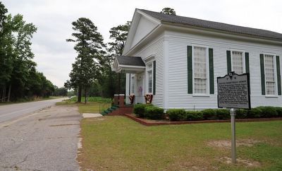
3. Kentyre Presbyterian Church Marker
Credits. This page was last revised on June 3, 2023. It was originally submitted on May 26, 2023, by Dave W of Co, Colorado. This page has been viewed 414 times since then and 36 times this year. Photos: 1, 2, 3. submitted on May 26, 2023, by Dave W of Co, Colorado. • Devry Becker Jones was the editor who published this page.
