Fort Payne in DeKalb County, Alabama — The American South (East South Central)
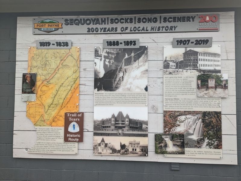
Sequoyah | Socks | Song | Scenery
200 Years of Local History
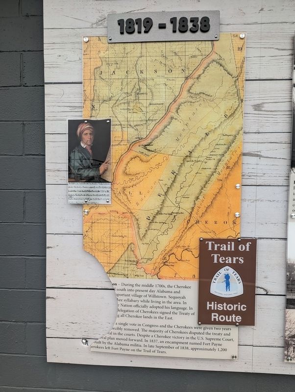
1819-1838
(partially broken)
?on - During the middle 1700s, the Cherokee
?south into present day Alabama and
?important village of Willstown. Sequoyah
?kee syllabary while living in the area. In
?e Nation officially dropped his language. In
?delegation of Cherokees signed the Treaty of
?g all Cherokee lands in the East.
?a single vote in Congress and the Cherokees were given two years
?forcibly removed. The majority of Cherokees disputed the treaty and
?val in the courts. Despite a Cherokee victory in the U.S. Supreme Court,
?removal plan moved forward. In 1837, an encampment named Fort Payne
?built by the Alabama militia. In late September 1838, approximately 1,200 Cherokees left Fort Payne on the Trail of Tears.
Panel 2
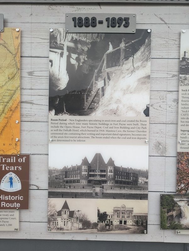
1888-1893
New Englanders speculating in area's iron and coal created the Boom Period during which time many historic buildings in Fort Payne were built. These included the Opera House, Fort Payne Depot, Coal and Iron Building and City Park as well as the DeKalb Hotel, which burned in 1918. Manitou Cave, the former Cherokee ceremonial site containing their writing and important dated signatures, becomes one of the area's first tourist attractions. The boom ended when the coal and iron deposits were determined to be inferior.
Panel 2
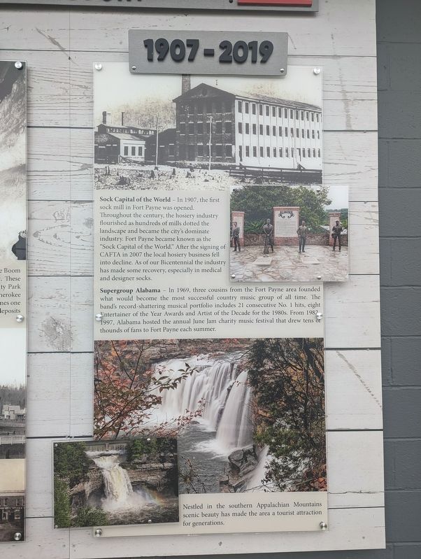
1907-2019
Sock Capital of the World-in 1907, the first sock mill in Fort Payne was opened. Throughout the century, the hosiery industry flourished as hundreds of mills dotted the landscape and became the city's dominate industry. Fort Payne became known as the "Sock Capital of the World." After the signing of CAFTA in 2007 the local hosiery business fell into decline. As of our Bicentennial the industry has made some recovery, especially in medical and designer socks.
Supergroup Alabama-In 1969, three cousins from the Fort Payne area founded what would become the most successful country music group of all time. The band's record-shattering musical portfolio includes 21 consecutive No. 1 hits, eight Entertainer of the Year Awards and Artist of the Decade for the 1980s. From 1982-1997, Alabama hosted the annual June Jam charity music festival that drew tens of thousands of fans to Fort Payne each summer.
Nestled in the southern Appalachian Mountains scenic beauty has made the area a tourist attraction for generations.
Topics. This historical marker is listed in these topic lists: Entertainment • Industry & Commerce • Native Americans. A significant historical month for this entry is September 1838.
Location. 34° 26.675′ N, 85° 43.139′ W. Marker
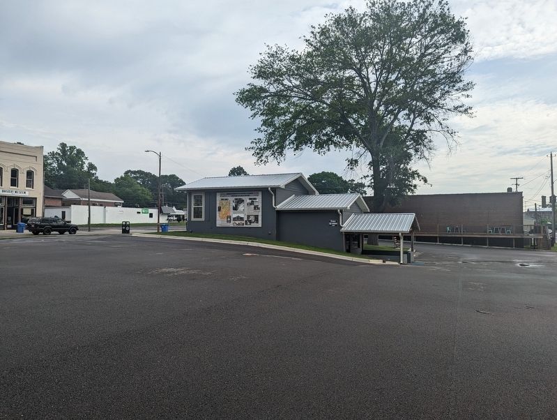
is in Fort Payne, Alabama, in DeKalb County. Mounted to the west side of the tourist information building. Touch for map. Marker is at or near this postal address: 509 Gault Ave N, Fort Payne AL 35967, United States of America. Touch for directions.
Other nearby markers. At least 8 other markers are within walking distance of this marker. Fort Payne Opera House (within shouting distance of this marker); Boom Town Historic District (within shouting distance of this marker); Confederate Monument (about 300 feet away, measured in a direct line); Fort Payne’s Fort (about 500 feet away); Sequoyah (about 500 feet away); Wills Town Mission (about 500 feet away); Whittler's Corner (about 600 feet away); Alabama (about 600 feet away). Touch for a list and map of all markers in Fort Payne.
Credits. This page was last revised on May 29, 2023. It was originally submitted on May 29, 2023, by Mike Wintermantel of Pittsburgh, Pennsylvania. This page has been viewed 115 times since then and 33 times this year. Photos: 1, 2, 3, 4, 5. submitted on May 29, 2023, by Mike Wintermantel of Pittsburgh, Pennsylvania.
