Antwerpen, Flanders, Belgium — Northwestern Europe
Ruihuis
NL Verdedigingsgordel of riool?
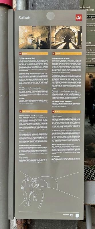
In de 11de eeuw nam de bevolking van Antwerpen enorm toe. Veel inwoners gingen wegens plaatsgebrek buiten de omwalling wonen. Om ook hun woongebied te bescher men werd een watersingel aangelegd: de ruien. De stad groeide verder en de verdedigingsgordel werd uitgebreid met nieuwe waterwegen en omwallingen. De ruien deden dienst als binnenhaven en als afwateringskanalen voor regen- en afvalwater.
Eeuwenlang loosden de Antwerpenaars afval in de ruien, met een grote stank en ziektes als gevolg. In de 19de eeuw werd er doortastend opgetreden: de ruien werden overwelfd en muren werden rechtgetrokken. Op het einde van de 19de eeuw waren de ruien officieel een riool en verdwenen ze uit het stadsbeeld. Vandaag stroomt er nog steeds afvalwater door de ruien, maar het loopt door le dingen en wordt gezuiverd voor het in de Schelde terechtkomt.
Wandeling door ondergrondse kanalen
Sinds 2005 kunt u dit stukje geschiedenis ontdekken met een geleide wandeling. U loopt en vaart ondergronds langs gewelven en fundamenten, bruggen en sluizen. Met de straatnaambordjes van de bovenliggende straten kunt u zich orienteren.
Wist u dit?
Tijdens de Tweede Wereldoorlog organiseerden de geal. lieerden feestjes in de ruien omdat het daar redelijk veilig was voor bombardementen.
DE Verteidigungsgürtel oder Abwasserkanal?
Im 11. Jahrhundert explodierte die Einwohnerzahl Ant werpens, weshalb sich viele Bürger außerhalb der wehrhaften Umwallung niederließen. Um auch ihre Sicherheit zu gewährleisten, wurde ein Ringgraben angelegt. Der artige Wasserläufe wurden (und werden) in Antwerpen ruien genannt. Mit der Ausbreitung der Stadt kamen weitere ruien und Umwallungen hinzu. An der Kais, die mittler weile schiffbaren Kanale wurden Waren umgeschlagen und die Kanale dienten auch der Abfuhr von Regen- und Abwasser.
Jedoch kippten die Antwerpener auch jahrhundertelang ihre Abfalle in die Kanale, was mit viel Gestank verbunden war und wodurch Krankheiten verbreitet wurden. Deshalb wurden die Kanale im 19. Jahrhundert überwölbt. Ende des Jahrhunderts wurden sie offiziell zu Abwasserkanalen erklärt. Auch heute noch fließt Abwasser durch die unterir dischen Kanale, aber es strömt durch Leitungen und wird gereinigt, bevor es in der Schelde landet.
Wanderung durch unterirdische Kanäle
Seit 2005 werden Führungen durch das unterirdische Kanal- netz veranstaltet. Teile
der Strecke werden mit einem Boot
zurückgelegt. Machen Sie Bekanntschaft mit unterirdischen Fundamenten und Gewölben, Brücken und Schleusen.
Anhand der alten Straßenschilder können Sie sich leicht
orientieren.
Schon gewusst?
Im Zweiten Weltkrieg veranstalteten die Alliierten regelmäßig ihre Feste in den ruien, da man dort gut geschützt war vor eventuellen Bombenangriffen.
FR Système de défense ou égouts?
Au XIe siècle, la population d'Anvers allant croissant, un grand nombre d'habitants doit se contenter, faute de place, d'une vie en dehors des remparts. Pour protéger leur zone d'habitation, ils creusent un canal de ceinture, baptisé ruien». Au fur et à mesure que la ville s'étend, le système de défense est agrandi. On creuse de nouvelles voies d'eau et on construit de nouveaux remparts. Les ruien font à la fois office de port intérieur et de système d'écoulement des eaux usées et des eaux de pluie.
Plusieurs siècles durant, les Anversois déversent leurs or dures dans les ruien, empestant l'air et provoquant des mal- adies. Au XIXe siècle, une intervention radicale s'impose : les ruien sont couverts et les murs alignés. A la fin du XIXe siècle, les ruien se voient attribuer officiellement le titre d'égouts et disparaissent définitivement du paysage urbain. Aujourd'hui, les ruien transportent toujours des eaux usées, mais par un système de canalisation. Les eaux usées sont d'ailleurs épurées avant d'être déversées dans l'Escaut.
Promenade à travers des canaux souterrains
Depuis 2005, vous pouvez découvrir cette page de l'histoire lors d'une promenade. Un guide vous emmène à pied et en bateau pour explorer les canaux voûtés, les ponts et les écluses. Les panneaux de signalisation correspondant aux rues en surface vous permettent de vous orienter.
Pour la petite histoire... saviez-vous
que durant la Deuxième Guerre mondiale, les Alliés organisaient des fêtes dans les ruien puisqu'ils y étaient plus en sécurité en cas de raid aérien
EN Defence or sewer?
In the eleventh century the population of Antwerp grew exponentially and many inhabitants were forced to live outside of the city walls due to the lack of space. A water canal was built to also protect their homes: it was called the ruien. The city further expanded and its defences were expanded with new waterways and defensive ramparts. The ruien were used as an inner port and as drainage ca nals for rainwater and wastewater.
For centuries the people of Antwerp discharged waste in these ruien, which led to terrible odour and disease. The town council finally took action in the nineteenth century: the canals were vaulted and the walls straightened. At the end of the nineteenth century, the ruien officially became the city's sewer and they disappeared entirely from the cityscape. Today, wastewater still flows through the ruien, but it runs through pipes and is purified before ending up in the River Scheldt.
Walking through underground channels
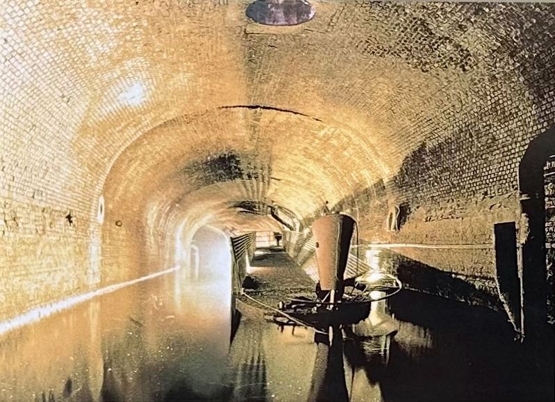
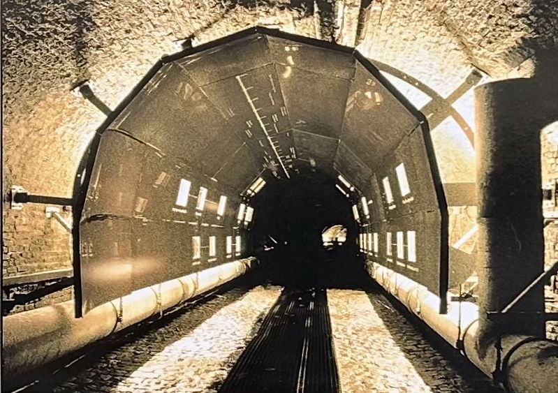
Since 2005 you can discover this part of Antwerp's history during a guided tour. You walk through the ruien and even take a boat trip through the underground vaults past foundations, bridges and locks. Street signs, referring to the streets above you, will help you orient yourself during your tour.
Did you know?
During WWII, the Allies organised parties in the ruien because they felt that this was the only place to escape German bombs.
Topics. This historical marker is listed in these topic lists: Forts and Castles • Man-Made Features. A significant historical year for this entry is 2005.
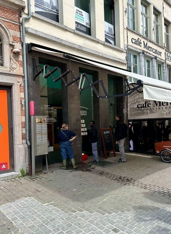
Location. 51° 13.264′ N, 4° 23.902′ E. Marker is in Antwerpen, Vlaams Gewest (Flanders). Marker is on Suikerrui, on the right when traveling west. Touch for map. Marker is at or near this postal address: Suikerrui 21, Antwerpen, Vlaams Gewest 2000, Belgium. Touch for directions.
Other nearby markers. At least 8 other markers are within walking distance of this marker. Ernest van Dyck (within shouting distance of this marker); Antoon van Dijck (about 90 meters away, measured in a direct line); Het Steen (about 150 meters away); Snoepje Napoleon / Napoleon Candy (about 150 meters away); Vleeshuis / Das Fleischhaus / La Halle des Bouchers / Butchers’ Hall (about 180 meters away); Sint-Annagodshuis / Saint Anne Almshouse (approx. 0.4 kilometers away); Sint-Carolus Borromeuskerk / St. Charles Borromeo Church (approx. 0.4 kilometers away); Albrecht Duerer (1471-1528) (approx. 0.4 kilometers away). Touch for a list and map of all markers in Antwerpen.
Also see . . . Secrets Flow Under the City (De Ruien). More about the Ruien, pictures, tour information. (Submitted on May 30, 2023.)
Credits. This page was last revised on December 31, 2023. It was originally submitted on May 29, 2023, by Andrew Ruppenstein of Lamorinda, California. This page has been viewed 53 times since then and 3 times this year. Photos: 1, 2. submitted on May 29, 2023, by Andrew Ruppenstein of Lamorinda, California. 3. submitted on May 30, 2023, by Andrew Ruppenstein of Lamorinda, California. 4. submitted on May 29, 2023, by Andrew Ruppenstein of Lamorinda, California.


