Braddock Heights in Frederick County, Maryland — The American Northeast (Mid-Atlantic)
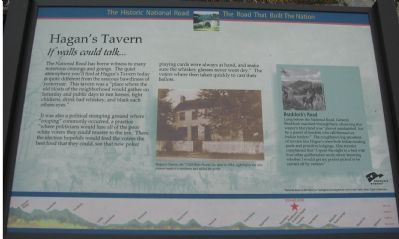
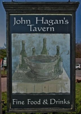
Haganís Tavern
If walls could talk..
It was also a political stomping ground where “cooping” commonly occurred, a practice “where politicians would lure all the poor white voters they could muster to the inn. There the election hopefuls would feed the voters the best food that they could, see that new poker playing cards were at hand, and make sure the whiskey glasses never went dry.” The voters were then taken quickly to cast their ballots.
(Sidebar): Braddockís Road
Long before the National Road, General Braddock marched through here, observing that western Maryland was “almost uninhabited, but by a parcel of banditti who call themselves Indian traders.” The roughhewn log ancestors of taverns like Haganís were both Indian trading posts and primitive lodgings. One traveler complained that “I spent the night in a bed with four other godforsaken souls; never knowing whether I would get my pocket picked or be carried off by vermin.”
Erected by America's Byways.
Topics and series. This historical marker is listed in this topic list: Roads & Vehicles. In addition, it is included in the Braddockís Road and Maj. Gen. Edward Braddock, and the The Historic National Road series lists.
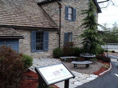
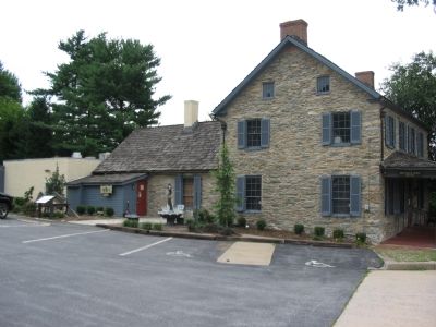
Location. 39° 25.421′ N, 77° 29.609′ W. Marker is in Braddock Heights, Maryland, in Frederick County. Marker is at the intersection of Old National Pike (Alternate U.S. 40) and Edgemont Road, on the right when traveling west on Old National Pike. Located in the parking lot for Hagenís Tavern. Touch for map. Marker is at or near this postal address: 5018 Old National Pike, Braddock Heights MD 21714, United States of America. Touch for directions.
Other nearby markers. At least 8 other markers are within 3 miles of this marker, measured as the crow flies. The Braddock-Washington Monument (approx. 0.7 miles away); This Boulder Marks the National Trail (approx. 0.7 miles away); General Edward Braddock (approx. 1.6 miles away); Woodmere (approx. 2Ĺ miles away); Maj. Gen. Edward Braddock (approx. 2.9 miles away); Charlie Keller (approx. 2.9 miles away); The Catoctin Mountain Range (approx. 3 miles away); Battle of Frederick (approx. 3 miles away). Touch for a list and map of all markers in Braddock Heights.
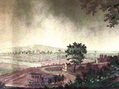
More about this marker. The background for the marker is “National Road at Fairview Inn” used on many of the National Road markers.
A picture of Hagenís Tavern carries the caption, “Hagenís Tavern, the ĎOld White Houseí as seen in 1914 right before the new owners made it a residence and added the porch.”
The sidebar has a drawing of Braddockís Army on the march through a mountain pass.
Also see . . . Hagan's Tavern, Old White House. National Register Form, F-3-15. MD-IHP.
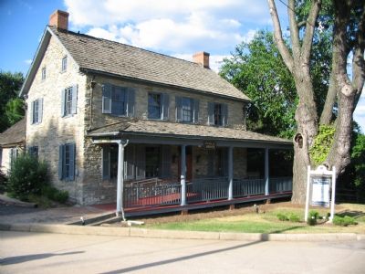
The house may have been built as early as 1790 and is thought to have been a tavern operated by James Nixdorf. Architectural features of the tavern suggest conflicts with documentary evidence and oral tradition regarding dates, leaving open the possibility of construction between 1820-1830. By the 1830's, it was owned by John Hagan. His father Peter Hagan was described in Searight's The Old Pike: A History of the National Road (1894) as having a log tavern on the south side of the pike near the stone Wilding's location which was famed among wagoners on the road. The current owner (1993) of Hagan's Tavern, Mr. Mark McConnell, believes that the stone house may have operated concurrently with the log structure, eventually superseding it altogether. Research by Ann Lebherz in the Frederick County Historical Society revealed that the tavern was still a well-known drinking place during the Civil War and was "patronized" by both Confederate and Union troops in their passages through Frederick County . With the advent of the automobile, the tavern continued to operate and had a notorious reputation during the early 20th century for its rough clientele. Memories of its use during the 1920's and early 1930's suggest it was known as a speakeasy as well as a legitimate restaurant. Later, it was used as an antique store. Mr. McConnell has information regarding several outbuildings which no longer exist, including stables, a summer kitchen, and a bank barn. (Submitted on October 2, 2013, by Allen C. Browne of Silver Spring, Maryland.)
Credits. This page was last revised on February 20, 2021. It was originally submitted on September 1, 2007, by Craig Swain of Leesburg, Virginia. This page has been viewed 4,915 times since then and 375 times this year. Last updated on February 18, 2021, by Carl Gordon Moore Jr. of North East, Maryland. Photos: 1. submitted on September 1, 2007, by Craig Swain of Leesburg, Virginia. 2. submitted on April 14, 2011, by Bill Coughlin of Woodland Park, New Jersey. 3, 4. submitted on September 1, 2007, by Craig Swain of Leesburg, Virginia. 5. submitted on October 2, 2013, by Allen C. Browne of Silver Spring, Maryland. 6, 7, 8. submitted on October 3, 2013, by Allen C. Browne of Silver Spring, Maryland. • J. Makali Bruton was the editor who published this page.
