Mariemont in Hamilton County, Ohio — The American Midwest (Great Lakes)
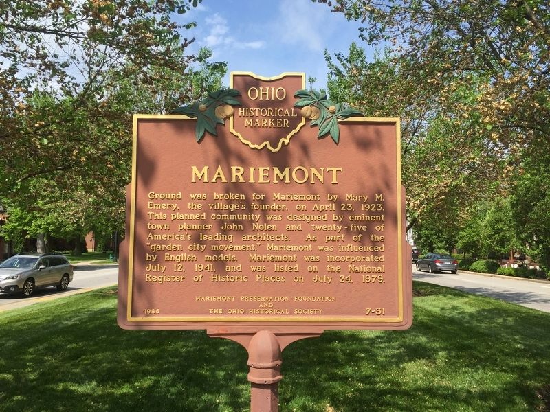
Mariemont
Erected 1986 by Mariemont Preservation Foundation, The Ohio Historical Society. (Marker Number 7-31.)
Topics and series. This historical marker is listed in these topic lists: Architecture • Settlements & Settlers. In addition, it is included in the Ohio Historical Society / The Ohio History Connection series list. A significant historical date for this entry is April 23, 1923.
Location. 39° 8.704′ N, 84° 22.504′ W. Marker is in Mariemont, Ohio, in Hamilton County. Marker is at the intersection of Wooster Street (U.S. 50) and Madisonville Road, in the median on Wooster Street. Touch for map. Marker is in this post office area: Cincinnati OH 45227, United States of America. Touch for directions.
Other nearby markers. At least 8 other markers are within 4 miles of this marker, measured as the crow flies. Village of Mariemont (within shouting distance of this marker); The Madisonville Site (approx. 0.7 miles away); Blockhouse (approx. 1.6 miles away); Cherry Tree Grove (approx. 2.3 miles away); The Cincinnati Observatory (approx. 2.6 miles away); Miller - Leuser Log House (approx. 3 miles away); Clark Stone House (approx. 3.4 miles away); Clough Pike (approx. 3.4 miles away). Touch for a list and map of all markers in Mariemont.
Credits. This page was last revised on May 30, 2023. It was originally submitted on May 2, 2019, by Steve Stoessel of Niskayuna, New York. This page has been viewed 229 times since then and 9 times this year. Last updated on May 30, 2023, by Robert Baughman of Bellefontaine, Ohio. Photos: 1, 2, 3. submitted on May 2, 2019, by Steve Stoessel of Niskayuna, New York. • Devry Becker Jones was the editor who published this page.


