Red Wing in Goodhue County, Minnesota — The American Midwest (Upper Plains)
Military Roads
Mendota to Wabasha
Military Roads
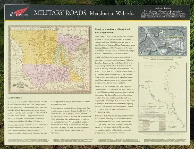
Thousands of immigrants and adventurers traveled to Minnesota Territory in the 1840s. They traveled by steamboat and humble wagon roads. Journeys could be difficult due to seasonal river conditions and the rough dirt trails. Soon pioneers demanded new and better byways. Congress heard these demands. In 1849, it provided $40,000 to build a military post road from Mendota to Wabasha.
Soon the government built more roads. A network of roads near the navigational head of the Mississippi River sprawled out like spokes of a wheel. Commonly called military roads, these new byways made it possible to carry supplies, mail, and people any time of the year.
The development included four military roads. One road extended northward through the St. Croix River Valley toward Lake Superior. A second headed southeast to Wabasha. It followed the western bank of the Mississippi River and guaranteed travel past ice-locked Lake Pepin. A third road followed the Minnesota River Valley to the southwest through Mankato. The fourth followed the Mississippi River northward to Fort Gaines, known today as Fort Ripley.
Mendota to Wabasha Military Road Red Wing Remnant
In Red Wing's Cannon River bottomlands, you can see one of the few existing sections of an early military road. It's a 3,000-foot unpaved segment of the Mendota-to-Wabasha Military Road, constructed between 1855 and 1858. This portion of the road included an elevated earthen roadway, with bridges, over the Cannon River and its bottomlands.
In 1857, the federal government stopped funding the military road between Mendota and Wabasha. Goodhue County and Burnside Township took over responsibility of the Cannon River section of the road. In the early 1900s, the county named it State Road 3. At this time, Goodhue County built two short iron bridges over minor branches of the Cannon River. In 1921, the road became part of the state's trunk highway system and a new concrete girder bridge over the Cannon River was built.
It was not to last, however. The District Highway Commissioner found fault with the road's alignment, and in 1931 the state built a new section of highway that crosses the Cannon River wet of its original location. That road is still in use today as Trunk Highway 61. The Cannon River section of the original military road was dropped from the trunk highway system. The road was officially renamed Cannon Bottom Road and became the responsibility of Burnside Township.
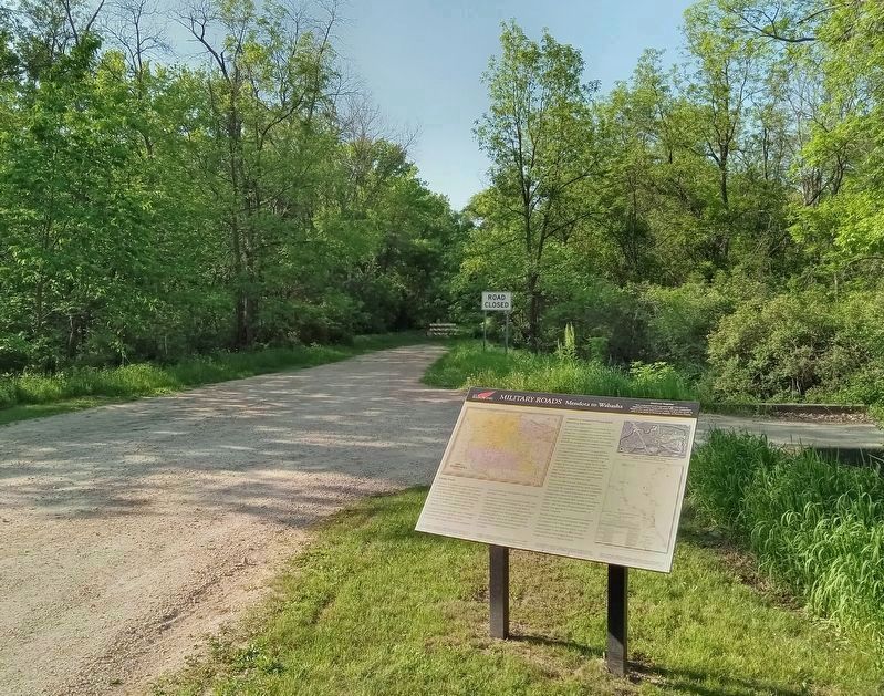
The City of Red Wing officially acquired this section of road when Red Wing and Burnside Township consolidated in 1971. Then safety concerns and ongoing flooding prompted the City to close this
stretch to traffic in the 1990s. In 2012, the City removed the two iron bridges, but the concrete bridge over the main channel remains.
This well-preserved fragment of the Mendota-to-Wabasha Military Road still exists between Collischan Road to the north and Cannon Valley Trail to the south. In 1991 it was listed in the National Register of Historic Places.
Caption: Map above shows location of the Red Wing Remnant of the Mendota to Wabasha Military Road.
Erected by City of Red Wing.
Topics. This historical marker is listed in this topic list: Roads & Vehicles. A significant historical year for this entry is 1855.
Location. 44° 34.467′ N, 92° 38.531′ W. Marker is in Red Wing, Minnesota, in Goodhue County. Marker is at the intersection of Cannon Bottom Road and the Cannon Valley Trail, on the right when traveling north on Cannon Bottom Road. Touch for map. Marker is at or near this postal address: 340 Cannon Bottom Road, Red Wing MN 55066, United States of America. Touch for directions.
Other nearby markers. At least 8 other markers are within 5 miles of this marker, measured as the crow flies. Anderson Center and Outdoor Sculpture Garden (about 700 feet away, measured in a direct line); Our Native Forests (approx. 0.2 miles away); Early Inhabitants (approx. 0.2 miles away); Oak Trees in the Tallgrass Prairie (approx. 0.2 miles away); Restoring the Land (approx. ¼ mile away); Red Wing Archaeological Preserve (approx. ¾ mile away); The Belle Creek Watershed (approx. 3.7 miles away); Cannon Valley Trail Archaeology (approx. 4.8 miles away). Touch for a list and map of all markers in Red Wing.
Credits. This page was last revised on May 31, 2023. It was originally submitted on May 30, 2023, by McGhiever of Minneapolis, Minnesota. This page has been viewed 185 times since then and 54 times this year. Photos: 1, 2. submitted on May 30, 2023, by McGhiever of Minneapolis, Minnesota. • J. Makali Bruton was the editor who published this page.

