Upperville in Loudoun County, Virginia — The American South (Mid-Atlantic)
Civil War Cavalry Equipment
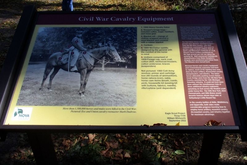
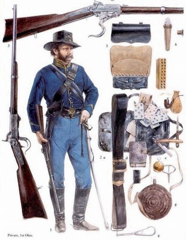
1) 1840 Heavy Cavalry Saber
2) Trooper’s forage bags – included coffee, sugar, hardtack, and mess gear
3) Blanket roll – change of clothes, wrapped around a wool blanket and covered with a rubber blanket
4) Canteen
5) 1859 McClellan saddle, designed by the general with the comfort of the horse in mind
6) Uniform comprised of 1859 Forage cap, sack coat, cotton shirt, reinforced trousers, cotton underwear, braces (suspenders)
Not pictured: 1860 Colt Army revolver, primer and cartridge box (40 rounds of ammunition), horse rations (corn, oats), horse care items (brush, comb, pick), housewife kit (sewing kit with buttons, fabrics, needle), rifle/carbine (unit dependent)
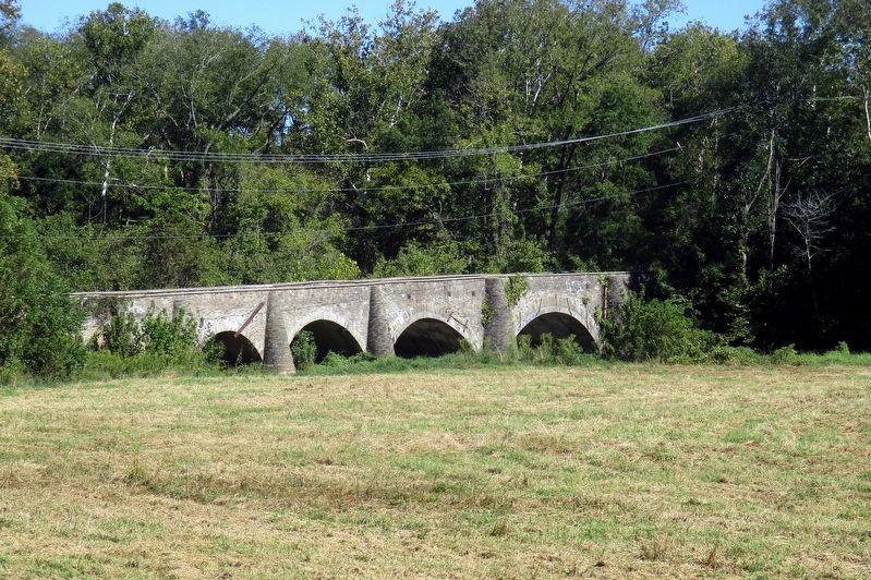
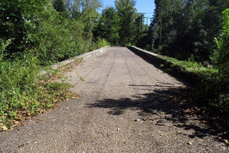
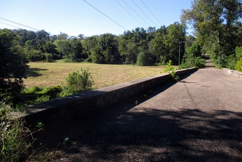
Here at Goose Creek Bridge, Confederate mounted cavalry barely got to this spot before Union Cavalry and their horse artillery got into position on the far side. Elements of the 1st South Carolina Cavalry, the last Confederates across, were hit by artillery on the bridge; nine went down from a single shot.
The first Union forces trying to cross in pursuit were likewise mounted troopers – from the 6th Ohio Cavalry. Like their Confederate counterparts, they were in perfect range of horse artillery, that of Hart’s and Mooreman’s Batteries of J.E.B. Stuart’s Horse Artillery positioned on the high ground you can see above the parking lot. Well-ensconced Confederate sharpshooters from Wade Hampton’s brigade were positioned just below them. The Ohioans were turned back.
Because horses and cavalry equipment were tremendously expensive and hard to replace, much of the fighting around here was done by horse artillery, dismounted cavalry sharpshooters, and infantry. The Union forces ultimately pushing across Goose Creek Bridge were from the 4th New York Cavalry, assisted by the 16th Michigan Infantry. It could not have been done without the simultaneous help of three additional infantry regiments, splashing on foot across the flooded creek under heavy fire. The 44th New York, 83rd Pennsylvania, and 20th Maine would become famous eleven days later at Gettysburg’s Little Round Top.
In the cavalry battles of Aldie, Middleburg and Upperville, both sides made considerable progress learning how to employ horse artillery, mounted cavalry, dismounted cavalry, and infantry together for maximum advantage.
More than 1.500,000 horses and mules were killed in the Civil War.
Pictured: Eve and Union cavalry reenactor Mark Dudrow.
Eagle Scout Project Troop 1158
William Withworth
September 2022
Erected 2022 by Eagle Scout Project, William Withworth, Troop 1158; NOVA Parks.
Topics. This historical marker is listed in this topic list: War, US Civil. A significant historical month for this entry is September 2022.
Location. 38° 58.949′ N, 77° 49.201′ W. Marker is in Upperville, Virginia, in Loudoun County. Marker can be reached from Lemmon Bottom Road north of John S. Moseby Highway (Virginia Route 50). Touch for map. Marker is at or near this postal address: Battle of Upperville/Goose Creek Bridge Park, Middleburg VA 20117, United States of America. Touch for directions.
Other nearby markers. At least 8 other markers are within 2 miles of this marker, measured as the crow flies. Attack At Goose Creek Bridge (about 400 feet away, measured in a direct line); In Appreciation of the Fauquier and Loudoun Garden Club (about 400 feet away); Preserving The Battlefield (about 400 feet away); Rector House (approx. 0.8 miles away); Rector’s Crossroads (approx. 0.8 miles away); Mosby’s Rangers (approx. 0.9 miles away); Welbourne (approx. 0.9 miles away); Rokeby Stables (approx. 1.3 miles away). Touch for a list and map of all markers in Upperville.
Also see . . .
1. Goose Creek Bridge and the Battle of Upperville. American Battlefield Trust website entry (Submitted on May 31, 2023, by Larry Gertner of New York, New York.)
2. Battle of Upperville/Goose Creek Bridge Historic Park. The Journey National Heritage Area website entry (Submitted on May 31, 2023, by Larry Gertner of New York, New York.)
Credits. This page was last revised on May 31, 2023. It was originally submitted on May 31, 2023, by Larry Gertner of New York, New York. This page has been viewed 301 times since then and 106 times this year. Photos: 1, 2, 3, 4, 5. submitted on May 31, 2023, by Larry Gertner of New York, New York.
