Bella Vista in Benton County, Arkansas — The American South (West South Central)
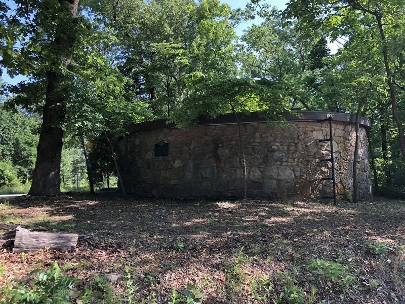
Bella Vista Water Tank
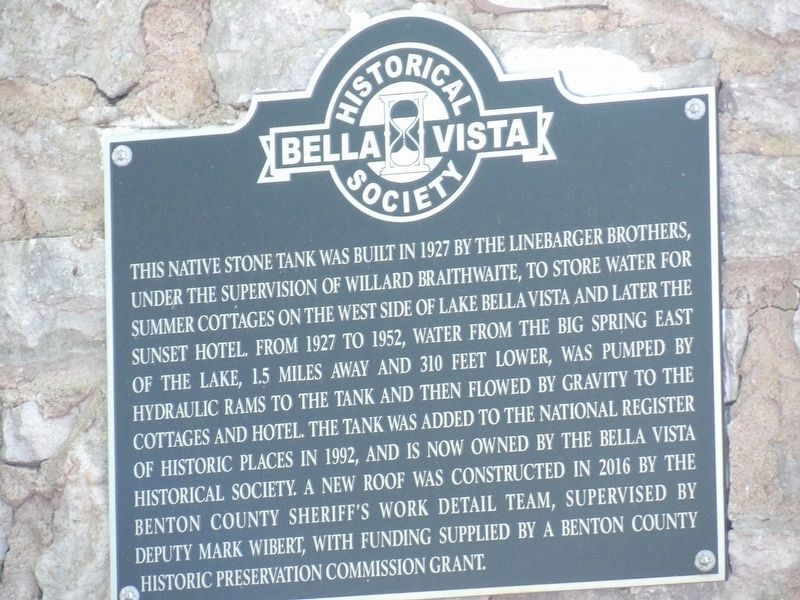
Photographed by Duane and Tracy Marsteller, May 21, 2023
1. Bella Vista Water Tank Marker
Erected by Bella Vista Historical Society.
Topics. This historical marker is listed in these topic lists: Industry & Commerce • Natural Resources • Notable Buildings. A significant historical year for this entry is 1927.
Location. 36° 25.719′ N, 94° 14.816′ W. Marker is in Bella Vista, Arkansas, in Benton County. It is at the intersection of Cedar Crest Drive and Cunningham Drive, on the
this page online

Regionally, this marker is in Northwest Arkansas, on the Ozark Plateau, in the Cherokee Heritage Region, and in Osage Territory. It is also in the American South, specifically in the Upper South, and in the Ozarks. Globally, it is in North America, the Western Hemisphere, the Western World, and the Anglosphere. Historically, it finds itself in what was once the territory of the Mississippian Culture, the Louisiana Purchase, one of the Confederate States of America, and the Antebellum South.
Other nearby markers. At least 8 other markers are within one mile of this marker, measured as the crow flies: Cold War (approx. one mile away); Korea (approx. one mile away); Vietnam (approx. one mile away); Persian Gulf War (approx. one mile away); War on Terrorism (approx. one mile away); The War in Afghanistan (approx. one mile away); Operation Iraqi Freedom (approx. one mile away); Victory in the Pacific (approx. one mile away).
Photographed by Duane and Tracy Marsteller, May 21, 2023
2. Bella Vista Water Tank Marker
The tank itself is made of reinforced concrete, with a native fieldstone facade.
Also see . . . Bella Vista Water Tank (PDF). National Register nomination for the tank, which was listed in 1992. (National Archives) (Submitted on June 2, 2023, by Duane and Tracy Marsteller of Murfreesboro, Tennessee.)
Credits. This page was last revised on November 30, 2023. It was originally submitted on June 2, 2023, by Duane and Tracy Marsteller of Murfreesboro, Tennessee. This page has been viewed 325 times since then and 42 times this year. Photos: 1, 2. submitted on June 2, 2023, by Duane and Tracy Marsteller of Murfreesboro, Tennessee.
