Terezín in Litoměřice, Aussiger, Czechia — Northwestern Bohemia (Central Europe)
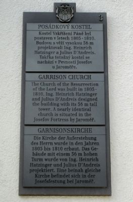
Garrison Church
Photographed by Andrew Ruppenstein, August 25, 2009
1. Garrison Church Marker
In English:
In German:
(Marker Number 3.)
Topics. This historical marker is listed in these topic lists: Forts and Castles • Religion & Religious Structures. A significant historical year for this entry is 1805.
Location. 50° 30.651′ N, 14° 9.056′ E. Marker is in Terezín, Ústecký kraj (Aussiger), in Litoměřice. It can be reached from Námestí Československé Armády near Husova, on the right. Touch for map. Marker is in this post office area: Terezín, Ústecký kraj 411 55, Czechia. Touch for directions.

Regionally, it is in Europe, the European Union, the Carpathian States, Central Europe, Eastern Europe, the Schengen Area, and the Western World. Historically, it finds itself in what was once the Holy Roman Empire.
Other nearby markers. At least 2 other markers are within walking distance of this marker: The Food Storeroom (approx. 0.3 kilometers away); Columbarium (approx. half a kilometer away).
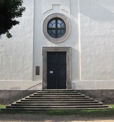
More about this marker. The marker is located just to the left of the side door (south
this page online
Regarding Garrison Church. Terezín started as Theresienstadt, a garrison town within a fortress, founded in 1780, to protect the borders of the Austro-Hungarian Empire. (To better understand the layout of the town and fortress, see the satellite view of the map and zoom in/out accordingly). Changes in military tactics and technology made the fortress obsolete, and by the 19th century the lower part of the fortress was put to use as a prison. Theresienstadt became best known for its historical role in WW II when under German occupation, the entire town was turned into a concentration camp, with the Small Fortress turned into a Gestapo prison, and the Large Fortress turned into a ghetto into which Jews, mostly from Czechoslovakia, were forcibly relocated.
Also see . . . Terezín. Wikipedia entry (Submitted on September 17, 2009.)
Photographed by Andrew Ruppenstein, August 25, 2009
2. Garrison Church Marker - Wide Shot
Photographed by Andrew Ruppenstein, August 25, 2009
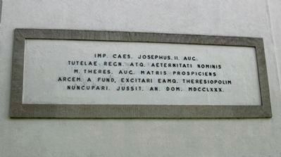
3. Dedication Plaque on the Northern Side of the Church
A dedication plaque in Latin, stating roughly that his Imperial Majesty Joseph the Second, Son of the Empress Maria Theresa, founded Theresienstadt in her honor in 1780.
Photographed by Andrew Ruppenstein, August 25, 2009
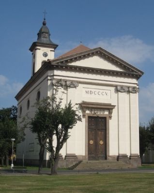
4. Garrison Church: The Church of the Resurrection of the Lord
Credits. This page was last revised on July 4, 2023. It was originally submitted on September 16, 2009, by Andrew Ruppenstein of Lamorinda, California. This page has been viewed 1,293 times since then and 12 times this year. Photos: 1. submitted on September 16, 2009, by Andrew Ruppenstein of Lamorinda, California. 2, 3, 4. submitted on September 17, 2009, by Andrew Ruppenstein of Lamorinda, California. • Kevin W. was the editor who published this page.
