Manteo in Dare County, North Carolina — The American South (South Atlantic)
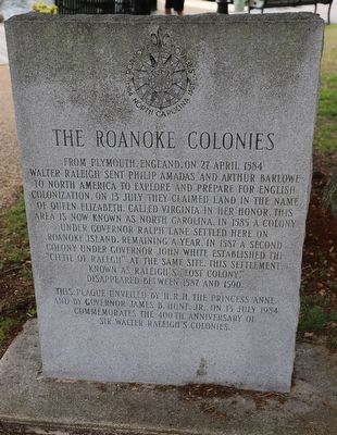
The Roanoke Colonies
From Plymouth, England, on 27 April 1584 Walter Raleigh sent Philip Amadas and Arthur Barlowe to North America to explore and prepare for English Colonization. On 13 July they claimed land in the name of Queen Elizabeth. Called Virginia in her honor, this area is now known as North Carolina. In 1585 a colony under Governor Ralph Lane settled here on Roanoke Island, remaining a year. In 1587 a second colony under Governor John White established the "Cittie of Ralegh” at the same site. This settlement, known as Raleigh’s "Lost Colony”, disappeared between 1587 and 1590.
This plaque unveiled by H.R.H. The Princess Anne and by Governor James B. Hunt, Jr., on 13 July 1984 commemorates the 400th anniversary of Sir Walter Raleigh’s Colonies.
Erected 1984.
Topics. This historical marker is listed in these topic lists: Colonial Era • Exploration • Settlements & Settlers. A significant historical date for this entry is April 27, 1584.
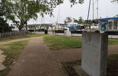
Location. 35° 54.611′ N, 75° 40.146′ W. Marker is in Manteo, North Carolina, in Dare County. Marker can be reached from Queen Elizabeth Avenue near Budleigh Street, on the left when traveling south. Touch for map. Marker is at or near this postal address: 400 Queen Elizabeth Ave, Manteo NC 27954, United States of America. Touch for directions.
Other nearby markers. At least 8 other markers are within walking distance of this marker. To Virginia Dare (within shouting distance of this marker); To Walter Raleigh's Colonists (within shouting distance of this marker); Dare County Veterans Memorial (within shouting distance of this marker); August 27, 2011 (about 500 feet away, measured in a direct line); Manteo Weather Tower (about 500 feet away); Roanoke Marshes Lighthouse (about 600 feet away); USLSS/USCG Station Pea Island Memorial (about 600 feet away); Spirit of Roanoke Island (about 700 feet away). Touch for a list and map of all markers in Manteo.
Credits. This page was last revised on June 4, 2023. It was originally submitted on June 4, 2023, by Dave W of Co, Colorado. This page has been viewed 146 times since then and 55 times this year. Photos: 1, 2. submitted on June 4, 2023, by Dave W of Co, Colorado. • Bernard Fisher was the editor who published this page.

