Eureka Springs in Carroll County, Arkansas — The American South (West South Central)
The Star of Gladness
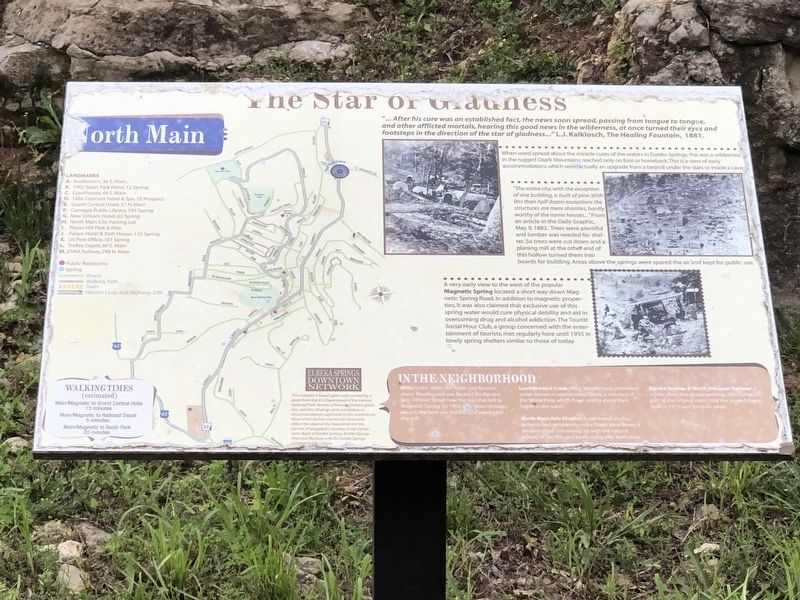
“… After his cure was an established fact, the news soon spread, passing from tongue to tongue, and other afflicted mortals, hearing this good news in the wilderness, at once turned their eyes and footsteps in the direction of the star of gladness …” – L.J.Kalklosch, The Healing Fountain, 1881.When word spread about the miracle cures of the waters in Eureka Springs, this was a wilderness in the rugged Ozark Mountains reached only on foot or horseback. This is a view of early accommodations which were actually an upgrade from a bedroll under the stars or in a cave.
“The entire city, with the exception of one building, is built of pine. With less than half dozen exceptions, the structures are mere shanties, hardly worthy of the name houses…” From an article in the Daily Graphic, May 9, 1882. Trees were plentiful and lumber was needed for shelter. So trees were cut down and a planing mill at the other end of this hollow turned them into boards for building. Areas above the springs were spared the ax and kept for public use.
A very early view to the west of the popular Magnetic Spring located a short way down Magnetic Spring Road. In addition to magnetic properties, it was also claimed that exclusive use of this spring water would cure physical debility and aid in overcoming drug and alcohol addiction. The Tourist Social Hour Club, a group concerned with the entertainment of tourists, met regularly here until 1935 in lovely spring shelters similar to those of today.
In the Neighborhood
Mills: In the 1890's the Webb and Brown's steam flouring mill was located on the east side of Main Street near the trail that led to Magnetic Spring. By 1914, after years of being vacant, the land was the site of a wood planing mill.
Leatherwood Creek: Main Street's most prominent water feature is Leatherman's Creek, a tributary of the White River which flows openly along Main Street to the north.
North Main Arts District: A number of studios, galleries and restaurants make North Main Street a pleasant stroll combing art with the natural beauty of the hills and bluffs rising over both sides.
Eureka Springs & North Arkansas Railway: A scenic short line passenger train offers a trip on part of the original route. Visit the second depot, built in 1913, and the train yards.
Erected by Eureka Springs Downtown Network.
Topics. This historical marker is listed in these topic lists: Industry & Commerce • Waterways & Vessels. A significant historical date for this entry is May 9, 1882.
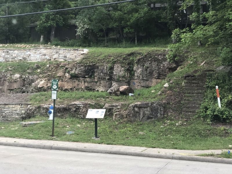
Location. 36° 24.623′ N, 93° 44.006′ W. Marker is in Eureka Springs, Arkansas, in Carroll County. Marker is at the intersection of North Main Street (Arkansas Route 23) and Magnetic Drive, on the right when traveling south on North Main Street. Touch for map. Marker is in this post office area: Eureka Springs AR 72632, United States of America. Touch for directions.
Other nearby markers. At least 8 other markers are within walking distance of this marker. The Town that Water Built (about 400 feet away, measured in a direct line); Bridgeford House (about 600 feet away); Magnetic Spring (approx. 0.2 miles away); The Brownstone Inn (approx. 0.2 miles away); The Round House (approx. 0.2 miles away); Few Things But Staples … (approx. 0.2 miles away); Clayton-Becker House (approx. 0.2 miles away); Steam Locomotive (approx. ¼ mile away). Touch for a list and map of all markers in Eureka Springs.
Credits. This page was last revised on June 4, 2023. It was originally submitted on June 4, 2023, by Duane and Tracy Marsteller of Murfreesboro, Tennessee. This page has been viewed 67 times since then and 15 times this year. Photos: 1, 2. submitted on June 4, 2023, by Duane and Tracy Marsteller of Murfreesboro, Tennessee.

