
Edenton in Chowan County, North Carolina — The American South (South Atlantic)
Rosenwald Schools
Photographed by Dave W, June 4, 2023
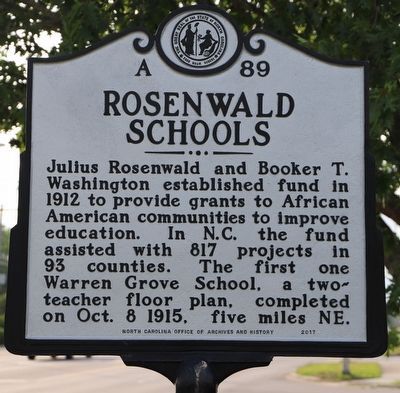
1. Rosenwald Schools Marker
Julius Rosenwald and Booker T. Washington established fund in 1912 to provide grants to African American communities to improve education. In N.C. the fund assisted with 817 projects in 93 counties. The first one was Warren Grove School, a two-teacher floor plan, completed on Oct. 8, 1915, five miles N.E
Erected 2017 by North Carolina Office of Archives and History. (Marker Number A-89.)
Topics and series. This historical marker is listed in these topic lists: African Americans • Charity & Public Work • Education. In addition, it is included in the North Carolina Division of Archives and History, and the Rosenwald Schools series lists. A significant historical date for this entry is October 8, 1915.
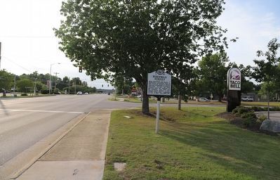
Location. 36° 4.356′ N, 76° 36.66′ W. Marker is in Edenton, North Carolina, in Chowan County. It is at the intersection of Virginia Road (North Carolina Route 32) and Luke Street, on the right when traveling west on Virginia Road. Touch for map. Marker is at or near this postal address: 232 Virginia Rd, Edenton NC 27932, United States of America. Touch for directions.

Regionally, this marker is in North Carolina’s
this page online
Other nearby markers. At least 8 other markers are within walking distance of this marker: First Post Road (approx. 0.3 miles away); Dr. Martin Luther King, Jr. in Edenton, 1962 (approx. 0.4 miles away); North Carolina National Guard Armory (approx. 0.4 miles away); State v. Mann (approx. 0.6 miles away); Harriet Jacobs (approx. ¾ mile away); St. Paul's Episcopal Church (approx. 0.8 miles away); a different marker also named St. Paul's Episcopal Church (approx. 0.8 miles away); Edenton United Methodist Church (approx. 0.8 miles away). Touch for a list and map of all markers in Edenton.
Another marker is no longer nearby. St Paul's Episcopal Church (was approx. 0.8 miles
Photographed by Dave W, June 4, 2023
2. Rosenwald Schools Marker
Credits. This page was last revised on June 5, 2023. It was originally submitted on June 5, 2023, by Dave W of Co, Colorado. This page has been viewed 479 times since then and 29 times this year. Photos: 1, 2. submitted on June 5, 2023, by Dave W of Co, Colorado. • Bernard Fisher was the editor who published this page.
