
Near Hamilton in Butler County, Ohio — The American Midwest (Great Lakes)
Hamilton Airport - Hogan Field
Photographed by Rev. Ronald Irick, August 13, 2019
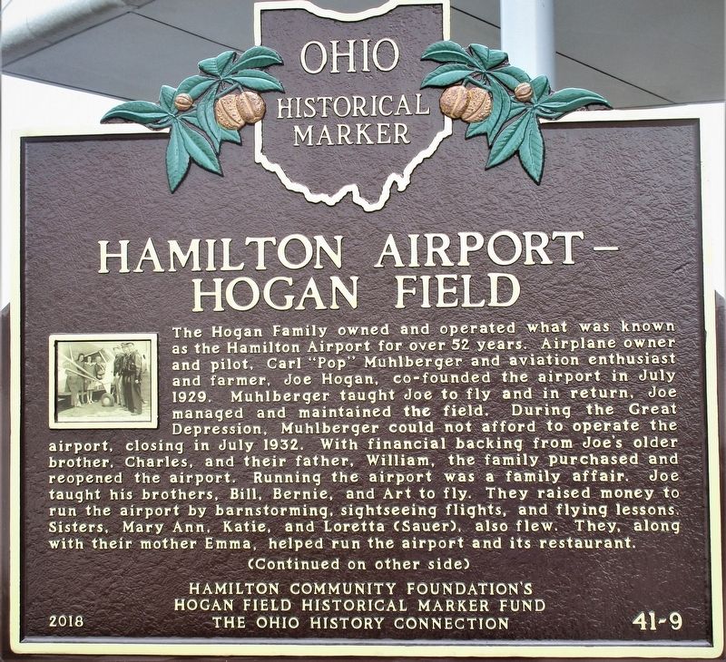
1. Hamilton Airport- Hogan Field Marker
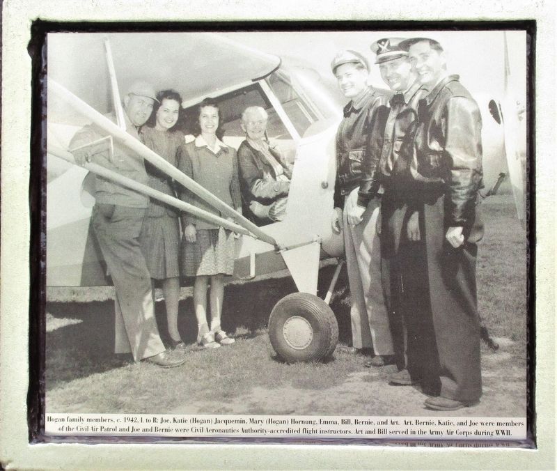
The Hogan Family owned and operated what was known as the Hamilton Airport for over 52 years. Airplane owner and pilot, Carl "Pop" Muhlberger and aviation enthusiast and farmer, Joe Hogan, co-founded the airport in July 1929. Muhlberger taught Joe to fly and in return, Joe managed and maintained the field. During the Great Depression, Muhlberger could not afford to operate the airport, closing in July 1932. With financial backing from Joe's older brother, Charles, and their father, William, the family purchased and reopened the airport. Running the airport was a family affair. Joe taught his brothers, Bill, Bernie, and Art to fly. They raised money to run the airport by barnstorming, sightseeing flights, and flying lessons. Sisters, Mary Ann, Katie, and Loretta (Sauer), also flew. They, along with their mother Emma, helped run the airport and its restaurant.
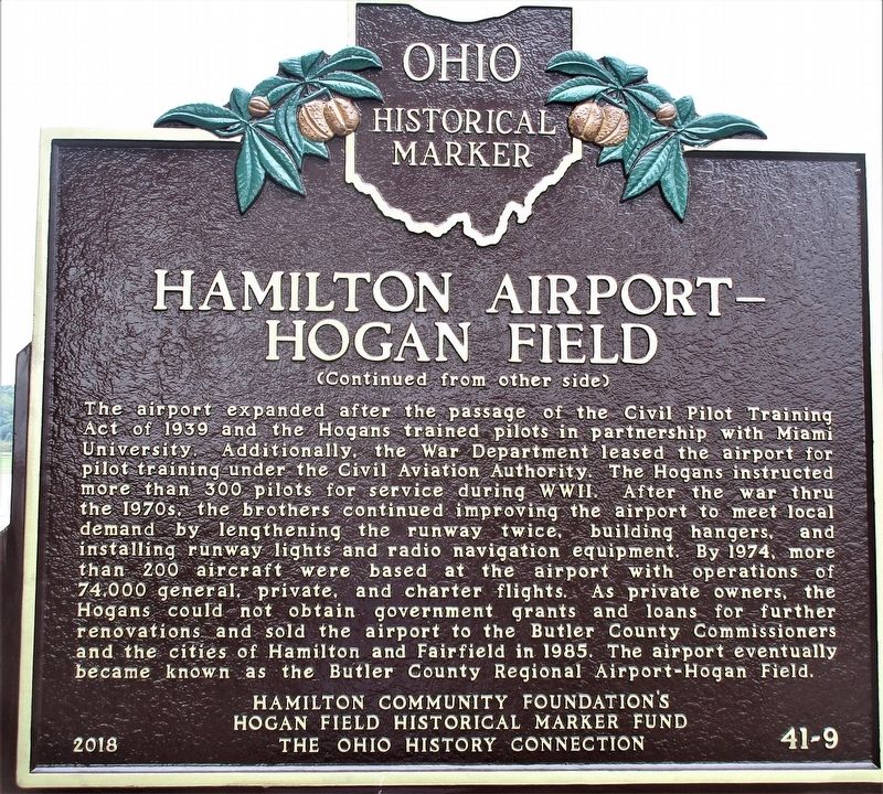
The airport expanded after the passage of the Civil Pilot Training Act of 1939 and the Hogans trained pilots in partnership with Miami University. Additionally, the War Department leased the airport for pilot training under the Civil Aviation Authority. The Hogans
this page online
Erected 2018 by Hamilton Community Foundation's Hogan Field Historical Marker Fund and The Ohio History Connection. (Marker Number 41- 9.)
Topics and series. This historical marker is listed in this topic list: Air & Space. In addition, it is included in the Ohio Historical Society / The Ohio History Connection series list.
Location. 39° 21.73′ N, 84° 31.48′ W. Marker is near Hamilton, Ohio, in Butler County.
Photographed by Rev. Ronald Irick, August 13, 2019
2. Hamilton Airport- Hogan Field Marker Reverse

Regionally, this marker is in Greater Cincinnati and in the Miami Valley. It is also in the American Midwest. Globally, it is in North America, the Western Hemisphere, the Western World, and the Anglosphere. Historically, it finds itself in what was once the Haudenosaunee (Iroquois) Confederacy, the territory of the Mississippian Culture, and the Northwest Territory.
Other nearby markers. At least 8 other markers are within 3 miles of this marker, measured as the crow flies: Crawford Woods (approx. 1.6 miles away); Historic Stones (approx. 1.9 miles away); Pro Patria (approx. 2½ miles away); Poppies (approx. 2½ miles away); The 105mm Howitzer (approx. 2½ miles away); America's Wars (approx. 2½ miles away); Fairfield Veterans Memorial Park (approx. 2½ miles away); Gold Star Families Memorial
Photographed by Rev. Ronald Irick, August 13, 2019
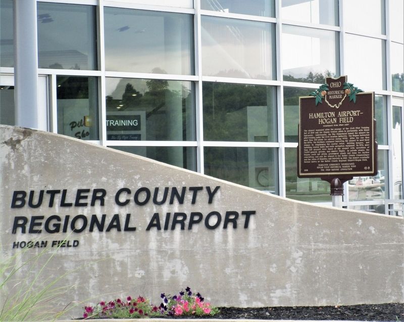
3. Hamilton Airport- Hogan Field Marker
full view of marker
Photographed by Rev. Ronald Irick, August 13, 2019
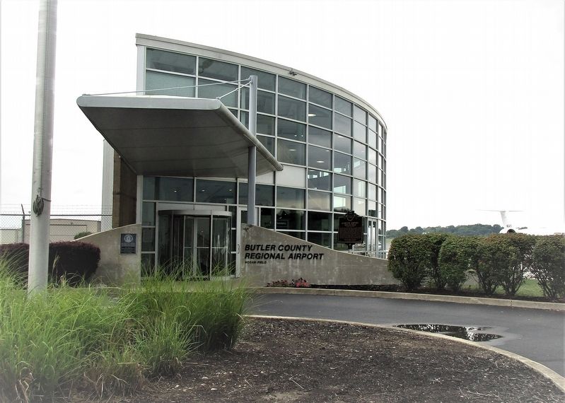
4. Hamilton Airport- Hogan Field Marker
marker as seen from Airport Drive
Photographed by Rev. Ronald Irick, August 13, 2019
5. Hamilton Airport- Hogan Field Marker
the Hogan family
Photographed by Rev. Ronald Irick, August 13, 2019
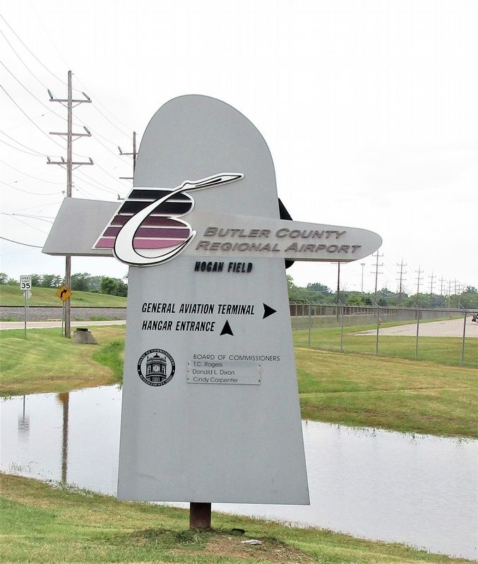
6. Hamilton Airport- Hogan Field Marker
airport sign at Bobmeyer Road

Photographed by Craig Doda, June 7, 2025
7. Hamilton Airport - Hogan Field Marker

Photographed by Craig Doda, June 7, 2025
8. Hamilton Airport - Hogan Field Marker
Credits. This page was last revised on June 16, 2025. It was originally submitted on August 13, 2019, by Rev. Ronald Irick of West Liberty, Ohio. This page has been viewed 1,435 times since then and 72 times this year. Last updated on June 7, 2023, by Grant & Mary Ann Fish of Galloway, Ohio. Photos: 1, 2, 3, 4, 5, 6. submitted on August 13, 2019, by Rev. Ronald Irick of West Liberty, Ohio. 7, 8. submitted on June 11, 2025, by Craig Doda of Napoleon, Ohio. • J. Makali Bruton was the editor who published this page.
