Richfield Township near Berkey in Lucas County, Ohio — The American Midwest (Great Lakes)
Roger T. Durbin
1920 - 2000
Photographed by Rev. Ronald Irick, September 25, 2012
1. Roger T. Durbin Marker
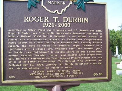
According to fellow World War II veteran and US Senator Bob Dole, Roger T. Durbin was “the public persona - the beacon - of the drive to build a National World War II Memorial in out nation’s capital”. It started with a conversation between Mr. Durbin and Congresswoman Marcy Kaptur at a local fish fry in February 1987. Enlisting Kaptur’s support, the work to create a memorial began. Described as a “gentleman with a square jaw, twinkling eyes, and girlish grin,” Mr. Durbin committed himself to serving others. he was a rural letter carrier, Richfield Township trustee, and coached Little League base-ball. He was a veteran of the Tenth Armored (Tiger) Division and saw action at the Battle of the Bulge. The National WW II Memorial was dedicated May 28, 2004. Although Mr. Durbin did not live to see that day, his determination is the reason it stands.
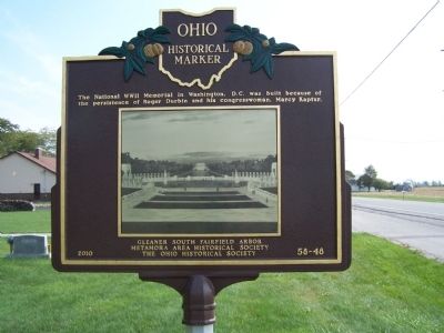
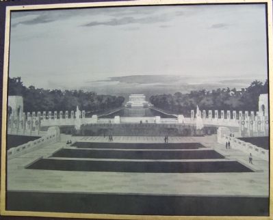
The National WW II in Washington D.C. was built because of the persistence of Roger Durbin and his Congresswoman, Kaptur.
Erected 2010 by Gleaner South Area Fairfield Arbor Metamora Area Historical Society and The Ohio Historical Society. (Marker Number 58-48.)
Topics and series.
this page online
Location. 41° 42.894′ N, 83° 49.959′ W. Marker is near Berkey, Ohio, in Lucas County. It is in Richfield Township. It is on Sylvania-Metamora Rd (County Route 4), on the right when traveling west. marker is in the edge of Berkey Cemetery, just east of Berkey Christian Church about 2000 ft south of the Michigan State Line. Touch for map. Marker is at or near this postal address: 11961 Sylvania-Metamora Rd, Berkey OH 43504, United States of America. Touch for directions.

Regionally, this marker is on the Lake Erie Shore and in the Toledo Metropolitan Area. It is also in the American Midwest and in the Corn Belt. Globally, it is in North America, on the Great Lakes, in the Western Hemisphere, in the Western World, and in the Anglosphere. Historically, it finds itself in what was once the Viceroyalty of New France, the Haudenosaunee (Iroquois) Confederacy, the territory of the Mississippian Culture, and the
Photographed by Rev. Ronald Irick, September 25, 2012
2. Roger T. Durbin Marker Reverse
Other nearby markers. At least 8 other markers are within 6 miles of this marker, measured as the crow flies: The Old Territorial Road (approx. 0.4 miles away); The Metamora School Bell (approx. 4.1 miles away); Amboy Township Veterans Memorial (approx. 4½ miles away); Centennial Terrace and Quarry / Fossil Park (approx. 4.6 miles away); Birthplace of Alexander Drabik (approx. 5.1 miles away); Whiteford Township WW II Memorial (approx. 5½ miles away in Michigan); In Memory Of All Our Fallen Soldiers (approx. 5½ miles away in Michigan); Erie and Kalamazoo Railroad (approx. 5½ miles away in Michigan).
Photographed by Rev. Ronald Irick, September 25, 2012
3. Roger T. Durbin Marker
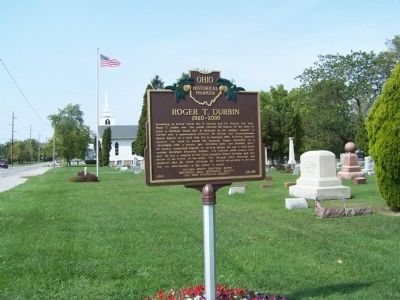
full view, looking west
Photographed by Rev. Ronald Irick, September 25, 2012
4. Roger T. Durbin Marker Photograph
Credits. This page was last revised on January 12, 2025. It was originally submitted on January 29, 2015, by Rev. Ronald Irick of West Liberty, Ohio. This page has been viewed 1,544 times since then and 65 times this year. Last updated on June 7, 2023, by Grant & Mary Ann Fish of Galloway, Ohio. Photos: 1, 2, 3, 4. submitted on January 29, 2015, by Rev. Ronald Irick of West Liberty, Ohio. • J. Makali Bruton was the editor who published this page.
