Elm City in Nash County, North Carolina — The American South (South Atlantic)
Cornwallis
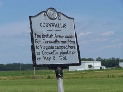
Photographed by Mike Stroud, 2011
1. Cornwallis Marker
Erected 1976 by North Carolina Office of Archives & History. (Marker Number E-87.)
Topics and series. This historical marker is listed in this topic list: War, US Revolutionary. In addition, it is included in the North Carolina Division of Archives and History series list. A significant historical date for this entry is May 8, 1781.
Location. 35° 51.267′ N, 77° 54.029′ W. Marker is in Elm City, North Carolina, in Nash County. It is at the intersection of North Carolina Route 97 and Airport Road, on the right when traveling north on North Carolina Route 97. Located at the Rocky Mount-Wilson Regional Airport. Touch for map. Marker is at or near this postal address: 7279 NC-97, Rocky Mount NC 27803, United States of America. Touch for directions.

Regionally, this marker is in North Carolina’s Piedmont. It is also in the American South and specifically in the Upper South. Globally, it is in North America, the Western Hemisphere, the Western World, and the Anglosphere. Historically, it finds itself in
this page online
Other nearby markers. At least 8 other markers are within 9 miles of this marker, measured as the crow flies: Fike Cyclones Football (approx. 7.1 miles away); Bishop FC Barnes (approx. 7.3 miles away); Walter Fenner "Buck" Leonard (approx. 7.8 miles away); Thelonious Sphere Monk (approx. 7.8 miles away); Around the "Y" Community (approx. 7.8 miles away); Nash County Vietnam Veterans Memorial (approx. 8 miles away); Agent Orange Victims (approx. 8 miles away); The ACL 303 (approx. 8.1 miles away).
Also see . . . Cornwallis - Essay. North Carolina Office of Archives & History (Submitted on June 10, 2023.)
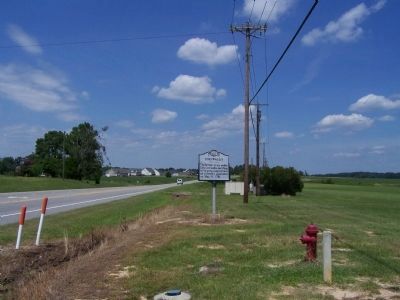
Photographed by Mike Stroud, July 18, 2011
2. Cornwallis Marker, looking north along Raleigh Road (NC 97)
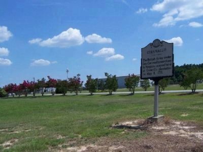
Photographed by Mike Stroud, July 18, 2011
3. Cornwallis Marker, near Airport Road
Credits. This page was last revised on June 10, 2023. It was originally submitted on August 4, 2011, by Mike Stroud of Bluffton, South Carolina. This page has been viewed 1,899 times since then and 83 times this year. Last updated on June 9, 2023, by Michael Buckner of Durham, North Carolina. Photos: 1, 2, 3. submitted on August 4, 2011, by Mike Stroud of Bluffton, South Carolina. • Bernard Fisher was the editor who published this page.
