Moss Neck in Caroline County, Virginia — The American South (Mid-Atlantic)
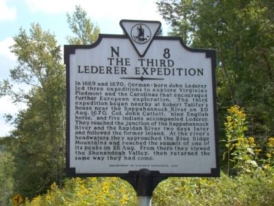
The Third Lederer Expedition
Erected 2000 by Department of Historic Resources. (Marker Number N-8.)
Topics and series. This historical marker is listed in these topic lists: Colonial Era • Exploration. In addition, it is included in the Virginia Department of Historic Resources (DHR) series list. A significant historical date for this entry is August 20, 1670.
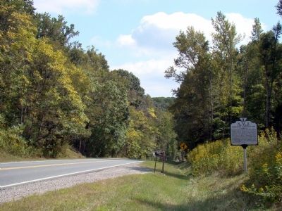
Location. 38° 13.296′ N, 77° 18.138′ W. Marker is in Moss Neck, Virginia, in Caroline County. Marker is on U.S. 17 just north of Ware Creek Road, on the right when traveling south. Touch for map. Marker is in this post office area: Rappahannock Academy VA 22538, United States of America. Touch for directions.
Other nearby markers. At least 8 other markers are within 6 miles of this marker, measured as the crow flies. Jackson's Headquarters (approx. half a mile away); Skinker’s Neck (approx. 0.6 miles away); Windsor (approx. 0.6 miles away); Lamb’s Creek Church (approx. 3.3 miles away); Stafford County / King George County (approx. 3.4 miles away); Rappahannock Academy (approx. 3½ miles away); Caroline County / Spotsylvania County (approx. 3.8 miles away); Hazelwood (approx. 5.1 miles away). Touch for a list and map of all markers in Moss Neck.
More about this marker. This marker replaced an earlier marker erected by 1932 with the same name and number that read “The explorer John Lederer and his companions started near here in August 1670 on their way to the Blue Ridge Mountains. Lederer was one of the first to explore the Piedmont north of the James River.”
Also see . . . The Discoveries of John Lederer. According to this essay by Walt Smith, Lederer was looking for a route to the Indian Ocean. “Having failed to find a passage in Southern Virginia, and perhaps part of Carolina, by late summer Lederer was ready to try again, in the northern part of the colony. ‘On the twentieth of August 1670, Col. Catlet of Virginia and my self, with nine English horse, and five Indians on foot, departed from the house of one Robert Talifer, and that night reached the falls of Rappahanock-river, in Indian Mantapeuck (near today’s Fredericksburg). The next day we passed it over where it divides into two branches north and south (fork with the Rapidan), keeping the main branch north of us. The three and twentieth we found it so shallow, that it onely wet our horses hoofs. The four and twentieth we travelled thorow the Savanae amongst vast herds of red and fallow deer which stood gazing at us; and a little after, we came to the Promontories or spurs of the Apalataean-mountains.’ After four days of traveling, the party had reached what is today, Rappahannock County. Lederer describes how beautiful was the sight of the Savanae, an area with marshes and waterfalls beyond, created by melting snow, beginning about the first of June. ‘Their verdure is wonderful pleasant to the eye, especially of such as having travelled through the shade of the vast forest, come out of a melacholy darkness of a sudden, into a clear and open skie... and flowry meads.’ ” (Submitted on September 20, 2009, by J. J. Prats of Powell, Ohio.)
Credits. This page was last revised on June 16, 2016. It was originally submitted on September 20, 2009, by J. J. Prats of Powell, Ohio. This page has been viewed 1,769 times since then and 66 times this year. Photos: 1, 2. submitted on September 20, 2009, by J. J. Prats of Powell, Ohio.

