Groningen, Netherlands — Northwestern Europe
Oosterstraat 44
— Stadsmonumenten —
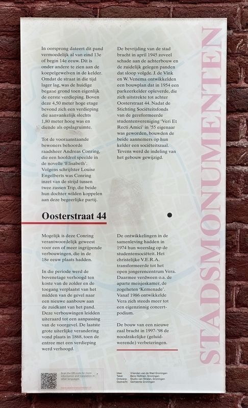
Tot de vooraanstaande bewoners behoorde raadsheer Andreas Conring, die een hoofdrol speelde in de novelle ‘Elisabeth’. Volgens schrijfster Louise Engelberts was Conring inzet van de strijd tussen twee zussen Trip, die beide hun dochter wilden koppelen aan deze begeerlijke partij. Mogelijk is deze Conring verantwoordelijk geweest voor een of meer ingrijpende verbouwingen, die in de 18e eeuw plaats hadden.
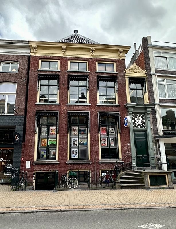
In die periode werd de bovenetage verhoogd ten koste van de zolder en de toegang verplaatst van het midden van de gevel naar een nieuwe aanbouw aan de zuidkant van het pand. Deze verbouwingen leidden uiteraard tot een aanpassing van de voorgevel. De laatste grote uiterlijke verandering vond plaats in 1868, toen de entree met een verdieping werd verhoogd. De bevrijding van de stad bracht in april 1945 zoveel schade aan de achterbouw en de zuidelijk gelegen panden dat sloop volgde. J. de Vink en W. Venema ontwikkelden een bouwplan dat in 1954 een parkeerkelder opleverde, die zich uitstrekte tot achter Oosterstraat 44. Nadat de Stichting Sociëteitsfonds van de gereformeerde studentenvereniging ‘Veri Et Recti Amici’ in 1955 eigenaar was geworden, bouwden de beide aannemers op hun kelder een sociëteitszaal. Tevens werd de indeling van het gebouw gewijzigd.
De ontwikkelingen in de samenleving hadden in 1974 hun weerslag op de studentensociëteit. Het christelijke V.E.R.A. transformeerde tot het open jongerencentrum Vera. Daarmee verdween o.a. de aparte meisjeskamer, de zogeheten ‘Kemenade’. Vanaf 1986 ontwikkelde Vera zich steeds meer tot een eigenzinnig concertpodium.
De bouw van een nieuwe zaal bracht in 1997-’98 de noodzakelijke (geluidwerende) verbeteringen.
(English translation provided by Stadsmonumenten.nl:)
In its origin, this house is presumably dating back to the end of the 13th or the beginning of the 14th century. One of the ways this is recognizable is by the domes in the basement. Since the street was lower during that time, the existing ground floor was actually the first floor. Above this 4.5 meters floor was another story that was initially just 1.8 meters high, and served as a storage space.
Prominent residents include the counselor Andreas Conring, who played a lead role in the novel “Elisabeth”. According to writer Louise Engelberts, Conring was in the midst of the competition between the Trip sisters, who both wanted to partner their daughter with this desirable suitor. It is possible that Conring was responsible for one or more of the major renovations that took place during the 18th century.
During this period, the upper floor was being heightened into the space of the attic, and the entrance was moved to the middle of the decorative facade to a new building at the south side of the house. These renovations ultimately led to an adjustment of the frontal facade. The last major outer change occurred in 1868, when the entrance was heightened by one story.
The liberation of the city in 1945 resulted in so much damage, to the backside of the house and the southern-situated buildings, that demolition soon followed. J. De Vink and W. Venema developed a construction plan of a parking basement in 1945, which stretched past Oosterstraat 44. After the “Stichting Sociëteitsfonds” (Society Club) of the reformed student association “Veri Et Recti Amici” became the owner in 1955, both contractors built a club hall in their basement. Furthermore, the layout of the building was changed.
The developments in the society had an impact on the student association in 1974. The Christian V.E.R.A. transformed into the open youth center “Vera”. With this, the girls room, called “Kemenade” ceased to exist. From 1986, Vera developed itself more and more to be a unique concert stage. In 1997-’98, the construction of a new hall brought the necessary (soundproof) improvements.
Erected by Gemeente Groningen. (Marker Number 070.)
Topics and series. This historical marker is listed in these topic lists: Arts, Letters, Music • Notable Buildings. In addition, it is included in the Groningen Stadsmonumenten series list. A significant historical month for this entry is April 1945.
Location. 53° 13.025′ N, 6° 34.203′ E. Marker is in Groningen. Marker is on Oosterstraat. Touch for map. Marker is at or near this postal address: Oosterstraat 44, Groningen 9711 NR, Netherlands. Touch for directions.
Other nearby markers. At least 8 other markers are within walking distance of this marker. Bentelaarsgang (within shouting distance of this marker); De Drie Gezusters / The Three Sisters (about 180 meters away, measured in a direct line); De bevrijding van Groningen / The Liberation of Groningen Memorial (about 240 meters away); Feithhuis (about 240 meters away); Groningen Municipal Council Members Memorial (approx. 0.2 kilometers away); Martinikerk / St. Martin Church (approx. 0.3 kilometers away); Provinciehuis / Provincial House (approx. 0.3 kilometers away); Martinitoren / St. Martin Tower (approx. 0.3 kilometers away). Touch for a list and map of all markers in Groningen.
Credits. This page was last revised on December 31, 2023. It was originally submitted on June 11, 2023, by Andrew Ruppenstein of Lamorinda, California. This page has been viewed 49 times since then and 9 times this year. Photos: 1, 2. submitted on June 11, 2023, by Andrew Ruppenstein of Lamorinda, California.

