Islamorada in Monroe County, Florida — The American South (South Atlantic)
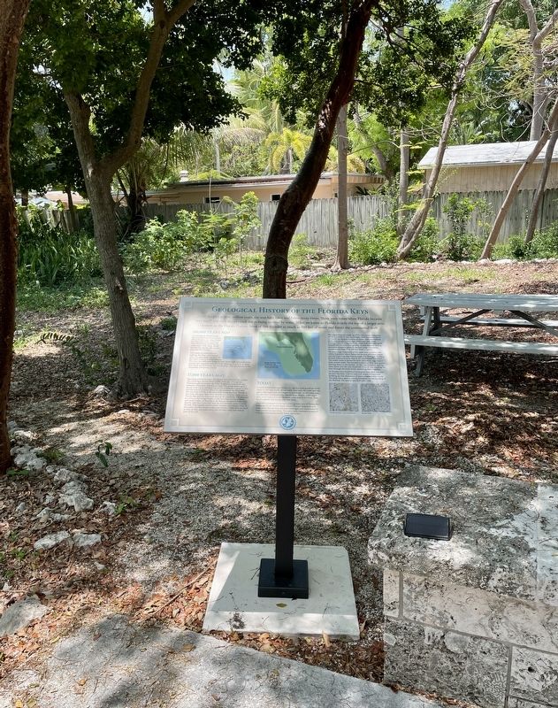
Geological History of the Florida Keys
Heritage Monument Trail, Matacumbe Historical Trust
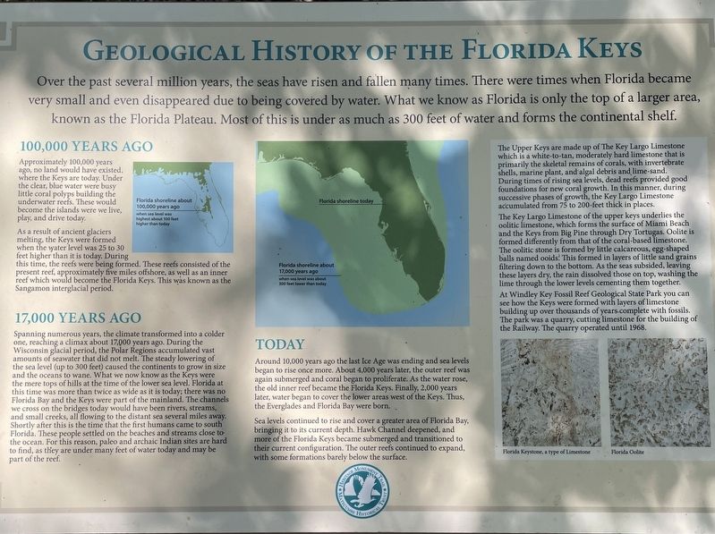
Over the past several million years, the seas have risen and fallen many times. There were times when Florida became very small and even disappeared due to being covered by water. What we know as Florida is only the top of a larger area, known as the Florida Plateau. Most of this is under as much as 300 feet of water and forms the continental shelf.
10,000 Years Ago
Approximately 100,000 years ago, no land would have existed, where the Keys are today. Under the clear, blue water were busy little coral polyps building the underwater reefs. These would become the islands were we live, play, and drive today.
As a result of ancient glaciers melting, the Keys were formed when the water level was 25 to 30 feet higher than it is today. During this time, the reefs were being formed. These reefs consisted of the present reef, approximately five miles offshore, as well as an inner reef which would become the Florida Keys. This was known as the Sangamon interglacial period.
17,000 Years Ago
Spanning numerous years, the climate transformed into a colder one, reaching a climax about 17,000 years ago. During the Wisconsin glacial period, the Polar Regions accumulated vast amounts of seawater that did not melt. The steady lowering of the sea level (up to 300 feet) caused the continents to grow in size and the oceans to wane. What we now know as the Keys were the mere tops of hills at the time of the lower sea level. Florida at this time was more than twice as wide as it is today; there was no Florida Bay and the Keys were part of the mainland. The channels we cross on the bridges today would have been rivers, streams, and small creeks, all flowing to the distant sea several miles away. Shortly after this is the time that the first humans came to south Florida. These people settled on the beaches and streams close to-the ocean. For this reason, paleo and archaic Indian sites are hard to find, as they are under many feet of water today and may be part of the reef.
Today
Around 10,000 years ago the last Ice Age was ending and sea levels began to rise once more. About 4,000 years later, the outer reef was again submerged and coral began to proliferate. As the water rose, the old inner reef became the Florida Keys. Finally, 2,000 years later, water began to cover the lower areas west of the Keys. Thus, the Everglades and Florida Bay were born.
Sea levels continued to rise and cover a greater area of Florida Bay, bringing it to its current depth. Hawk Channel deepened, and more of the Florida Keys became submerged and transitioned to their current configuration. The outer reefs continued to expand, with some formations barely below the surface.
(sidebar)
The Upper Keys are made up of The Key Largo Limestone which is a white-to-tan, moderately hard limestone that is primarily the skeletal remains of corals, with invertebrate shells, marine plant, and algal debris and lime-sand.
During times of rising sea levels, dead reefs provided good foundations for new coral growth. In this manner, during successive phases of growth, the Key Largo Limestone accumulated from 75 to 200-feet thick in places.
The Key Largo Limestone of the upper keys underlies the oolitic limestone, which forms the surface of Miami Beach and the Keys from Big Pine through Dry Tortugas. Oolite is formed differently from that of the coral-based limestone. The oolitic stone is formed by little calcareous, egg-shaped balls named ooids! This formed in layers of little sand grains filtering down to the bottom. As the seas subsided, leaving these layers dry, the rain dissolved those on top, washing the lime through the lower levels cementing them together.
At Windley Key Fossil Reef Geological State Park you can see how the Keys were formed with layers of limestone building up over thousands of years complete with fossils. The park was a quarry, cutting limestone for the building ot the Railway. The quarry operated until 1968.
(captions)
Florida shoreline about 100,000 years ago when the sea level was highest about 100 feet higher than today.
Florida shoreline about 17,000 years ago when the sea level was about 300 feet lower than today.
Florida shoreline today
Florida Keystone, a type of Limestone
Florida Oolite
Erected by Heritage Monument Trail, Matacumbe Historical Trust.
Topics. This historical marker is listed in this topic list: Natural Features.
Location. 24° 55.573′ N, 80° 37.582′ W. Marker is in Islamorada, Florida, in Monroe County. Marker can be reached from Overseas Highway (U.S. 1) near North Ocean Lane, on the left when traveling north. Touch for map. Marker is at or near this postal address: 82616 Overseas Highway, Islamorada FL 33036, United States of America. Touch for directions.
Other nearby markers. At least 8 other markers are within walking distance of this marker. The Early Settlers of Upper Matecumbe Key (here, next to this marker); The Florida Keys Memorial (here, next to this marker); Native Americans (here, next to this marker); The Spanish Treasure Fleets (here, next to this marker); The Railway That Went To Sea (here, next to this marker); The Storm that Still Howls (a few steps from this marker); Site of Islamorada Railway Station (approx. ¼ mile away); The 1935 Hurricane (approx. 0.9 miles away). Touch for a list and map of all markers in Islamorada.
Also see . . .
1. Geology and Origin of the Florida Keys. (Submitted on June 11, 2023, by Brandon D Cross of Flagler Beach, Florida.)
2. Heritage Monument Trail, Matacumbe Historical Trust. (Submitted on June 11, 2023, by Brandon D Cross of Flagler Beach, Florida.)
Credits. This page was last revised on June 12, 2023. It was originally submitted on June 11, 2023, by Brandon D Cross of Flagler Beach, Florida. This page has been viewed 69 times since then and 25 times this year. Photos: 1, 2. submitted on June 11, 2023, by Brandon D Cross of Flagler Beach, Florida. • Bernard Fisher was the editor who published this page.

