
Ipswich in Suffolk, England, United Kingdom — Northwestern Europe (the British Isles)
Ipswich Almshouses
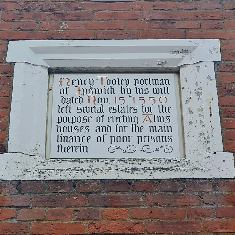
Photographed by Stephen Palmer, June 3, 2023
1. Ipswich Almshouses Marker
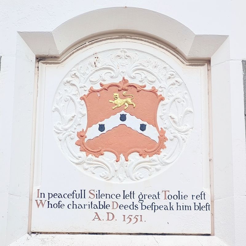
In peaceful silence lett great Toolie rest
Whose charitable deeds bespeak him blest
A.D.1551
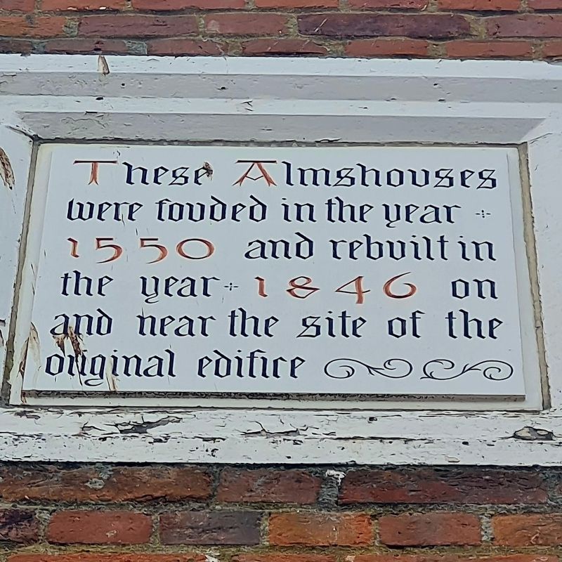
These Almshouse were founded in the year 1550 and rebuilt in the year 1846 on and near the site of the edifice
Topics. This historical marker is listed in this topic list: Charity & Public Work. A significant historical date for this entry is November 15, 1550.
Location. 52° 3.286′ N, 1° 9.464′ E. Marker is in Ipswich, England, in Suffolk. It is on Foundation Street, on the right when traveling north. Touch for map. Marker is at or near this postal address: 34 Foundation Street, Ipswich, England IP4 1BE, United Kingdom. Touch for directions.

Regionally, this marker is in England’s East Anglia. Globally, it is on the Atlantic Ocean, in the North Atlantic Region, in Europe, in Atlantic Europe, on one of the British Isles, in the Western World, and in the Anglosphere. Historically, it finds itself in what was once the Roman Empire.
Other nearby markers. At
this page online
Also see . . . Tooley's Foundation and Smart's Charity. Excerpt from the Suffolk Archives
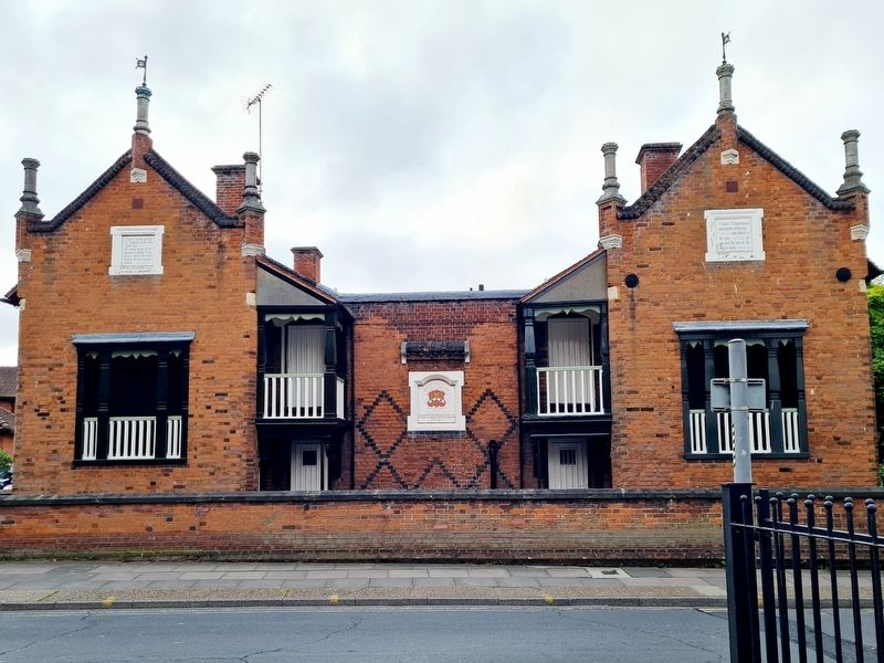
"Most of the income was devoted to maintaining the almshouse which, despite the long-running litigation, seems already to have been built by the late 1550s on a site in what is now Foundation Street, not far from Tooley's burial place in the parish church of St Mary at Quay. It originally consisted of five separate lodgings, each to accommodate two people, though it was early recognised that, after the deaths of Tooley's widow Alice and Alice Thwaytes, both of whom received pensions out of the endowment, more almspeople could be maintained." (Submitted on June 13, 2023, by Stephen Palmer of Ascot, England.)
Photographed by Stephen Palmer, June 3, 2023
2. Ipswich Almshouses Marker
Photographed by Stephen Palmer, June 3, 2023
3. Ipswich Almshouses Marker
Photographed by Stephen Palmer, June 3, 2023
4. Ipswich Almshouses
Credits. This page was last revised on June 13, 2023. It was originally submitted on June 13, 2023, by Stephen Palmer of Ascot, England. This page has been viewed 272 times since then and 24 times this year. Photos: 1, 2, 3, 4. submitted on June 13, 2023, by Stephen Palmer of Ascot, England. • Andrew Ruppenstein was the editor who published this page.
