Centrum in Den Haag, South Holland, Netherlands — Northwestern Europe
Lange Voorhout 17
Photographed by Andrew Ruppenstein, May 8, 2023
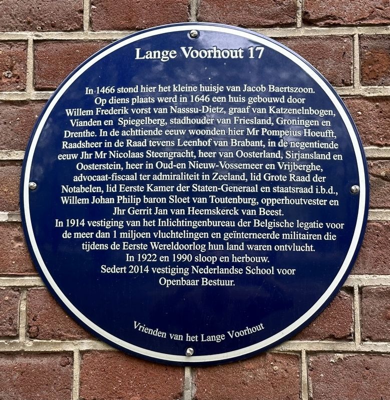
1. Lange Voorhout 17 Marker
Inscription.
In 1466 stond hier het kleine huisje van Jacob Baertszoon.
Op diens plaats werd in 1646 een huis gebouwd door
Willem Frederik vorst van Nasssu-Dietz, graaf van Katzenelnbogen,
Vianden en Spiegelberg, stadhouder van Friesland, Groningen en
Drenthe. In de achttiende eeuw woonden hier Mr Pompeius Hoeufft,
Raadsheer in de Raad tevens Leenhof van Brabant, in de negentiende
eeuw Jhr Mr Nicolaas Steengracht, heer van Oosterland, Sirjansland en
Oosterstein, heer in Oud-en Nieuw-Vossemeer en Vrijberghe,
advocaat-fiscaal ter admiraliteit in Zeeland, lid Grote Raad der
Notabelen, lid Eerste Kamer der Staten-Generaal en staatsraad i.b.d.,
Willem Johan Philip baron Sloet van Toutenburg, opperhoutvester en
Jhr Gerrit Jan van Heemskerck van Beest.
In 1914 vestiging van het Inlichtingenbureau der Belgische legatie voor
de meer dan 1 miljoen vluchtelingen en geïnterneerde militairen die
tijdens de Eerste Wereldoorlog hun land waren ontvlucht.
In 1922 en 1990 sloop en herbouw.
Sedert 2014 vestiging Nederlandse School voor
Openbaar Bestuur.
(English translation:)
In 1466, the small house of Jacob Baertszoon
Click or scan to see this page online
stood here.
A house was built in its place in 1646 for
William Frederick Prince of Nasssu-Dietz, Count of Katzenelnbogen,
Vianden and Spiegelberg, Stadtholder of Friesland, Groningen and
Drenthe. In the eighteenth century Mr. Pompeius Hoeufft lived here,
Member in the Council, as well as the Leenhof van Brabant; and in the nineteenth
century Lord Nicolaas Steengracht, the Lord of Oosterland, Sirjansland and
Oosterstein, Lord of Old and New Vossemeer and Vrijberghe,
And tax lawyer at the admiralty in Zeeland, member of the Grand Council of the Netherlands Notables, member of the Senate of the States General and State Councilor i.b.d.,
Willem Johan Philip baron Sloet van Toutenburg, chief forester and
Lord Gerrit Jan van Heemskerck van Beest.
In 1914 it was part of the Intelligence Bureau of the Belgian Legation for the more than 1 million refugees and interned military personnel who
had fled their country during the First World War.
Demolition and reconstruction in 1922 and 1990.
Since 2014 it has been the location of the Dutch School for Public Administration.
Erected by Vrienden van het Lange Voorhout.
Topics.
Photographed by Andrew Ruppenstein, May 8, 2023
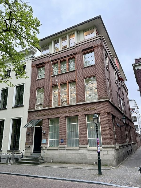
2. Lange Voorhout 17 Marker - wide view
This historical marker is listed in this topic list: Government & Politics. A significant historical year for this entry is 1466.
Location. 52° 4.925′ N, 4° 18.724′ E. Marker is in Den Haag, Zuid-Holland (South Holland). It is in Centrum. It is on Lange Voorhout, on the right when traveling east. Touch for map. Marker is at or near this postal address: Lange Voorhout 17, Den Haag, Zuid-Holland 2514 EC, Netherlands. Touch for directions.
Regionally, it is in Europe, the European Union, Atlantic Europe, the Benelux Low Countries, the Schengen Area, Western Europe, and the Western World. Historically, it finds itself in what was once the Roman Empire and specifically also the Holy Roman Empire.
Credits. This page was last revised on December 31, 2023. It was originally submitted on June 14, 2023, by Andrew Ruppenstein of Lamorinda, California. This page has been viewed 218 times since then and 23 times this year. Photos:1, 2. submitted on June 14, 2023, by Andrew Ruppenstein of Lamorinda, California.