De Baarsjes in Amsterdam, North Holland, Netherlands — Northwestern Europe
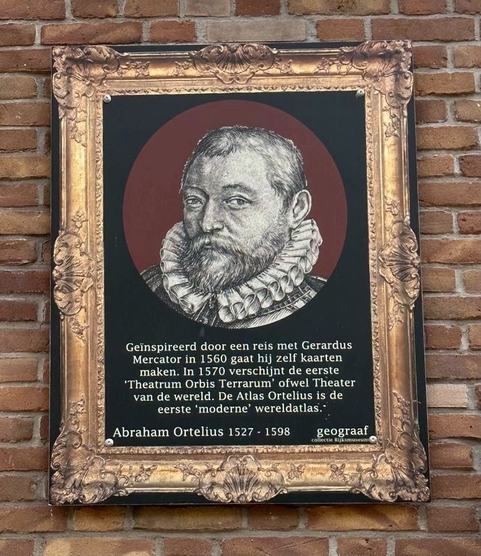
Abraham Ortelius: Geograaf
⎯⎯⎯
Geographer
Photographed by Andrew Ruppenstein, May 6, 2023
1. Abraham Ortelius Marker

Geïnspireerd door een reis met Gerardus Mercator in 1560 gaat hij zelf kaarten maken. In 1570 verschijnt de eerste 'Theatrum Orbis Terrarum' ofwel Theater van de wereld. De Atlas Ortelius is de eerste 'moderne' wereldatlas.
Erected by Geef Straten Een Gezicht.
Topics and series. This historical marker is listed in this topic list: Arts, Letters, Music. In addition, it is included in the Give Streets a Face / Geef Straten Een Gezicht series list. A significant historical year for this entry is 1527.
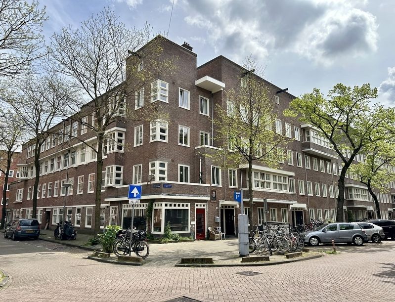
Location. 52° 22.111′ N, 4° 51.005′ E. Marker is in Amsterdam, Noord-Holland (North Holland). It is in De Baarsjes. It is at the intersection of Orteliusstraat and Van Spilbergenstraat, on the right when traveling north on Orteliusstraat. Touch for map. Marker is at or near this postal address: Orteliusstraat 146III, Amsterdam, Noord-Holland 1057 RB, Netherlands.
this page online

Regionally, it is in Europe, the European Union, Atlantic Europe, the Benelux Low Countries, the Schengen Area, Western Europe, and the Western World. Historically, it finds itself in what was once the Holy Roman Empire.
Other nearby markers. At least 8 other markers are within walking distance of this marker: Abraham Ortelius (about 150 meters away, measured in a direct line); Henry Hudson (about 180 meters away); William Baffin (about 210 meters away); Gerardus Mercator (approx. 0.3 kilometers away); Pedro Àlvares Cabral (approx. 0.3 kilometers away); Jan Mayen Island (approx. 0.3 kilometers away); Amerigo Vespucci (approx. 0.3 kilometers away); Marco Polo (approx. 0.4 kilometers away). Touch for a list and map of all markers in Amsterdam.
Also see . . . Abraham Ortelius (Wikipedia).
Overview: Abraham Ortelius (also Ortels, Orthellius, Wortels; 4 or 14 April 1527 – 28 June 1598) was a Brabantian cartographer, geographer, and cosmographer. He is recognized as the creator of the first modern atlas, the Theatrum Orbis Terrarum (Theatre of the World). Along with Gemma Frisius and Gerardus Mercator,(Submitted on June 14, 2023.)Ortelius is generally considered one of the founders of the Netherlandish school of cartography and geography. He was a notable figure of this school in its golden age (approximately 1570s–1670s) and an important geographer of Spain during the age of discovery. The publication of his atlas in 1570 is often considered as the official beginning of the Golden Age of Netherlandish cartography. He was the first person proposing that the continents were joined before drifting to their present positions.Photographed by Andrew Ruppenstein, May 6, 20232. Abraham Ortelius Marker - wide view
Credits. This page was last revised on December 31, 2023. It was originally submitted on June 14, 2023, by Andrew Ruppenstein of Lamorinda, California. This page has been viewed 178 times since then and 30 times this year. Photos: 1, 2. submitted on June 14, 2023, by Andrew Ruppenstein of Lamorinda, California.
