
Caguas in Municipio de Caguas, Puerto Rico — The Caribbean (The West Indies)
Casa Alcaldia
[City Hall]
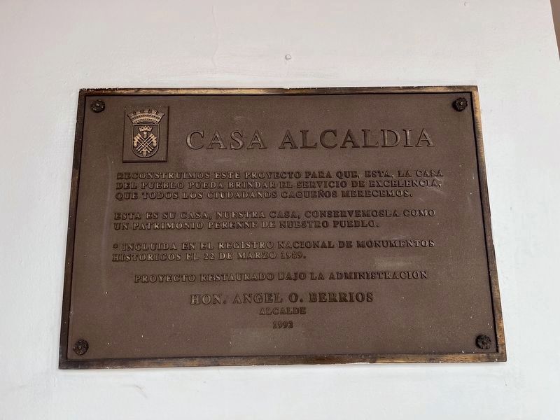

Reconstuimos este proyecto para que, esta, la Casa del Pueblo pueda brindar el servicio de excelencia, que todos los ciudadanos cagueños merecemos.
Esta es su casa, nuestra casa, conservemosea como un patriotism perrene de nuestro pueblo.
* Incluida en el Registro Nacional de Monumentos Historicos el 22 de marzo 1989.
We reconstructed this project so that this, the Town Hall can provide the excellent service that all citizens of Caguas deserve.
This is your house, our house, let us preserve it as a perennial patriotism of our people.
* Included in the National Register of Historical Places on March 22, 1989.
Erected 1992 by Municipio de Caguas, Hon. Angel O. Berrios, Alcalde.
Topics. This historical marker is listed in this topic list: Government & Politics. A significant historical date for this entry is March 22, 1989.
Location. 18° 14.086′ N, 66° 2.15′ W. Marker is in Caguas in Municipio de Caguas, Puerto Rico. It is on Calle Muñoz Rivera (Puerto Rico Route 1) just south of Calle Ruiz Belvis ( Route 768), on the right when traveling south. Touch for map. Marker is at or near
this page online

Regionally, this marker is in the San Juan Metropolitan Area. Globally, it is one of the Greater Antilles on the Caribbean Sea, on in the Atlantic Ocean, in North America, in the Western Hemisphere, in the Western World, and in the Anglosphere. Historically, it finds itself in what was once a Spanish colony.
Other nearby markers. At least 8 other markers are within 8 kilometers of this marker, measured as the crow flies: Don Luis Muñoz Rivera (within shouting distance of this marker); Edificio Rafaela Conde viuda de Mirabal (about 300 feet away, measured in a direct line); Casa Amarilla (about 300 feet away); Carlos Manuel "Charlie" Rodríguez Santiago (about 400 feet away); Don Miguel Hernández Rodriguez (approx. 2.3 kilometers away); Lcdo. Ángel Viera Martínez (approx. 7.1 kilometers away); Luis del Carmen Echevarria Delgado (approx. 7.1 kilometers away); Luis A. Ferré Aguayo (approx. 7.1 kilometers away). Touch for a list and map of all markers in Caguas.
Credits. This page was last revised on April 6, 2024. It was originally submitted on June 14, 2023, by Devry Becker Jones of Washington, District of Columbia. This page has been viewed 140 times since then and 15 times this year. Photos: 1, 2, 3. submitted on June 14, 2023, by Devry Becker Jones of Washington, District of Columbia.
Editor’s want-list for this marker. Photo of the town hall. • Can you help?
