La Perla in San Juan in Municipio de San Juan, Puerto Rico — The Caribbean (The West Indies)
La Perla
San Juan National Historic Site
— National Park Service, U.S. Department of the Interior —
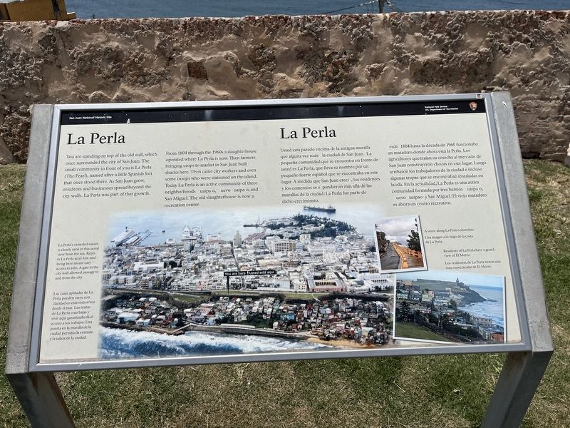
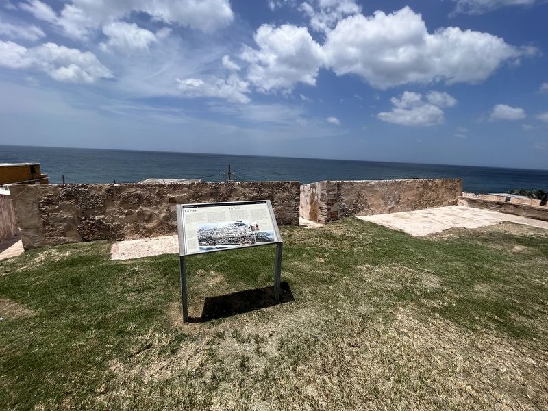
You are standing on top of the old wall, which once surrounded the city of San Juan. The small community in front of you is La Perla (The Pearl), named after a little Spanish fort that once stood there. As San Juan grew, residents and businesses spread beyond the city walls. La Perla was part of that growth.
From 1804 through the 1960s a slaughterhouse operated where la Perla is now. Then farmers bringing crops to market in San Juan built shacks here. Then came city workers and even some troops who were stationed on the island. Today La Perla is an active community of three neighborhoods: uaipa o, Nuevo uaipa o, and San Miguel. The old slaughterhouse is now a recreation center.
[Caption:]
La Perla's crowded nature is clearly seen in this aerial view from the sea. Rents in La Perla were low and living here meant easy access to jobs. A gate in the city wall allowed passage to and from the city.
Dede 1804 hasta la década de 1960 funcionaba un matadero donde ahora está la Perla. Los agricultores que traían su cosecha al mercado de San Juan construyeron chozas en este lugar. Luego arribaron los trabajadores de la ciudad e incluso algunas tropas que se encontraban instaladas en la isla. En la actualidad, La Perla es una activa comunidad formada por tres barrios uaipa o, Nuevo uaipao y San Miguel. El viejo matadero es ahorra un centro recreativo.
[Subtítulo:]
Las casas apiñadas de La Perla pueden verse con claridad en esta vista aérea dede el mar. Las rentas de La Perla eran bajas y vivir aquí garantizaba fácil acceso a los trabajos. Una puerta en la muralla de la ciudad permitía la entrada y la salida de la ciudad.
Erected by National Park Service, U.S. Department of the Interior.
Topics. This historical marker is listed in these topic lists: Agriculture • Forts and Castles • Industry & Commerce • Settlements & Settlers. A significant historical year for this entry is 1804.
Location. 18° 28.093′ N, 66° 6.858′ W. Marker is in San Juan in Municipio de San Juan, Puerto Rico. It is in La Perla. Marker is on Calle Norzagaray, 0.2 kilometers west of Calle Calle José Celso Barbosa, on the right when traveling west. Touch for map. Marker is at or near this postal address: Calle Norzagaray 304, San Juan PR 00901, United States of America. Touch for directions.
Other nearby markers. At least 8 other markers are within walking distance of this marker. Unforeseen Stresses / Presiones Imprevistas (about 400 feet away, measured in a direct line); Noel Estrada (approx. 0.2 kilometers away); Plaza de Colón (approx. 0.3 kilometers away); José Julián Acosta Birthplace (approx. 0.3 kilometers away); National Historic Site (approx. 0.3 kilometers away); In Defense of San Juan / En defenso de San Juan (approx. 0.3 kilometers away); What About Water? / ¿De Dónde Viene el Agua? (approx. 0.3 kilometers away); Firepower (approx. 0.3 kilometers away). Touch for a list and map of all markers in San Juan.
Credits. This page was last revised on June 14, 2023. It was originally submitted on June 14, 2023, by Devry Becker Jones of Washington, District of Columbia. This page has been viewed 75 times since then and 12 times this year. Photos: 1, 2. submitted on June 14, 2023, by Devry Becker Jones of Washington, District of Columbia.

