Southam in Hamilton, Ontario — Central Canada (North America)
Mountain View Hotel
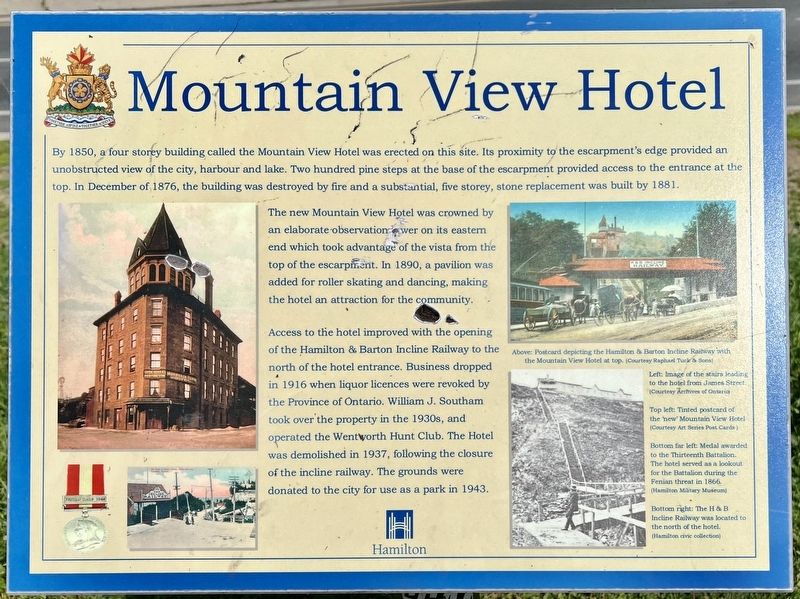
Photographed by Tim Boyd, May 18, 2023
1. Mountain View Hotel Marker
By 1850, a four storey building called the Mountain View Hotel was erected on this site. Its proximity to the escarpment's edge provided an unobstructed view of the city, harbour and lake. Two hundred pine steps at the base of the escarpment provided access to the entrance at the top. In December of 1876, the building was destroyed by fire and a substantial, five storey, stone replacement was built by 1881.
The new Mountain View Hotel was crowned by an elaborate observation tower on its eastern end which took advantage of the vista from the top of the escarpment. In 1890, a pavilion was added for roller skating and dancing, making the hotel an attraction for the community.
Access to the hotel improved with the opening of the Hamilton & Barton Incline Railway to the north of the hotel entrance. Business dropped in 1916 when liquor licences were revoked by the Province of Ontario. William J. Southam took over the property in the 1930s, and operated the Wentworth Hunt Club. The Hotel was demolished in 1937, following the closure of the incline railway. The grounds were donated to the city for use as a park in
this page online
Erected by City of Hamilton.
Topics. This historical marker is listed in these topic lists: Architecture • Industry & Commerce. A significant historical year for this entry is 1850.
Location. 43° 14.668′ N, 79° 52.511′ W. Marker is in Hamilton, Ontario. It is in Southam. It is at the intersection of Clairmont Access and Inverness Avenue west, on the right when traveling south on Clairmont Access. The marker is in Southam Park. Touch for map. Marker is at or near this postal address: 480 Upper James Street, Hamilton ON L9C L9C, Canada. Touch for directions.

Regionally, this marker is on the Golden Horseshoe, in the Hamilton-Halton-Brant Area, and specifically in the Toronto Metropolitan Area. It is also in Central Canada. Globally, it is in North America, on the Great Lakes, in the Western Hemisphere, in the Western World, and in the Anglosphere. Historically, it finds itself in what was once a British colony, the Viceroyalty of New France, the Haudenosaunee (Iroquois) Confederacy, and Rupert’s Land.
Other nearby markers. At least 8 other markers are within walking distance of this marker: The Incline Railway
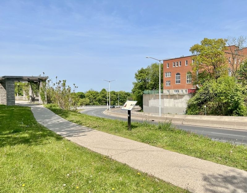
Photographed by Tim Boyd, May 28, 2023
2. Mountain View Hotel Marker
Also see . . . Memories of Hamilton’s Mountainview Inn Kept Alive in Small Park.
Overlooking the City of Hamilton, on the edge of the Niagara Escarpment (known locally as Hamilton Mountain) at Upper James Street and Claremont Drive, is a 3-acre park named Southam Park, named after Major Gordon Southam, a Canadian Field Artillery officer who was killed on 15 October 1916, during the Battle of the Somme.(Submitted on June 15, 2023, by Tim Boyd of Hamilton, Ontario.)
With a commanding view of the city below, it was once the site of a popular hotel, the Mountain View Hotel.
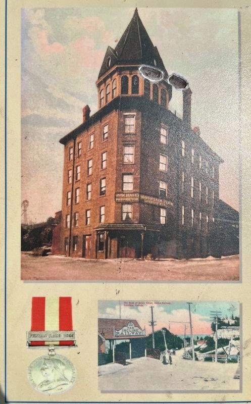
3. Mountain View Hotel Marker detail (left side)
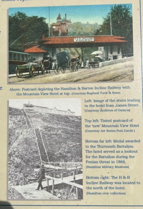
4. Mountain View Hotel Marker detail (right side)
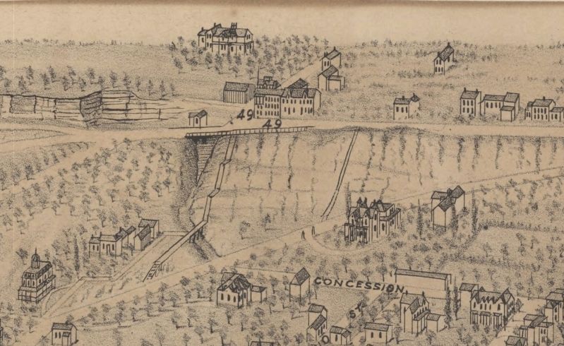
1876
5. The old Mountain View Hotel.
From a Birdseye View of Hamilton, 1876, showing the old hotel (labeled 49) and the steps leading to it.
Source; MacMaster university Digital Archives
Credits. This page was last revised on June 19, 2023. It was originally submitted on June 15, 2023, by Tim Boyd of Hamilton, Ontario. This page has been viewed 1,288 times since then and 120 times this year. Photos: 1, 2, 3, 4, 5. submitted on June 15, 2023, by Tim Boyd of Hamilton, Ontario. • Andrew Ruppenstein was the editor who published this page.
