Hanover in Hanover County, Virginia — The American South (Mid-Atlantic)
Washington-Rochambeau Route
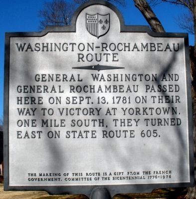
Photographed by Bernard Fisher, February 2, 2009
1. Washington-Rochambeau Route Marker
The marking of this route is a gift from the French Government. Committee of the Bicentennial 1776-1976
Erected by French Government, Committee of the Bicentennial 1776-1976.
Topics and series. This historical marker is listed in this topic list: War, US Revolutionary. In addition, it is included in the Former U.S. Presidents: #01 George Washington, and the The Washington-Rochambeau Route series lists. A significant historical month for this entry is September 1864.
Location. Marker has been permanently removed. It was located near 37° 45.769′ N, 77° 22.029′ W. Marker was in Hanover, Virginia, in Hanover County. It was on Hanover Courthouse Road (U.S. 301) 0.2 miles north of Depot Road, on the right when traveling north. Touch for map. Marker was in this post office area: Hanover VA 23069, United States of America.
We have been informed that this marker is no longer there and will not be replaced. This page is an archival view of what was.
Regionally, this marker
this page online

Other nearby markers. At least 8 other markers are within walking distance of this location: Hanover Confederate Soldiers Monument (within shouting distance of this marker); Hanover Courthouse (within shouting distance of this marker); The Fields Family (within shouting distance of this marker); a different marker also named Hanover Courthouse (within shouting distance of this marker); Hanover Tavern (within shouting distance of this marker); a different marker also named Hanover Tavern (within shouting distance of this marker); Patrick Henry (within shouting distance of this marker); a different marker also named
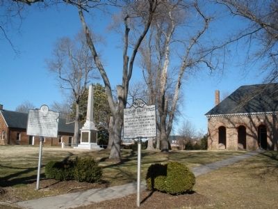
Photographed by Bernard Fisher, February 2, 2009
2. Washington-Rochambeau Route Marker
Another marker is no longer nearby. Hanover Court House (was here, next to this marker but has been permanently removed).
More about this marker. Marker has been removed by Hanover Court with permission of Preservation Virginia due to inaccuracy, is in possession of the Hanover County Historical Society. Washington, Rochambeau, Chastellux and their staff officers did not travel through Hanover County in their movement from Newport, RI to Yorktown, VA. They left Mount Vernon on 12 Sep 1781 enroute to Fredericksburg, spending the night there. 13 Sep 1781, they proceeded to Aylett(s) (Col.) via Bowling Green to Aylett(s) spending night at Col. Aylett's Fairfield. 14 Sep 1781 proceeded to Williamsburg, crossing the Pamunkey River via Ruffin's Ferry from King and Queen into New Kent County. Thus no Hanover route. Washington (in Nov 1781) and Rochambeau (in Feb 1781) did come though Hanover Courthouse on return from Yorktown.
Source: Revolutionary War Road and Transportation Survey in the Commonwealth of Virginia, 1781 - 1782 by Robert A. Selig (2010). Partners review copies published for review, undergoing final revisions. (Lengthy, comprehensive study.)
Also see . . . Washington-Rochambeau Revolutionary Route.
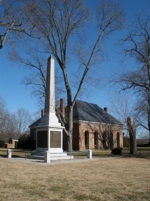
Photographed by Bernard Fisher, February 2, 2009
3. Hanover Court House
Credits. This page was last revised on September 2, 2025. It was originally submitted on February 5, 2009, by Bernard Fisher of Richmond, Virginia. This page has been viewed 2,072 times since then and 72 times this year. Last updated on June 17, 2023. Photos: 1, 2, 3. submitted on February 5, 2009, by Bernard Fisher of Richmond, Virginia.
