Amsterdam Oud-West , North Holland, Netherlands — Northwestern Europe
Kantoor Gemeentetram
⎯⎯⎯
Municipal Tram Office
Photographed by Andrew Ruppenstein, May 17, 2023
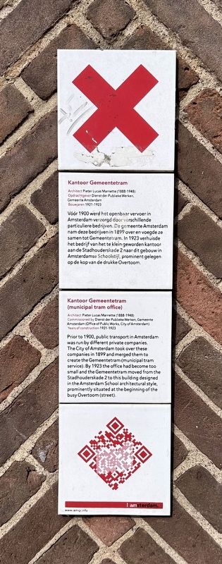
1. Kantoor Gemeentetram / Municipal Tram Office Marker

Architect Pieter Lucas Marnette (1888-1948)
Opdrachtgever Dienst der Publieke Werken, Gemeente Amsterdam
Bouwjaren 1921-1923
Vóór 1900 werd het openbaar vervoer in Amsterdam verzorgd door verschillende particuliere bedrijven. De gemeente Amsterdam nam deze bedrijven in 1899 over en voegde ze samen tot Gemeentetram. In 1923 verhuisde het bedrijf van het te klein geworden kantoor aan de Stadhouderskade 2 naar dit gebouw in Amsterdamse Schoolstijl, prominent gelegen op de kop van de drukke Overtoom.
Kantoor Gemeentetram
(municipal tram office)
Architect Pieter Lucas Marnette (1888-1948)
Commissioned by Dienst der Publieke Werken, Gemeente Amsterdam (Office of Public Works, City of Amsterdam)
Years of construction 1921-1923
Prior to 1900, public transport in Amsterdam was run by different private companies. The City of Amsterdam took over these companies in 1899 and merged them to create the Gemeentetram (municipal tram service). By 1923 the office had become too small and the Gemeentetram moved from the Stadhouderskade 2 to this building designed in the Amsterdam School architectural style, prominently situated at the beginning of the busy Overtoom (street).
Erected by IAmsterdam.
Topics and series. This historical marker is listed in this topic list: Railroads & Streetcars. In addition, it is included in the IAmsterdam series list. A significant historical year for this entry is 1900.
Location. 52° 21.821′ N, 4° 52.755′ E. Marker is in Amsterdam, Noord-Holland (North Holland). It is in Amsterdam Oud-West. It is at the intersection of Stadhouderskade and Overtoom, on the right when traveling north on Stadhouderskade. Touch for map. Marker is at or near this postal address: Stadhouderskade 1, Amsterdam, Noord-Holland 1054 ES, Netherlands.
this page online

Regionally, it is in Europe, the European Union, Atlantic Europe, the Benelux Low Countries, the Schengen Area, Western Europe, and the Western World. Historically, it finds itself in what was once the Holy Roman Empire.
Other nearby markers. At least 8 other markers are within walking distance of this marker: Marnixstraat 1945 Executions Memorial (about 150 meters away, measured in a direct line); H.F. Westerveld (about 150 meters away); Doctor Aletta H. Jacobs (about 180 meters away); Roemer Visscher (about 210 meters away); Tegen alle stromen in / Against the Tide (about 240 meters away); Vrijmetselaarsloge (freemason’s lodge) (approx. 0.3 kilometers away); Nico Richter (approx. 0.4 kilometers away); Pietro Antonio Locatelli (approx. 0.4 kilometers away). Touch for a list and map of all markers in Amsterdam.
Photographed by Andrew Ruppenstein, May 17, 2023
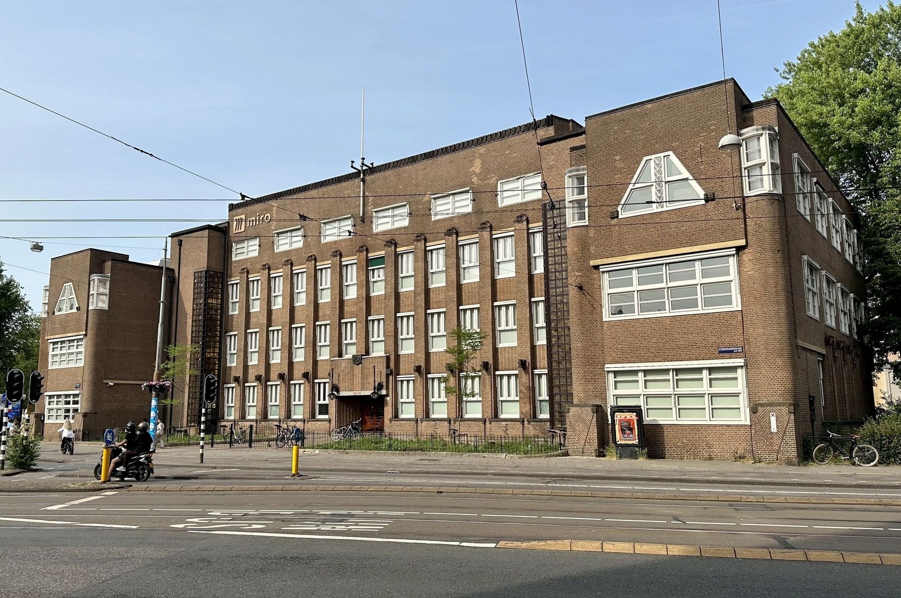
2. Kantoor Gemeentetram / Municipal Tram Office Marker - wide view
The marker is visible here on the very right of the building.
Credits. This page was last revised on December 31, 2023. It was originally submitted on June 18, 2023, by Andrew Ruppenstein of Lamorinda, California. This page has been viewed 273 times since then and 27 times this year. Photos: 1, 2. submitted on June 18, 2023, by Andrew Ruppenstein of Lamorinda, California.
