
Kinston in Lenoir County, North Carolina — The American South (South Atlantic)
Harmony Hall
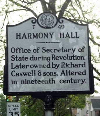
Photographed by Mike Stroud, April 19, 2013
1. Harmony Hall Marker
Erected 1972 by Office of Archives and History. (Marker Number F-49.)
Topics and series. This historical marker is listed in these topic lists: Notable Buildings • War, US Revolutionary. In addition, it is included in the North Carolina Division of Archives and History series list.
Location. Marker is missing. It was located near 35° 15.525′ N, 77° 34.813′ W. Marker was in Kinston, North Carolina, in Lenoir County. It was on East King Street (State Highway 11 & 55) near South McLewean Street, on the right when traveling east. Touch for map. Marker was in this post office area: Kinston NC 28501, United States of America. Touch for directions.

Regionally, this marker was in North Carolina’s Coastal Plain. It was also in the American South and specifically in the Upper South. Globally, it was in North America, the Western Hemisphere, the Western World, and the Anglosphere. Historically, it found itself in what was once the territory
this page online
Other nearby markers. At least 8 other markers are within walking distance of this location: Caswell (within shouting distance of this marker); In Honor and Remembrance (about 300 feet away, measured in a direct line); CSS Neuse (about 300 feet away); Lenoir County WW I and WW II Memorial (about 300 feet away); The Town Of Kingston (about 300 feet away); Fire Hydrants (about 300 feet away); Kinston Sit-Ins (about 600 feet away); CSS Neuse Confederate Ironclad Gunboat (approx. 0.2 miles away). Touch for a list and map of all markers in Kinston.
Another marker is no longer nearby. Kinston Hangings (was about 400 feet away but has been permanently removed).
Regarding Harmony Hall. The town of Kinston, in the colony of North Carolina, was established in 1762 after William Heritage donated land for the town. Heritage, a prominent New Bern attorney, became an integral part of the town’s development and served as a trustee during its early stages of growth. After the town was created,
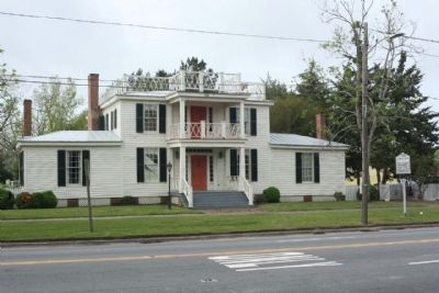
Photographed by Mike Stroud, April 19, 2013
2. Harmony Hall and Marker
One of the first houses constructed in the new town is now known as "Harmony Hall." The first section of the frame home was constructed during the last quarter of the eighteenth century and has seen several additions and changes as subsequent owners lived in the structure. The name "Harmony Hall" was added to the house in the twentieth century and was, until that time, known as the Peebles House. The Peebles family lived in the house longer than any other. Richard Caswell, the first governor of the state of North Carolina, owned the house although there is some question as to whether he lived in the house or used it for business or state purposes.
The home was acquired by the Lenoir County Historical Association and restored to reflect occupation of the house over its long history. Harmony Hall opened as a historic house museum and offices for the Historical Association in 1984 and can be toured today. (North Carolina Office of
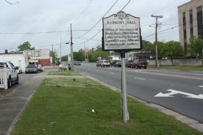
Photographed by Mike Stroud, April 19, 2013
3. Harmony Hall Marker looking west along NC 11/55 (East King Street)
Department of Cultural Resources)
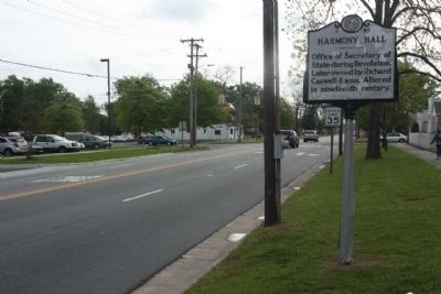
Photographed by Mike Stroud, April 19, 2013
4. Harmony Hall Marker looking eastward
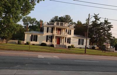
Photographed by Dave W, June 17, 2023
5. Harmony Hall Marker Missing
Credits. This page was last revised on February 1, 2025. It was originally submitted on July 1, 2013, by Mike Stroud of Bluffton, South Carolina. This page has been viewed 946 times since then and 53 times this year. Last updated on June 18, 2023, by Dave W of Co, Colorado. Photos: 1, 2, 3, 4. submitted on July 1, 2013, by Mike Stroud of Bluffton, South Carolina. 5. submitted on June 18, 2023, by Dave W of Co, Colorado. • Bernard Fisher was the editor who published this page.
