Currie in Pender County, North Carolina — The American South (South Atlantic)
Moores Creek Bridge
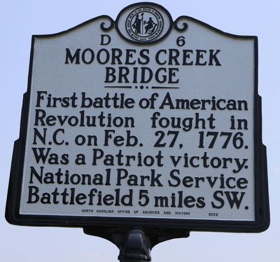
Photographed by Dave W, June 17, 2023
1. Moores Creek Bridge Marker
First battle of American Revolution fought in N.C. on Feb. 27, 1776. Was a Patriot victory. National Park Service Battlefield 5 miles SW.
Erected 2022 by North Carolina Office of Archives and History. (Marker Number D-6.)
Topics. This memorial is listed in these topic lists: Colonial Era • Patriots & Patriotism • War, US Revolutionary. A significant historical date for this entry is February 27, 1776.
Location. 34° 30.094′ N, 78° 3.372′ W. Memorial is in Currie, North Carolina, in Pender County. It is at the intersection of U.S. 421 and Malpass Corner Road, on the right when traveling north on U.S. 421. Touch for map. Memorial is at or near this postal address: 5210 Malpass Corner Rd, Currie NC 28435, United States of America. Touch for directions.

Regionally, this memorial is in North Carolina’s Coastal Plain. It is also in the American South, specifically in the Upper South, in the Tidewater, and on the Eastern Seaboard. Globally, it is in the North Atlantic Region, North America, the Western Hemisphere, the Western World, and the Anglosphere. Historically, it finds itself in what was once the territory
this page online
Other nearby markers. At least 8 other markers are within 5 miles of this marker, measured as the crow flies: Battle of Moore’s Creek Bridge (approx. 4.2 miles away); A Changing Landscape (approx. 4.2 miles away); Ghosts of an Industry (approx. 4.2 miles away); Tar Kiln (approx. 4.2 miles away); Vanishing Longleafs (approx. 4.3 miles away); Brave Patriots (approx. 4.3 miles away); Road to Independence (approx. 4.3 miles away); Boxing the Pines (approx. 4.3 miles away). Touch for a list and map of all markers in Currie.
Also see . . . National Park Service site for Moores Creek.
In the early morning hours of February 27, 1776, Loyalist forces charged across a partially dismantled Moores Creek Bridge. Beyond the bridge, nearly 1,000 North Carolina Patriots waited quietly with cannons and muskets poised to fire. This battle marked the last broadsword charge by Scottish Highlanders and the first significant victory for the Patriots in the American Revolution.(Submitted on June 19, 2023, by Dave W of Co, Colorado.)
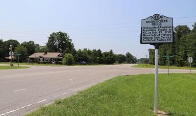
Photographed by Dave W, June 17, 2023
2. Moores Creek Bridge Marker
Credits. This page was last revised on June 19, 2023. It was originally submitted on June 19, 2023, by Dave W of Co, Colorado. This page has been viewed 586 times since then and 109 times this year. Photos: 1, 2. submitted on June 19, 2023, by Dave W of Co, Colorado. • Bernard Fisher was the editor who published this page.
