Wendover in Tooele County, Utah — The American Mountains (Southwest)
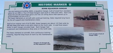
Bomb Squadron Hangar
Photographed by Dawn Bowen, June 17, 2007
1. Bomb Squadron Hangar Marker
The heavy demands on aircraft with continual training, likely required long hours by the air support and maintenance crews.
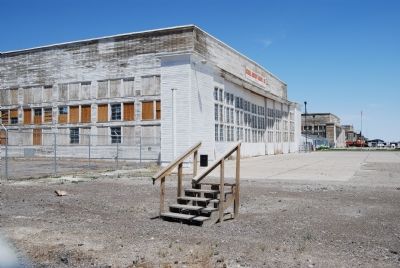
Built at an original cost of $175,000, these hangars are about 122 feet wide by 88 feet deep and have a one story shed on the north side. A coal fired coal steam boiler in each hangar provided heat. Each hangar had a restroom and maintenance shop area on the north side.
The heavy demand on aircraft, from continuous training missions, required long hours of work by the maintenance crews.
Topics. This historical marker is listed in these topic lists: Air & Space • War, World II. A significant historical year for this entry is 1942.
Location. 40° 43.673′ N, 114° 2.263′ W. Marker is in Wendover, Utah, in Tooele County. It can be reached from Historic Wendover Airfield. Touch for map. Marker is in this post office area: Wendover
this page online

Regionally, this marker is in Utah’s Wasatch Front, in the West Desert, and in Greater Salt Lake. It is also in the American Mountain West and on the Colorado Plateau. Globally, it is in North America, the Rocky Mountains, the Western Hemisphere, the Western World, and the Anglosphere. Historically, it finds itself in what was once New Spain and also Mexico’s Alta California.
Other nearby markers. At least 8 other markers are within 2 miles of this marker, measured as the crow flies: Control Tower (here, next to this marker); South Base Area (within shouting distance of this marker); Operations Building (within shouting distance of this marker); Atomic Mission Hangar 1831 (approx. 0.4 miles away); Airmen’s Dining Hall and Barracks (approx. 0.6 miles away); Base Chapel (approx. 0.6 miles away); First Transcontinental Telephone Line (approx. 0.6 miles away in Nevada); 509th Composite Group – First Atomic Bombardment (approx. 1.2 miles away in Nevada). Touch for a list and map of all markers in Wendover.
Also see . . . Wendover Air Field. (Submitted on June 26, 2007, by Dawn Bowen of Fredericksburg, Virginia.)
Photographed by Dawn Bowen, June 17, 2007
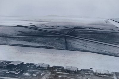
2. Hangars #2 through #5 as they appeared in 1959
Photographed by Dawn Bowen, 6
3. Bomb Squadron Hangar
Credits. This page was last revised on June 20, 2023. It was originally submitted on June 25, 2007, by Dawn Bowen of Fredericksburg, Virginia. This page has been viewed 1,868 times since then and 16 times this year. Last updated on June 19, 2023, by Carl Gordon Moore Jr. of North East, Maryland. Photos: 1, 2, 3. submitted on June 25, 2007, by Dawn Bowen of Fredericksburg, Virginia. • J. Makali Bruton was the editor who published this page.
