Middletown Township near Highlands in Monmouth County, New Jersey — The American Northeast (Mid-Atlantic)
Fort Hancock
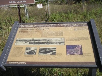
Coastal Defenses of Sandy Hook
| — | Maritime History | — |
Photographed by Bill Coughlin, September 20, 2009
1. Fort Hancock Marker
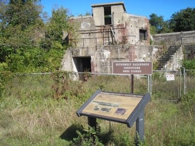
Sandy Hook has been fortified to defend New York Harbor for more than two centuries – first by British Loyalists occupying the Sandy Hook Lighthouse during the American Revolution and the American troops constructed a wooden palisade fort during the War of 1812.
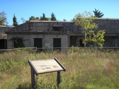
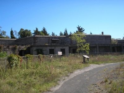
By the 1890s, concrete gun batteries were constructed to defend against long-range naval cannon. The batteries were continually improved and remained operational through World War II. Nike missiles, placed here in the 1950s, were the final descendants of the coastal defenses built on Sandy Hook.
Erected by National Park Service, U.S. Department of the Interior; State of New Jersey Division of Parks & Forestry.
Topics and series. This historical marker is listed in this topic list: Forts and Castles. In addition, it is included in the Lighthouses series list. A significant historical year for this entry is 1812.
Location. 40° 28.253′ N, 74° 0.269′ W. Marker is near Highlands, New Jersey, in Monmouth County. It is in Middletown Township. It is on Cainfield Road, on the left when traveling east. Marker is in Fort Hancock in the Sandy Hook Unit of Gateway National
this page online

Regionally, this marker is in Central Jersey, specifically on the Jersey Shore, and in the New York City Metropolitan Area. It is also in the American Northeast, in the Mid-Atlantic, and on the Eastern Seaboard. Globally, it is in the North Atlantic Region, North America, the Western Hemisphere, the Western World, and the Anglosphere. Historically, it finds itself in what was once New Netherland and also one of the original Thirteen Colonies.
Other nearby markers. At least 8 other markers are within walking distance of this marker: Navigating Sandy Hook Waters (about 500 feet away, measured in a direct line); The World War II Years (about 700 feet away); Site of Master Mechanic’s Quarters (approx. 0.2 miles away); Chemical Laboratory (approx. 0.2 miles away); Locomotive Engineer’s House (approx. ¼ mile away); Fort Hancock Officers’ Club (approx. ¼ mile away); Proving Ground Foreman’s House (approx. ¼ mile away); Battery Potter (approx. 0.3 miles away). Touch for a list and map of all
Photographed by Bill Coughlin, September 20, 2009
2. Coastal Defenses of Sandy Hook Marker
More about this marker. A series of photographs appear on the bottom of the marker. An 1880s view of the “Fort at Sandy Hook” has a caption of “The ‘Fort at Sandy Hook’ was begun in 1859 but never completed. The east wall later became the foundation for Nine Gun Battery. The southwest bastion still stands and serves as a base for a watertank.” A picture of a “Twelve inch disappearing gun at Battery Richardson, 1910 includes a caption of “The ‘disappearing guns’ of Nine Gun Battery were loaded and aimed from behind the protection of massive concrete walls. When ready to fire, the gun carriage was raised. Firing of the gun caused it to recoil behind the wall, making it ‘disappear’ from the enemy’s view.” Another photo depicting a “Nike missile complex on Sandy Hook, June 1959” has a caption of “Nike missiles were directed against high altitude aircraft. These missiles, along with all coastal defense installations, became obsolete with the development of ICBMs and advancing technologies in the mid 1960s.” The final picture is a “1990 aerial photograph of Sandy Hook” showing the existing fortifications and indicating
Photographed by Bill Coughlin, September 20, 2009
3. Fort Hancock Marker
Also see . . .
1. Fort Hancock and Sandy Hook Proving Ground National Historic Landmark. National Park Service website entry (Submitted on September 15, 2022, by Larry Gertner of New York, New York.)
2. New Jersey Coastal Heritage Trail Route. National Park Service website. (Submitted on September 22, 2009, by Bill Coughlin of Woodland Park, New Jersey.)
Photographed by Bill Coughlin, September 20, 2009
4. Fort Hancock Marker
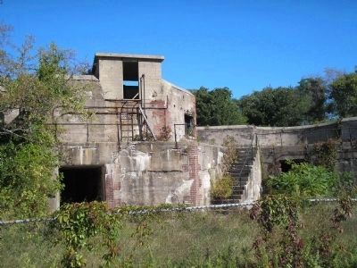
Photographed by Bill Coughlin, September 20, 2009
5. Fort Hancock Battery
The remains of Sandy Hook's concrete gun batteries can still be seen in Fort Hancock.
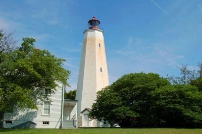
Photographed by Terese Hatch, August 24, 2009
6. Sandy Hook Lighthouse at Fort Hancock
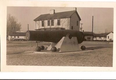
Photographed by Tech Sgt. Charles R. Hatch, circa 1947
7. Fort Hancock Cannon
This photo was taken while Tech Sgt. Hatch was stationed at Fort Hancock from 1945 to 1947.
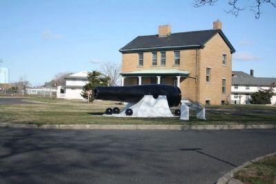
Photographed by David W. Hatch, November 21, 2008
8. Fort Hancock Cannon
This photo of the same cannon was taken by Tech Sgt. Hatch's son 61 years later.
Credits. This page was last revised on February 7, 2023. It was originally submitted on September 22, 2009, by Bill Coughlin of Woodland Park, New Jersey. This page has been viewed 2,046 times since then and 52 times this year. Photos: 1, 2, 3, 4, 5. submitted on September 22, 2009, by Bill Coughlin of Woodland Park, New Jersey. 6. submitted on May 29, 2010, by Terese Hatch of Bridgewater, New Jersey. 7, 8. submitted on May 29, 2010, by David W. Hatch of Bridgewater, New Jersey.
