Fairview Manor in Overland Park in Johnson County, Kansas — The American Midwest (Upper Plains)
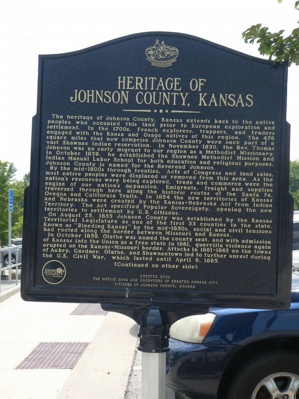
Heritage of Johnson County, Kansas
The heritage of Johnson County, Kansas extends back to the native peoples who occupied this land prior to European exploration and settlement. In the 1700s, French explorers, trappers and traders engaged with the Kansa and Osage natives of this region. The 476 square miles that now comprise Johnson County were once part of a vast Shawnee Indian reservation. In November 1830, the Rev. Thomas Johnson was an early migrant to our region as a Methodist Missionary. In October 1839, he established the Shawnee Methodist Mission and Indian Manual Labor School for both education and religious purposes. Johnson County is named for the Reverend Johnson.
By the mid-1800s through treaties, Acts of Congress and land sales, most native peoples were displaced or removed from this area. As the nation's resources were being explored, trade and commerce were the engine of our nation's expansion. Emigrants, freight and supplies traversed through here along the historic routes of the Santa Fe, Oregon and California Trails. In 1854 the new territories of Kansas and Nebraska were created by the Kansas-Nebraska Act from Indian Territory. The Act specified Popular Sovereignty, opening the new territories to settlement by U.S. citizens.
On August 25, 1855 Johnson County was established by the Kansas Territorial Legislature as one of the first 33 counties in the state. Known as "Bleeding Kansas" by the mid-1850s, social and civil tensions had rooted along the border between Missouri and Kansas.
In October 1859, Olathe was named the county seat, and with admission of Kansas into the Union as a free state in 1861, guerrilla violence again erupted on the Kansas-Missouri border. Attacks in 1861-1862 on the towns of Aubry, Gardner, Olathe, and Shawneetown led to further unrest during the U.S. Civil War, which lasted until April 9, 1865.
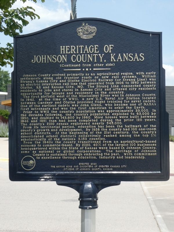
Johnson County evolved primarily as an agricultural region, with early settlements along old frontier roads or new rail systems. William Strang's Kansas City and Olathe Electric Railway (or Strang Line) was an electric interurban rail line that operated from 1906 to 1940 between Olathe, KS and Kansas City, MO. The Strang Line connected county residents to jobs and stores in Kansas City and offered city residents opportunity for leisure and residency in the country.
The first airfield west of the Mississippi River was in Johnson County. In 1942, at the time of WWII, a new U.S. Naval Air Station located between Gardner and Olathe provided flight training for naval cadets. One of the earliest cadets was John Glenn, who became one of NASA's first astronauts and was the first American to orbit the Earth. Prior to WWII the county's population was approximately 33,000. In the decades following, the county's population exploded to 63,000 by 1950, and doubled to 143,800 by 1960. More houses were built between 1946 and 1951 than had been completed during the prior 120 years. The county's 2010 census registered nearly 545,000.
From its territorial period, education has been the hallmark of the county's growth and development. By 1926 the county had 100 one-room school districts. At the beginning of the 21st century, the county's consolidated school districts collectively ranked among the top 1% scholastically of the nation's 3,153 counties.
From the 1940s the county transitioned from an agricultural-based economy to commerce-based. By 2020, 40% of the largest 100 businesses headquartered within the State of Kansas were based in Johnson County, some as national or global corporations. The heritage of Johnson County is sustained through embracing the past, with commitment to excellence through education, industry and leadership.
Erected 2020 by The Native Sons and Daughters of Kansas City and Citizens of Johnson County, Kansas.
Topics. This historical marker is listed in these topic lists: Native Americans • Railroads & Streetcars. A significant historical date for this entry is April 9, 1865.
Location. 38° 58.157′ N, 94° 40.082′ W. Marker is in Overland Park, Kansas, in Johnson County. It is in Fairview Manor. Marker is on Metcalf Avenue (Road 8788), on the right when traveling south. This marker is at the Johnson County Historical Museum, south of 87th Street on the west side going south on Metcalf. Touch for map. Marker is at or near this postal address: 8788 Metcalf Avenue, Overland Park KS 66212, United States of America. Touch for directions.
Other nearby markers. At least 8 other markers are within one mile of this marker, measured as the crow flies. Wilson-Weldon Buildings (approx. one mile away); Overland Park State Bank Building (approx. one mile away); Hedrick-Fleming Hall & Post Office (approx. one mile away); A. M. Wood Buildings (approx. one mile away); William B. Strang, Jr. (approx. one mile away); Two Ways West from Westport (approx. one mile away); A Day on the Santa Fe Trail (approx. one mile away); "A Day on the Trail" (approx. one mile away). Touch for a list and map of all markers in Overland Park.
Credits. This page was last revised on July 2, 2023. It was originally submitted on June 23, 2023, by Robert Macoubrie of Lenexa, Kansas. This page has been viewed 75 times since then and 16 times this year. Photos: 1, 2. submitted on June 23, 2023, by Robert Macoubrie of Lenexa, Kansas. • J. Makali Bruton was the editor who published this page.
Editor’s want-list for this marker. A wide view photo of the marker and the surrounding area together in context. • Clarification of the marker's exact location. • Can you help?

