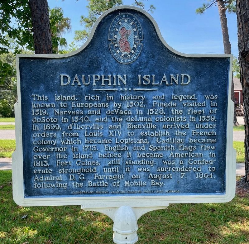
Dauphin Island in Mobile County, Alabama — The American South (East South Central)
Dauphin Island
Erected by the Christopher Branch Chapter Colonial Dames XVII Century.
Topics and series. This historical marker is listed in these topic lists: Exploration • Settlements & Settlers • War, US Civil. In addition, it is included in the The Colonial Dames XVII Century, National Society series list. A significant historical date for this entry is August 7, 1864.
Location. 30° 15.239′ N, 88° 6.867′ W. Marker is on Dauphin Island, Alabama, in Mobile County. Marker is at the intersection of Bienville Boulevard and Lackland Street, on the right when traveling east on Bienville Boulevard. Located in front of the Town Hall. Touch for map. Marker is at or near this postal address: 1011 Bienville Blvd, Dauphin Island AL 36528, United States of America. Touch for directions.
Other nearby markers. At least 8 other markers are within 3 miles of this marker, measured as the crow flies. A different marker also named Dauphin Island (a few steps from this marker); Patriot (a few steps from this marker); Dauphin Island Indian Shell Mound Park (approx. 0.4 miles away); John F. Porter, Jr. Goat Tree Reserve / The Goat Tree (approx. ¾ mile away); 19th Century Shipwreck (approx. 2.3 miles away); Fort Gaines (approx. 2.3 miles away); British Occupation of Dauphin Island (approx. 2.3 miles away); "To Be Blown To Kingdom Come" (approx. 2.3 miles away). Touch for a list and map of all markers in Dauphin Island.
Also see . . . Encyclopedia of Alabama article about Dauphin Island. (Submitted on June 25, 2023, by Mark Hilton of Montgomery, Alabama.)
Credits. This page was last revised on June 25, 2023. It was originally submitted on June 25, 2023, by Mark Hilton of Montgomery, Alabama. This page has been viewed 102 times since then and 39 times this year. Photos: 1, 2. submitted on June 25, 2023, by Mark Hilton of Montgomery, Alabama.

