Tyrone Township in Blair County, Pennsylvania — The American Northeast (Mid-Atlantic)
"The Lead Mine Fort"
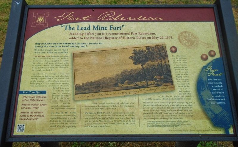
Fort Roberdeau
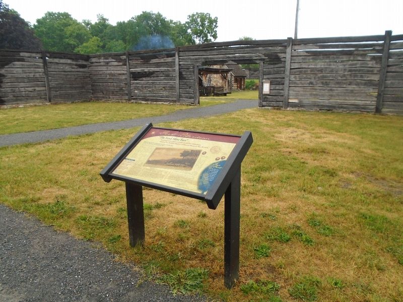
Standing before you is a reconstructed Fort Roberdeau, added to the National Register of Historic Places on May 29, 1974.
Why and How did Fort Roberdeau become a frontier fort during the American Revolutionary War?
Well, the answers can be found in the Fort's name and nickname.
The Why and How:
During the early phase of the Revolutionary War, the American Continental Army struggled to supply the soldiers with food, clothing, rifles & muskets, cannon, pack horses and lead for the manufacture of small arms ammunition, for example, musket balls.
The solution for shortage of lead was to find domestic lead ore sites and mine them. Sinking Valley, the valley of this location, came to the attention of Pennsylvania authorities. In the Spring of 1778, an expedition was organized from Carlisle under the direction of General Daniel Roberdeau to mine the local lead ore deposits in order to supply lead for the Army. General Roberdeau served as militia general and member of Congress from Pennsylvania.
On March 30, 1778, the Pennsylvania Assembly approved Roberdeau to vest the lands and gave him permission to mine the lead. The Fort was named after the expedition leader General Roberdeau and nicknamed after the purpose of lead mining. The bulk of fort construction took place from April to June 1778.
On June 4, 1778, Daniel Roberdeau reported to General Washington, "To prevent the Evacuation of the frontier and general defense against Indian incursions I have built with logs at the Mine in Sinking Springs Valley at the foot of Tussee Mountain, a Fort, Cabbin fashion, 50 yds. square with a Bastion at each Corner"
The cabin fashion was the horizontal log wall technique in front of you. Historians speculate that the ground here was too hard and rocky to allow digging a ditch for a more common stockade (vertical) wall fort of the day. The timbers were simply set atop each other to the desired height and served as a wall for the cabins which helped stabilize the structure.
The bastion serves a military purpose by projecting out past the fort walls at an angle to the wall, so as to allow to better survey around the fort and provide defensive fire in several directions. Simply, the bastion allowed a few men, perhaps only eight with two on post in each bastion, to survey and cover the entire area around the fort. A practical design for the manpower challenges on the frontier.
[Center sepia illustration caption reads]
A View of Fort Robertdeau in Sinking Spring Valley, State of Pennsylvania.
Fun Fact
The Fort was never directly attacked. It served as a safe haven for soldiers, lead miners and local settlers.
Fort Tour Quiz:
What is the nickname of Fort Roberdeau?
What is unusual about our logs? Why?
What is the military name of the diamond shaped corners?
Erected by the Fort Roberdeau Association.
Topics. This historical marker is listed in these topic lists: Environment • Forts and Castles • Patriots & Patriotism • War, US Revolutionary. A significant historical date for this entry is March 30, 1778.
Location. 40° 34.949′ N, 78° 16.441′ W. Marker is in Tyrone Township, Pennsylvania, in Blair County. Marker is near the entrance to Fort Roberdeau. Touch for map. Marker is at or near this postal address: 383 Fort Roberdeau Road, Altoona PA 16601, United States of America. Touch for directions.
Other nearby markers. At least 8 other markers are within 7 miles of this marker, measured as the crow flies. The 1976 Bicentennial Reconstruction (a few steps from this marker); The Three Sisters (within shouting distance of this marker); Conestoga Wagon & Pennsylvania Barn (within shouting distance of this marker); Fort Roberdeau (approx. 2.4 miles away); Arch Springs Cemetery (approx. 4.4 miles away); "The Big Spring" (approx. 6.4 miles away); First Building (approx. 6.4 miles away); Site of the Former Historic City Hotel (approx. 6.4 miles away). Touch for a list and map of all markers in Tyrone Township.
Also see . . .
1. Fort Roberdeau National Register Nomination Form. (Submitted on June 26, 2023, by William Fischer, Jr. of Scranton, Pennsylvania.)
2. Fort Roberdeau Historic Site. (Submitted on June 26, 2023, by William Fischer, Jr. of Scranton, Pennsylvania.)
Credits. This page was last revised on June 26, 2023. It was originally submitted on June 26, 2023, by William Fischer, Jr. of Scranton, Pennsylvania. This page has been viewed 129 times since then and 49 times this year. Photos: 1, 2, 3. submitted on June 26, 2023, by William Fischer, Jr. of Scranton, Pennsylvania.


