Würzburg, Bavaria, Germany — Central Europe
Old Cranes
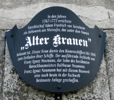
Alter Kranen
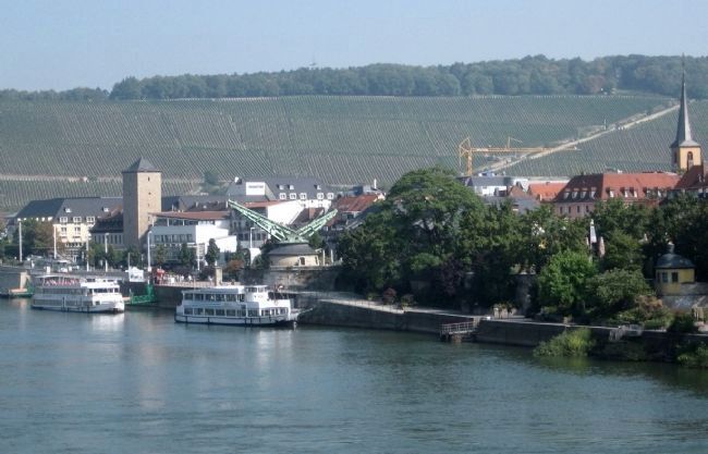
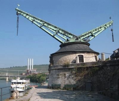
In the years 1767-1773, Prince-Bishop Adam Friedrich von Seinsheim built on the banks of the Main River a lifting facility, which is known by the name "Old Cranes". This crane was used by barge operators to unload ships until 1846. The executive architect was Franz Ignaz Neumann, the son of the famous Baroque master Johann Balthasar Neumann. With this structure Franz Ignaz Neumann created an engineering marvel which is still admired today.
Topics. This historical marker is listed in these topic lists: Industry & Commerce • Waterways & Vessels. A significant historical year for this entry is 1846.
Location. 49° 47.767′ N, 9° 55.555′ E. Marker is in Würzburg, Bayern (Bavaria). Marker is at the intersection of Kranenkai and Gerberstrasse, on the right when traveling south on Kranenkai. The Old Cranes are located on the river bank, roughly 150 feet west of where Gerberstrasse runs into Kranenkai/Mainkai. Touch for map. Marker is in this post office area: Würzburg BY 97070, Germany. Touch for directions.
Other nearby markers. At least 8 other markers are within walking distance of this marker. Hof "Zum Stachel" / The Mace Inn (about 210 meters away, measured in a direct line); Hof Castell (approx. 0.3 kilometers away); The Lower Main Mill (approx. 0.3 kilometers away); Emy Roeder (approx. 0.3 kilometers away); Augustiner Kirche / Church of St. Augustine (approx. 0.4 kilometers away); Gasthof zum Hirschen / The Inn of the Stag (approx. 0.4 kilometers away); Historicher Gedenkpunkt / A Place for Historical Contemplation (approx. 0.4 kilometers away); Eduard Buchner (approx. 0.4 kilometers away). Touch for a list and map of all markers in Würzburg.
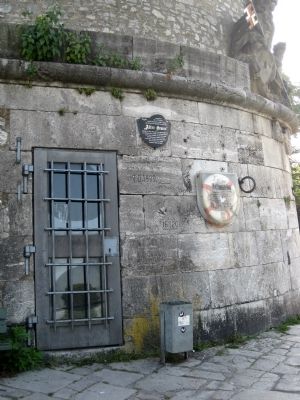
More about this marker. The marker is located on the north side of the crane structure, below street level (take the stairs down from the street to the quay level).
Also see . . . Alter Kranen (Würzburg). Wikipedia.org's German language article on the history of the Old Crane. (Submitted on September 24, 2009.)
Photographed By Andrew Ruppenstein, August 27, 2009
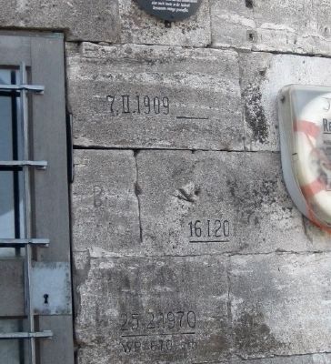
3. High Water Marks by the Marker
Engraved in the stones below the marker are several highwater marks and dates: February 7, 1909; January 16, (19)20; and February 25, 1970. This location is the oldest flow measuring station on the Main River, with measurements dating back to October 1823. Although not so engraved, records indicate flood levels in 1342, 1784, and 1845 that were even higher than the 1909 level.
Photographed By Andrew Ruppenstein, August 27, 2009
4. Old Cranes - Looking North
The crane mechanism is simple chain, pulley, and hook system within a double treadmill, supported by copper clad oaken beams. Two men could lift loads up to two tons, with another 2-4 men necessary to rotate the structure, overseen by a crane master.
Artist Unknown, Copy of Engraving Courtesy of Wikipedia.org
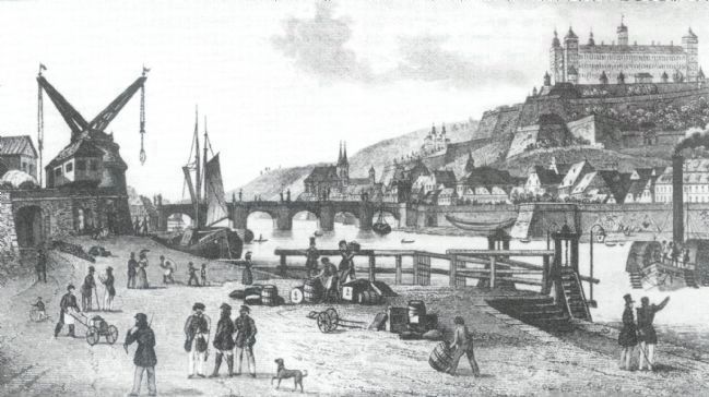
5. Wuerzburg - Looking South Along the Main River (early 1800's)
Looking south along the Main River, Old Cranes is visible on the left, the Alte Mainbrücke (Old Main Bridge) in the center, and the Marienberg Fortress on the bluff on the right.
Credits. This page was last revised on January 3, 2024. It was originally submitted on September 23, 2009, by Andrew Ruppenstein of Lamorinda, California. This page has been viewed 2,059 times since then and 48 times this year. Photos: 1, 2. submitted on September 23, 2009, by Andrew Ruppenstein of Lamorinda, California. 3, 4, 5, 6. submitted on September 24, 2009, by Andrew Ruppenstein of Lamorinda, California. • Syd Whittle was the editor who published this page.
