Derry in Natchitoches Parish, Louisiana — The American South (West South Central)
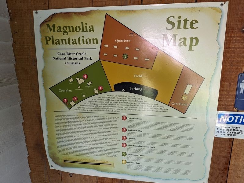
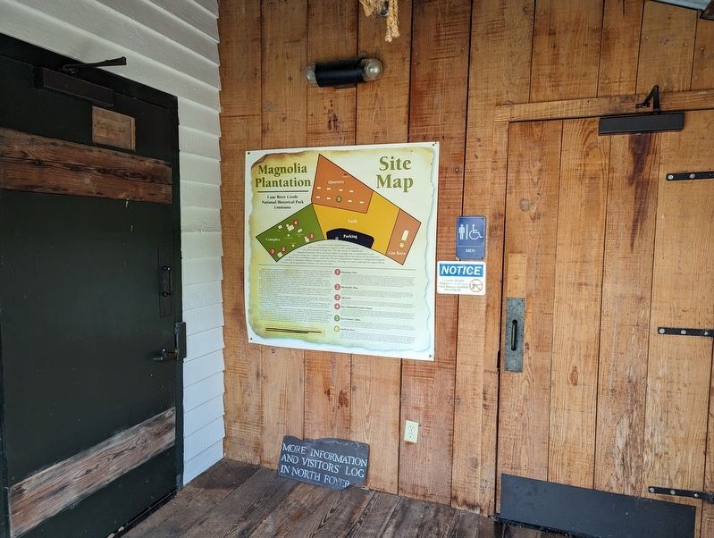
Magnolia Plantation Site Map
Cane River Creole National Historical Park Louisiana
Cane River Creole National Historical Park was established by Congress in 1994, along with the Cane River National Heritage Area. The park consists of Oakland and Magnolia Plantations, which are located within the heritage area. In establishing the park and the heritage area, Congress recognized the area's unique history, the cultures that developed here, and the their remarkable progress to present day. The surviving plantation complexes at Oakland and Magnolia represent a continuum of history throughout three centuries. They help us to better understand the region's diverse cultures, and the generations of families who have lived here.
Magnolia Plantation, originally known as Magnolia Grove Plantation, was established by Ambrose LeComte II and his wife Julia Buard LeComte. The plantation's beginnings are rooted in 18th century colonial Louisiana with the efforts of the LeComte family to establish substantial agricultural holdings along the Cane River. In 1753, Jean Baptiste LeComte I applied for and received a land grant on both sides of the Cane River. Over the next 80 years, successive generations of LeComtes continued to add to the family holdings, laying the foundation for a cotton plantation unrivaled in the Cane River region.
In 1860, Magnolia included over 6,000 acres, of which 2,240 were "improved" or cultivated. Two hundred seventy-five enslaved persons cultivated and harvested the crops of cotton and corn grown in the plantation. The plantation's 70 cabins provided the physical setting for the large community of Magnolia's enslaved workers. Approximately 24 of these cabins were unusual brick two-room structures which housed two families or groups. Converted to tenant housing after the Civil War to house only one family per structure, eight of the cabins have survived.
Ambrose and Julia's daughters married into the Hertzog family, another prominent planter family in the area. Laura married Bernard Theophile Henry Hertzog, and her sister, Ursula Atala married his brother, Mathew Henry. Mathew and Atala moved to Magnolia shortly after their marriage in 1852 and took over its management from Ambrose II, who preferred to live in his townhouse in Natchitoches and tend to his race horses, a business for which he was famous. The name Hertzog became inextricably linked with Magnolia.
The Civil War had a devastating effect on Magnolia Plantation and the LeComte and Hertzog families. Numerous family members were killed or wounded during the conflict. During the abortive Red River Campaign of 1864, retreating Union troops burned the plantation's main house, which presently lies adjacent to the park's boundaries.
Despite the war's devastation, the Hertzogs set out to rebuild their lives and home. Among the many challenges they faced was establishing a new relationship with their formerly enslaved work force. Many freedmen remained on the plantation as tenants or day laborers, and Magnolia's residents, both black and white, worked to find a new level of social and economic communication and accommodation.
Over the next hundred years, Magnolia continued to function, though in a distinctly different manner from its antebellum roots. The plantation included a store that reinforced the sense of community at Magnolia, but also bound some workers through persistent debt. Cotton, corn, and livestock remained the primary crops, but Magnolia itself had shrunk in size through property division and sales among family members. Mules provided the majority of motive power through the first decades of the 20th century, but increasing mechanization after the Great Depression signaled the eventual end of plantation agriculture at Magnolia and numerous other places throughout Louisiana and the South. In spite of difficulties the African American community have faced, they still maintain a strong presence in the Cane River region. Traditions rooted in African, French, Native American and Spanish influences give this area its character.
Magnolia Plantation's main house is not part of Cane River Creole National Historical Park. It is still owned by the Hertzog family, descendents of the plantation's founder, Ambrose LeComte.
Plantation Store
Architectural and other evidence suggests that this structure was probably constructed circa 1873. The Plantation Store served as the center of the labor systems that arose after the Civil War. Each large plantation had its own store and the tenants purchased their equipment for farming the land from the store. The Magnolia Store also carried a number of household items such as medicines, candles, kerosene, clothing, and small tools. The store became a gathering place for the former slaves and others in the community. It was an area where local musicians could perform. Former tenants recall Mathew Hertzog II, "Mister Matt," as he was commonly referred to, sponsoring community entertainment at the store in the 1940s. The store has its original cash register, wooden shelves, counters, and display cases. The two shed-roof additions were used as storage. The store office is located in the back room and has its original fireplace/mantel and desk. Part of this space was partitioned off for a clerk's office, which also served as his residence.
Blacksmith Shop
The Blacksmith Shop was one of the most important buildings on the plantation and would have been one of the first buildings constructed. The blacksmith repaired tools, and made the nails and hardware for constructions of the other buildings. The structure contains hewn wood, hand-wrought nails, and may have already been on the property when it was purchased by the LeComtes in 1824 from the Barthelemy LaCour estate. It was used as a blacksmith shop from the 1840s. The Blacksmith Shop is a poteaux-sur-sol style of building that is a Creole form of architecture.
Pigeonnier
Usually there were two pigeonniers flanking the main house. Pigeonniers were an elegant part of the Creole landscape and served to emphasize the wealth and importance of the owner. They served a practical purpose as well: to house pigeons. Pigeon droppings were used as a fertilizer for the gardens, and the young pigeons, called squab, were used as food. Squab on toast was considered a delicacy. This particular pigeonnier dates from 1840-1855.
Slave Hospital/Overseer's House
This structure was used as a Slave Hospital and is thought to have been constructed for that purpose. Since its construction, it has been used for various functions. It was perhaps the home for Atala and Matthew Hertzog for 30 years, while they were rebuilding the Main House. Magnolia's Main House was burned by Union troops in 1864, and the new house was not completed until the 1890s. After that period, family tradition gives its use as an Overseer's house. Overseers were usually white men who were paid annual salary and provided with a house and a domestic worker. In this area however, Overseers in the post-bellum period were often local Creoles.
Slave/Tenant Cabins
The eight unusual brick cabins are all that remain of the 70 cabins that once housed the plantation's 275 enslaved workers. Of the original cabins, 24 were brick, and the rest were timber construction. Family tradition holds that most of the cabins were torn down after the Civil War and that many bricks from them were used to rebuild the Main House in the 1890s. Originally, these cabins would each have held two families or groups of enslaved workers. After emancipation, a door was cut between the two rooms in the cabins and each cabin held only one family of tenant workers.
Gin/Press Barn
This structure contains ginning and pressing equipment, some of which was used as early as 1835, some of which was in use as late as 1939. Although cotton remained king after the Civil War, it was much less profitable than it had been in the pre-war years, and as such many plantations tried to save money by using equipment from before the war. Magnolia's wooden screw-type cotton press is an example of one such piece. The press dates to 1835. It was originally mule powered, and rose to a height of 30 feet when operating. When cotton had been through the ginning process, and was clean and ready to sell, it was put in the press and compressed into bales weighing between 400 and 500 pounds. Also in the barn is a double cotton gin and hydraulic press from the late 1800s.
Topics. This historical marker is listed in these topic lists: Agriculture • Settlements & Settlers. A significant historical year for this entry is 1994.
Location. 31° 33.012′ N, 92° 56.505′ W. Marker is in Derry, Louisiana, in Natchitoches Parish. Marker is on State Highway 119, one mile north of State Highway 1. Touch for map. Marker is at or near this postal address: 5549 LA=119, Cloutierville LA 71416, United States of America. Touch for directions.
Other nearby markers. At least 8 other markers are within walking distance of this marker. Cash or Credit (a few steps from this marker); The Sound of Time (a few steps from this marker); Farming Transitions (within shouting distance of this marker); Oakland Plantation (within shouting distance of this marker); Magnolia Plantation (within shouting distance of this marker); Changing Residents (within shouting distance of this marker); Corn Crib (within shouting distance of this marker); Livestock (within shouting distance of this marker). Touch for a list and map of all markers in Derry.
More about this marker. Marker is located at the Magnolia General Store/NPS Stamping center. Part of the Magnolia Plantation Grounds (Cane River Creole National Historical Park: National Park Service)
Credits. This page was last revised on July 3, 2023. It was originally submitted on July 3, 2023, by Cajun Scrambler of Assumption, Louisiana. This page has been viewed 93 times since then and 31 times this year. Photos: 1, 2. submitted on July 3, 2023, by Cajun Scrambler of Assumption, Louisiana.

