Derry in Natchitoches Parish, Louisiana — The American South (West South Central)
Oakland Plantation
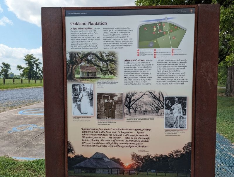
A few miles upriver, Oakland Plantation was founded on a 1785 Spanish-era land grant by Jean Pierre Emanuel Prud'homme. A small enslaved work force grew tobacco and indigo. From domestic and agricultural workers to craftsmen such as blacksmiths, carpenters and masons, the skills and strengths of enslaved Africans were vital to the survival of the plantation. The invention of the cotton gin in 1793 made the processing of large amounts of cotton possible. Emanuel Prud'homme purchased a mechanical gin making cotton the plantation's main crop. As textile mills increased their demand for cotton, the use of enslaved labor increased. By the Civil War, nearly 150 enslaved people labored on the plantation.
After the Civil War and into the 20th century, life continued to revolve around cotton. Descendants of enslaved workers remained as tenant farmers and sharecroppers and new families moved here for work to support their families. The legacy of these families, including Helaire, Metoyer, Williams, Toussaint, Shields, and others remains as many of their descendants continue to reside nearby. The plantation survived the Civil War, Reconstruction, boll weevils, and the Great Depression. Increasingly machines replaced the need for draft animals and farm workers; what began in the 1930s accelerated after World War II bringing the end of the plantation era. The last tenant family moved off the plantation in the early 1960s. The main house, built in 1821 and updated through the years, was the Prud'homme family home until acquired by the National Park Service in 1998.
Erected by National Park Service.
Topics. This historical marker is listed in these topic lists: Agriculture • Landmarks • Notable Places • Settlements & Settlers.
Location. 31° 32.991′ N, 92° 56.498′ W. Marker is in Derry, Louisiana, in Natchitoches Parish. Marker is on Route 119, one mile north of Louisiana Route 1, on the right when traveling north. Touch for map. Marker is in this post office area: Cloutierville LA 71416, United States of America. Touch for directions.
Other nearby markers. At least 8 other markers are within walking distance of this marker. Magnolia Plantation (here, next to this marker); The Sound of Time (within shouting distance of this marker); Magnolia Plantation Site Map (within shouting distance of this marker); Cash or Credit (within shouting distance of this marker); Farming Transitions (within shouting distance of this marker); Plantation Landscape (about 300 feet away, measured in a direct line); Changing Residents (about 300 feet away); Livestock (about 300 feet away). Touch for a list and map of all markers in Derry.
Credits. This page was last revised on July 4, 2023. It was originally submitted on July 4, 2023, by Cajun Scrambler of Assumption, Louisiana. This page has been viewed 87 times since then and 19 times this year. Photos: 1, 2. submitted on July 4, 2023, by Cajun Scrambler of Assumption, Louisiana.

