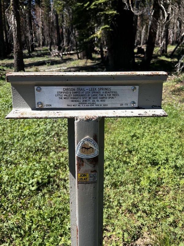
Near Singleton Springs in Amador County, California — The American West (Pacific Coastal)
Carson Trail - Leek Springs
— Carson Trail —
Erected 2004 by Trails West Inc. (Marker Number CR-55.)
Topics and series. This historical marker is listed in these topic lists: Roads & Vehicles • Settlements & Settlers. In addition, it is included in the Kit Carson Trail, and the Trails West Inc. series lists. A significant historical date for this entry is July 19, 1850.
Location. 38° 38.303′ N, 120° 14.406′ W. Marker is near Singleton Springs, California, in Amador County. Marker is on Mormon Emigrant Trail (NF-5), one mile west of 88 (California Route 88), on the right when traveling west. Touch for map. Marker is in this post office area: Kyburz CA 95720, United States of America. Touch for directions.
Other nearby markers. At least 8 other markers are within 10 miles of this marker, measured as the crow flies. Maiden's Grave (approx. 3.7 miles away); Tragedy Spring (approx. 5 miles away); Old Emigrant Road (approx. 5.3 miles away); Mormon-Carson Pass Emigrant Trail (approx. 5.6 miles away); Plasse Resort (approx. 6.1 miles away); Plasse’s Trading Post (approx. 6.1 miles away); Ham's Station (approx. 9.8 miles away); Webster’s (approx. 9.9 miles away).
Additional commentary.
1. On Reverse
Grizzly Flat Road – Leek Spring Valley
The road forks here one is a new road passing a new mining place called Grisly Flats but terminating the same place the other does Hangtown. We took the new road which proved a very rough one – Richard, Augustus Keen, July 22, 1852. Note To Editor only visible by Contributor and editor
— Submitted July 9, 2023, by Darrin McNeice of Camino, California.
Credits. This page was last revised on August 1, 2023. It was originally submitted on July 9, 2023, by Darrin McNeice of Camino, California. This page has been viewed 105 times since then and 41 times this year. Photo 1. submitted on July 9, 2023, by Darrin McNeice of Camino, California. • Andrew Ruppenstein was the editor who published this page.
