Marker Logo
THE HISTORICAL
MARKER DATABASE
“Bite-Size Bits of Local, National, and Global History”
Boron in Kern County, California — The American West (Pacific Coastal)
 

Miner's Cabin


Miner's Cabin Marker image. Click for full size.
Photographed by Denise Boose, June 28, 2023
1. Miner's Cabin Marker
Inscription. This is one of the original miner's cabins built at the Baker Mine site to house Pacific Coast Borax employees. It was built in 1929, and usually housed one or two unmarried men. It is of wooden frame construction with a wooden floor and a double roof for insulation against the summer sun. A wood or coal burning stove provided heat in the winter. The cabin had electricity, but did not have running water. Rent for the cabin was included in a board and room package that cost $5.00 per week. At that time the town of Boron did not exist, and the area at the Baker Mine was a single man's camp. This form of housing was in use until the 1960's, when the company — now U.S. Borax — ended their policy of providing company owned housing. Boron had become a well established town and company housing was no longer needed. We have restored the cabin to show what is might have looked like when it was occupied.
 
Erected by Twenty Mule Team Museum.
 
Topics. This historical marker is listed in these topic lists: Industry & CommerceSettlements & Settlers. A significant historical year for this entry is 1929.
 
Location. 34° 59.949′ N, 117° 39.016′ W.
Paid Advertisement
Click or scan to see
this page online
Marker is in Boron, California, in Kern County. It is at the intersection of Twenty Mule Team Road and Boron Avenue, on the left when traveling west on Twenty Mule Team Road. Located in the Twenty Mule Team Museum Park. Touch for map. Marker is at or near this postal address: 26962 Twenty Mule Team Road, Boron CA 93516, United States of America. Touch for directions.

Regionally, this marker is in California’s San Joaquin Valley, specifically in the Central Valley, and in the Sierra Nevada. It is also on the American Pacific Coast. Globally, it is in North America, on the Ring of Fire, in the Pacific Rim, in the Western Hemisphere, in the Western World, and in the Anglosphere. Historically, it finds itself in what was once New Spain and also Mexico’s Alta California.

Other nearby markers. At least 8 other markers are within 13 miles of this marker, measured as the crow flies: Florence Lowe “Pancho” Barnes (within shouting distance of this marker); Twenty-Mule Teams (within shouting distance of this marker); Twenty-Mule Team Borax Wagon (approx. 3 miles away); a different marker also named Miner's Cabin (approx.
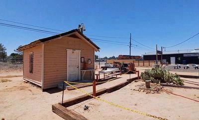
Miner's Cabin and Marker image. Click for full size.
Photographed by Denise Boose, June 28, 2023
2. Miner's Cabin and Marker
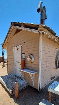
3 miles away); Twenty Mule Team (approx. 3 miles away); Borax (approx. 3.9 miles away); Rocket Site (approx. 5½ miles away); Capt. Mel Apt, USAF (approx. 12.2 miles away). Touch for a list and map of all markers in Boron.
 
Miner's Cabin Marker image. Click for full size.
Photographed by Denise Boose, June 28, 2023
3. Miner's Cabin Marker
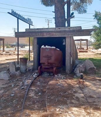
Ore Car image. Click for full size.
Photographed by Denise Boose, June 28, 2023
4. Ore Car
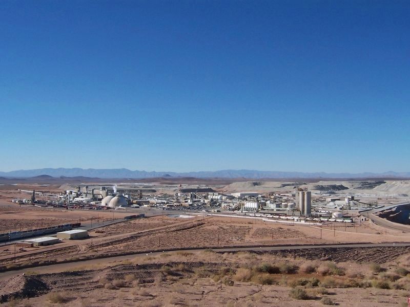
Borax Company Plant image. Click for full size.
Photographed by Denise Boose, November 18, 2003
5. Borax Company Plant
Located 3 miles northwest of the museum.
 
 
Credits. This page was last revised on June 4, 2025. It was originally submitted on July 11, 2023, by Denise Boose of Tehachapi, California. This page has been viewed 391 times since then and 17 times this year. Photos:   1, 2, 3, 4, 5. submitted on July 11, 2023, by Denise Boose of Tehachapi, California. • Andrew Ruppenstein was the editor who published this page.

m=228026

CeraNet Cloud Computing sponsors the Historical Marker Database.
This website earns income from purchases you make after using our links to Amazon.com. We appreciate your support.
Paid Advertisement
Jul. 10, 2026
