Near Big Springs in Deuel County, Nebraska — The American Midwest (Upper Plains)
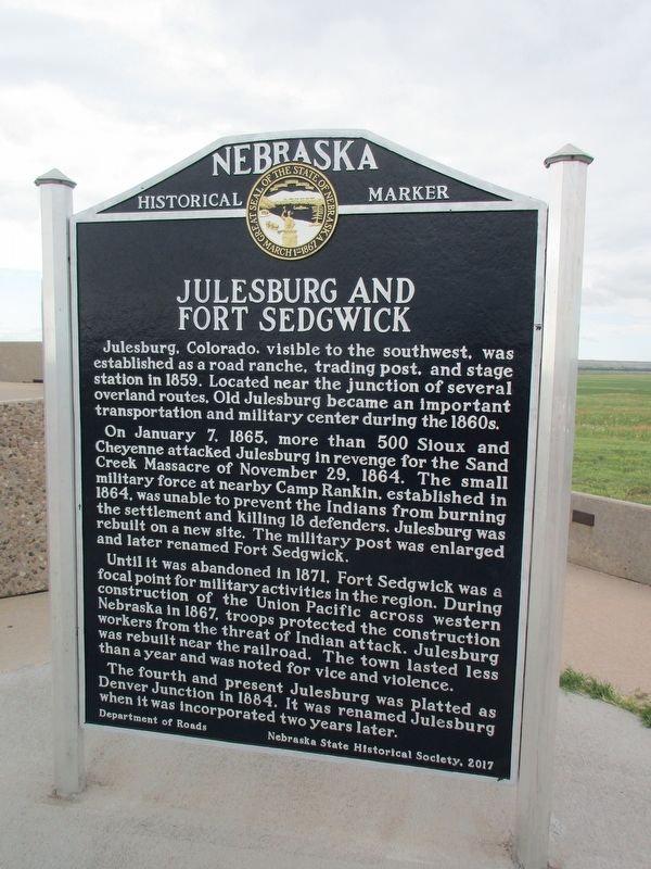
Julesburg and Fort Sedgwick
Julesburg, Colorado, visible to the southwest, was established as a road ranche, trading post, and stage station in 1859. Located near the junction of several overland routes, Old Julesburg became an important transportation and military center during the 1860s.
On January 7, 1865. more than 500 Sioux and Cheyenne attacked Julesburg in revenge for the Sand Creek Massacre of November 29, 1864. The small military force at nearby Camp Rankin, established in 1864, was unable to prevent the Indians from burning the settlement and killing 18 defenders. Julesburg was rebuilt on a new site. The military post was enlarged and later renamed Fort Sedgwick.
Until it was abandoned in 1871. Fort Sedgwick was a focal point for military activities in the region. During construction of the Union Pacific across western Nebraska in 1867, troops protected the construction workers from the threat of Indian attack. Julesburg was rebuilt near the railroad. The town lasted less than a year and was noted for vice and violence.
The fourth and present Julesburg was platted as Denver Junction in 1884. It was renamed Julesburg when it was incorporated two years later.
Erected 2017 by Nebraska State Historical Society. (Marker Number 112.)
Topics and series. This historical marker is listed in these topic lists: Forts and Castles • Railroads & Streetcars • Settlements & Settlers • Wars, US Indian. In addition, it is included in the Nebraska State Historical Society series list.
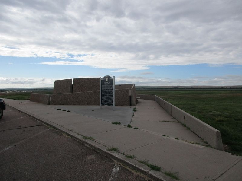
Location. 41° 2.056′ N, 102° 12.68′ W. Marker is near Big Springs, Nebraska, in Deuel County. Marker is on Interstate 80 at milepost 99, on the right when traveling east. Touch for map. Marker is in this post office area: Big Springs NE 69122, United States of America. Touch for directions.
Other nearby markers. At least 8 other markers are within 5 miles of this marker, measured as the crow flies. The Great Platte River Road (a few steps from this marker); Big Springs (a few steps from this marker); South Platte Station (approx. 3.4 miles away); Colorado (approx. 4.1 miles away in Colorado); Oregon Trail (approx. 4.3 miles away in Colorado); Julesburg, Colorado (approx. 4.3 miles away in Colorado); The Town that Wouldn't Die (approx. 4.4 miles away in Colorado); Fourth Julesburg (approx. 4.4 miles away in Colorado). Touch for a list and map of all markers in Big Springs.
Credits. This page was last revised on July 22, 2023. It was originally submitted on July 15, 2023, by Jeff Leichsenring of Garland, Texas. This page has been viewed 86 times since then and 36 times this year. Photos: 1, 2. submitted on July 15, 2023, by Jeff Leichsenring of Garland, Texas. • J. Makali Bruton was the editor who published this page.

