Near Carson City, Nevada — The American Mountains (Southwest)
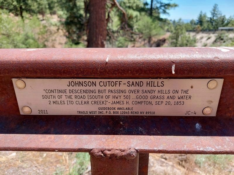
Johnson Cutoff - Sand Hills
Erected 2011 by Trails West, Inc. (Marker Number JC-4.)
Topics and series. This historical marker is listed in these topic lists: Roads & Vehicles • Settlements & Settlers. In addition, it is included in the Trails West Inc. series list. A significant historical date for this entry is September 20, 1853.
Location. 39° 7.369′ N, 119° 50.248′ W. Marker is near Carson City, Nevada. Marker can be reached from U.S. 50, on the right when traveling west. Touch for map. Marker is in this post office area: Carson City NV 89706, United States of America. Touch for directions.
Other nearby markers. At least 8 other markers are within 4 miles of this marker, measured as the crow flies. Clear Creek-Kings Canyon Fire (approx. 1.3 miles away); History of the Borda Ranch (approx. 2.4 miles away); Green Gold (approx. 3.4 miles away); Life at the Summit (approx. 3.4 miles away); Riding the Flume (approx. 3.4 miles away); Tomb of the Sierras (approx. 3.4 miles away); Spooner Summit (approx. 3.4 miles away); Tahoe Rim Trail (approx. 3.4 miles away). Touch for a list and map of all markers in Carson City.
Credits. This page was last revised on July 21, 2023. It was originally submitted on June 27, 2022, by Bruce Armbrust of Gardnerville, Nevada. This page has been viewed 128 times since then and 16 times this year. Last updated on July 16, 2023, by Bruce Armbrust of Gardnerville, Nevada. Photos: 1. submitted on June 27, 2022, by Bruce Armbrust of Gardnerville, Nevada. 2. submitted on July 14, 2022, by Mary K Doherty of Reno, Nevada. • J. Makali Bruton was the editor who published this page.
Editor’s want-list for this marker. Wide area view of the marker and its surroundings. • Can you help?

