Near Worden in Yellowstone County, Montana — The American West (Mountains)
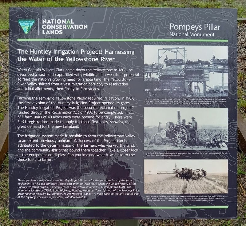
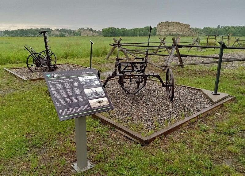
The Huntley Irrigation Project: Harnessing the Water of the Yellowstone River
— Pompeys Pillar National Monument —
Inscription.
When Captain William Clark came down the Yellowstone in 1806, he described a vast landscape filled with wildlife and a wealth of potential. To feed the nation's growing need for arable land, the Yellowstone River Valley shifted from a vast migration corridor, to reservation and tribal allotments, then finally to farmsteads.
Farming the semi-arid Yellowstone Valley required irrigation. In 1907, the first division of the Huntley Irrigation Project opened its gates. The Huntley Irrigation Project was the second "reclamation project" funded through the Reclamation Act of 1902 to be completed. In all, 582 farm units of 40 acres each were opened for entry. There were 5,491 registrations made to apply for those first units, showing the great demand for the new farmland.
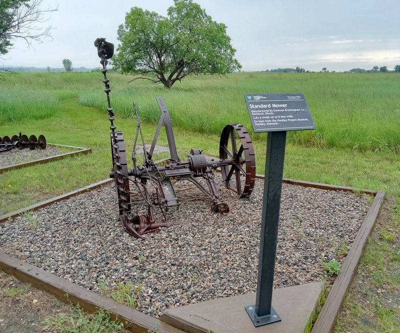
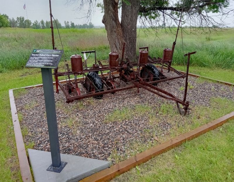
The irrigation system made it possible to farm the Yellowstone Valley to an extent previously unheard of. Success of the Project can be attributed to the determination of the farmers who worked the land, and the community spirit that bound them together. Take a closer look at the equipment on display. Can you imagine what it was like to use these tools to farm?
The Huntley Irrigation Project made it possible for cash crops like sugar beets to be farmed in the Yellowstone River Valley. After the beets were harvested from the field, they were hauled to a beet dump and transported by rail to be processed in sugar factories.
1916 Mogul 10-20 Tractor breaking soil with a gang plow. Gang plows had two or more plowshares to till the soil.
By horsepower and elbow grease, assisted by "modern" technology, the Yellowstone River Valley became a productive agricultural hub for southern and eastern Montana. The photograph above shows a horse-drawn combine harvesting wheat.
Thank you to our neighbors at the Huntley Project Museum for the generous loan of the farm equipment to help tell our story. Please visit them to learn more about the unique history of the Huntley Irrigation Project, and enjoy more historic farm equipment, buildings, and tools. The Museum is located at 770 Railroad Highway, Huntley, Montana. Turn right out of the Pompeys Pillar driveway onto Highway 312. Huntley Project Museum is about 12 miles west on the left (south) side of the highway. For more information, call 406-348-2533.
Erected by Bureau of Land Management.
Topics. This historical marker is listed in this topic list: Agriculture. A significant historical year for this entry is 1907.
Location. 45° 59.447′ N, 108° 0.095′ W. Marker is near Worden, Montana, in Yellowstone County. Marker is on Pompeys Pillar National Monument
entrance road near S. 31st Road, on the left when traveling north. The marker is in Pompeys Pillar National Monument, at a pullout about halfway between the entrance station and the visitor center. Touch for map. Marker is at or near this postal address: 3039 US Highway 312, Worden MT 59088, United States of America. Touch for directions.
Other nearby markers. At least 8 other markers are within walking distance of this marker. The "Yellowstone River" Walkway (approx. ¼ mile away); Buffalo: Then and Now (approx. ¼ mile away); Coal: Black Wave of the Future (approx. ¼ mile away); Triumph and Torment (approx. ¼ mile away); A Good Home (approx. ¼ mile away); Open Spaces: Room to Roam (approx. ¼ mile away); Sign of American Indians (approx. 0.3 miles away); Making Canoes, Then and Now (approx. 0.3 miles away). Touch for a list and map of all markers in Worden.
Credits. This page was last revised on August 11, 2023. It was originally submitted on July 11, 2023, by McGhiever of Minneapolis, Minnesota. This page has been viewed 67 times since then and 22 times this year. Last updated on July 16, 2023, by McGhiever of Minneapolis, Minnesota. Photos: 1, 2, 3. submitted on July 11, 2023, by McGhiever of Minneapolis, Minnesota. 4. submitted on July 16, 2023, by McGhiever of Minneapolis, Minnesota. 5, 6, 7. submitted on July 11, 2023, by McGhiever of Minneapolis, Minnesota. • J. Makali Bruton was the editor who published this page.
