Laurel in Prince George's County, Maryland — The American Northeast (Mid-Atlantic)
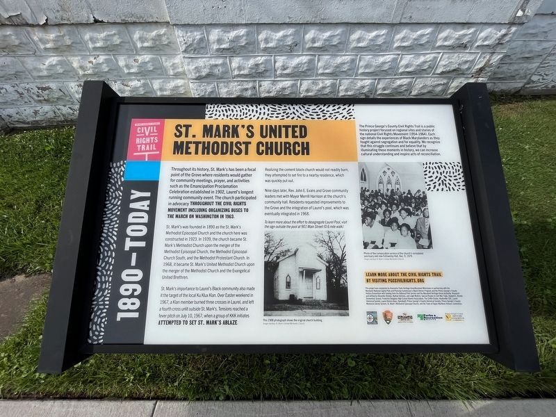
St. Mark's United Methodist Church
1890 - Today
— Prince George's County Civil Rights Trail —

Photographed By Devry Becker Jones (CC0), July 22, 2023
1. St. Mark's United Methodist Church Marker
Throughout its history, St. Mark's has been a focal point of the Grove where residents would gather for community meetings, prayer, and activities such as the Emancipation Proclamation Celebration established in 1902, Laurel's longest running community events. The church participated in advocacy throughout the civil rights movement including organizing buses to the March on Washington in 1963.
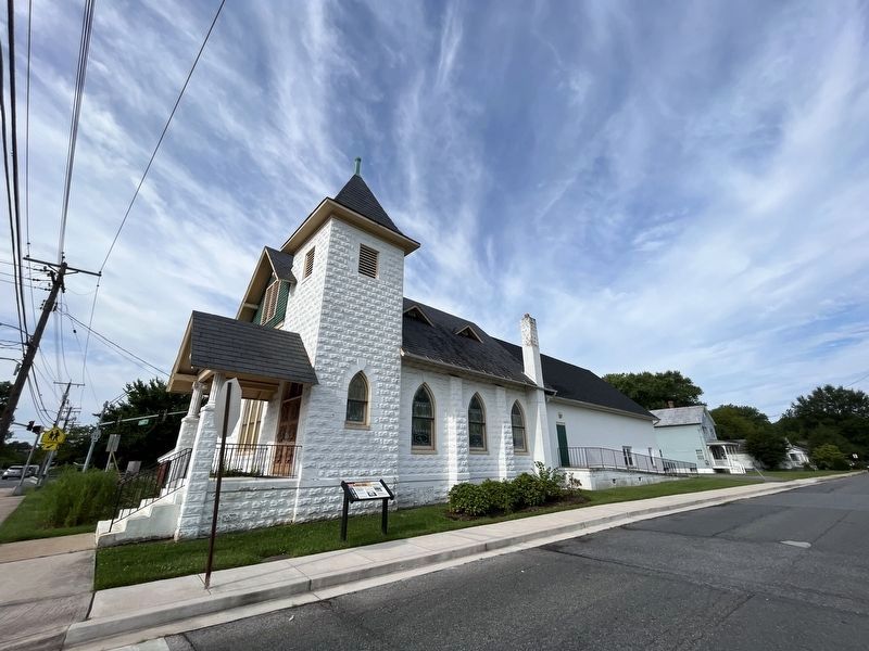
St. Mark's was founded in 1890 as the St. Marks Methodist Episcopal Church and the church here was constructed in 1923. In 1939, the church became St. Mark's Methodist Church upon the merger of the Methodist Episcopal Church, the Methodist Episcopal Church South, and the Methodist Protestant Church. In 1968, it became St. Mark's United Methodist Church upon the merger of the Methodist Church and the Evangelical Union Brethren.
St. Mark's importance to Laurel's Black community also made it the target of the local Ku Klux Klan. Over Easter weekend in 1967, a Klan member burned three crosses in Laurel, and left a fourth cross unlit outside St. Mark's. Tensions reached a fever pitch on July 10, 1967, when a group of KKK initiates attempted to set St. Mark's ablaze.
Realizing the cement block church would not readily burn, they attempted to set fire to a nearby residence, which was quickly put out.
Nine days later, Rev. John E. Evans and Grove community leaders met with Mayor Merrill Harrison at the church's community hall. Residents requested improvements to the Grove and the integration of Laurel's pool, which was eventually integrated in 1968.
To learn more about the effort to desegregate Laurel Pool, visit the sign outside the pool at 901 Main Street (0.6 mile walk)
Erected 2023 by Maryland Milestones; National Park Service, U.S. Department of the Interior; Maryland Heritage Area Authority; MNCPPC; Prince George's County History Consortium.
Topics. This historical marker is listed in these topic lists: African Americans • Churches & Religion • Civil Rights. A significant historical date for this entry is July 10, 1967.
Location. 39° 6.176′ N, 76° 51.453′ W. Marker is in Laurel, Maryland, in Prince George's County. Marker is at the intersection of West Street and 8th Street, on the left when traveling west on West Street. Touch for map. Marker is at or near this postal address: 519 8th Street, Laurel MD 20707, United States of America. Touch for directions.
Other nearby markers. At least 8 other markers are within walking distance of this marker. The Grove Community (about 300 feet away, measured in a direct line); Baseball in the Grove (about 400 feet away); Methodism in Laurel (approx. 0.4 miles away); Early Buildings on St. Mary's Place
Credits. This page was last revised on July 22, 2023. It was originally submitted on July 22, 2023, by Devry Becker Jones of Washington, District of Columbia. This page has been viewed 68 times since then and 22 times this year. Photos: 1, 2. submitted on July 22, 2023, by Devry Becker Jones of Washington, District of Columbia.
