Sharon Township in Sharon Hollow in Washtenaw County, Michigan — The American Midwest (Great Lakes)
Harnessing The Power Of The River Raisin
Inscription.
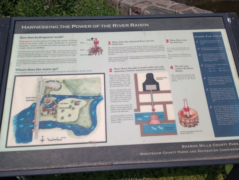
How does hydro-power work?
Hydropower is the process of using the energy of falling water to do work, either to move machinery or generate electricity. Power is transferred when moving water spins a water wheel or turbine.
The turbine that ran the grist mill at Sharon Mills connected directly to many belts and gears that drove the machines. This early mill used water to generate mechanical energy. Later, the turbine was connected to an electric generator to produce electrical energy. A simple turbine is shown at right
Mechanical energy is less useful than electrical energy because it must be transferred through moving parts like gears. Much mechanical energy is lost through friction. Electrical energy is transported through wires with less energy lost en route.
Where does the water go?
Follow the blue arrows to learn how the water flows through the mill and back to the River Raisin.
1 Water from the mill pond flows into the head race.
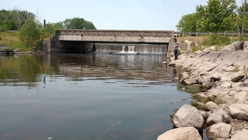
The mill pond was formed when early Sharon Hollow settlers constructed a dam on the River Raisin, raising the level of the water by several feet. Raising the water level was important because the farther the water has to fall before hitting a water wheel, the more energy it will have, and the more power it will generate.
Some of the water from the mill pond flows into the head race, a channel that guides water to the turbine. A check dam can be raised and lowered to control the height of the water.
2 Water flows through a tunnel under the mill, spinning a turbine and generating electricity.
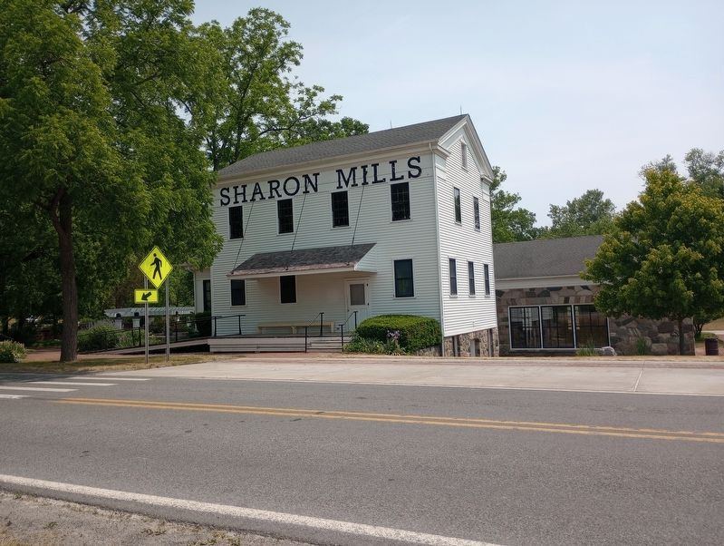
When Henry Ford renovated the grist mill in the 1930s, he replaced the old turbine and added a solid brass generator. This turbine and generator can still generate electricity today.
Water flowing from the head race spins the turbine, which turns a shaft. At the end of the shaft is a metal coil, which rotates between two poles of a magnet, generating electric current.
After the water spins the blades, it flows through the hollow center of the turbine and into the tail race.
A turbine similar to the one Henry Ford installed at Sharon Mills is pictured at the far right.
3 Water flows into the tail race.
As it enters the tail race, the water has given up most of its energy.
Where does the water flow faster, in the head race or in the tail race?
4 The tail race rejoins the River Raisin.
After passing through the mill, the diverted water rejoins the main channel of the River Raisin.
[Sidebar:]
Hydro Fun Facts
The Greeks were the first to use water power to grind grain, around. 19 B.C.
Michael Faraday created the world's first electric generator in 1831.
In 1880, Michigan's Grand Rapids Electric Light and Power Company was the first to combine a water. wheel and a generator to produce hydroelectric power.
Percentage of U.S. energy supplied by hydro-power:
1907: 15%
1920: 25%
1940: 40%
2000: about 7%
Unlike oil or coal, which exist in limited amounts on earth, water is at renewable resource, meaning that it can be recycled again and again to generate power.
The highest dam in the U.S. is the Oroville Dam in California, which is 754 feet tall-about as tall as a 60-story building--and a mile wide. The highest dam in the world is the Nurek Dam in Tadzikistan in central Asia. This dam is 984 feet tall!
One of the most famous dams in the U.S. is the Hoover Dam, built across the Colorado River in 1946. It is 726 feet tall and stores 21 million acre-feet of water in Lake Mead Reservoir, enough water to cover the State of Pennsylvania to a depth of one foot! The amount of concrete used in the Hoover Dam could pave a highway from New York to San Francisco.
Erected by Sharon Mills County Park; Washtinaw County Parks and Recreation Commission.
Topics. This historical marker is listed
in these topic lists: Industry & Commerce • Natural Resources • Waterways & Vessels. A significant historical year for this entry is 1831.
Location. 42° 10.637′ N, 84° 5.571′ W. Marker is in Sharon Hollow, Michigan, in Washtenaw County. It is in Sharon Township. Marker is on Sharon Hollow Road south of Bethel Church Road, on the right when traveling north. Touch for map. Marker is at or near this postal address: 5701 Sharon Hollow Rd, Manchester MI 48158, United States of America. Touch for directions.
Other nearby markers. At least 8 other markers are within 4 miles of this marker, measured as the crow flies. Exploring The History Of Sharon Mills (here, next to this marker); Welcome To Sharon Mills County Park! (within shouting distance of this marker); The River Raisin Watershed (within shouting distance of this marker); Along The Rivers Edge (within shouting distance of this marker); Native American Trails (approx. 2.8 miles away); Manchester War Memorial (approx. 3 miles away); Manchester's Old Burying Ground (approx. 3.2 miles away); Founding Members of Immanuel United Evangelical Church (approx. 3.2 miles away). Touch for a list and map of all markers in Sharon Hollow.
Credits. This page was last revised on August 21, 2023. It was originally submitted on July 23, 2023, by Craig Doda of Napoleon, Ohio. This page has been viewed 51 times since then and 6 times this year. Photos: 1, 2, 3, 4. submitted on July 23, 2023, by Craig Doda of Napoleon, Ohio. • Devry Becker Jones was the editor who published this page.


