Holly Hill in Orangeburg County, South Carolina — The American South (South Atlantic)
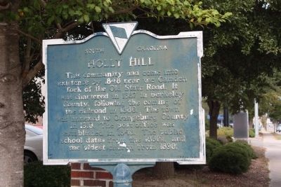
Holly Hill
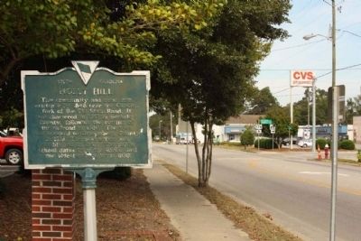
This community had come into existence by 1848 near the Camden fork of the Old State Road. It was chartered in 1887 in Berkeley County, following the coming of the railroad in 1886. The town was annexed to Orangeburg County in 1910. The post office was established in 1848. The public school dates from the 1880s, and the oldest church from 1890.
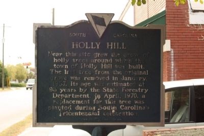
(Reverse text)
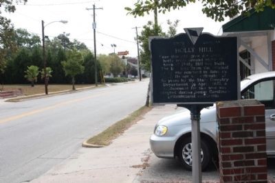
Near this site grew the grove of holly trees around which the town of Holly Hill was built. The last tree from the original grove was removed in January, 1957. Its age was estimated at 98 years by the State Forestry Department. In April, 1970, a replacement for this tree was planted during South Carolina's Tricentennial celebration.
Erected 1972 by Ivy Garden Club and Holly Hill Garden Club. (Marker Number 38-17.)
Topics. This historical marker is listed in this topic list: Settlements & Settlers. A significant historical month for this entry is January 1957.
Location. 33° 19.35′ N, 80° 24.803′ W. Marker is in Holly Hill, South Carolina, in Orangeburg County. Marker is at the intersection of State Street (U.S. 176) and Eutaw Road (State Highway 453), on the right when traveling south on State Street. Touch for map. Marker is in this post office area: Holly Hill SC 29059, United States of America. Touch for directions.
Other nearby markers. At least 8 other markers are within 9 miles of this marker, measured as the crow flies. A different marker also named Holly Hill (about 300 feet away, measured in a direct line); Target Methodist Church (approx. 2.4 miles away); Berkeley County (approx. 4.8 miles away); Eutawville (approx. 6.7 miles away); Harleyville (approx. 7.7 miles away); Astronaut Frank L. Culbertson, Jr. (approx. 7.7 miles away); Spring Hill Methodist Church (approx. 8.1 miles away); Providence Methodist Church (approx. 8.8 miles away). Touch for a list and map of all markers in Holly Hill.
Credits. This page was last revised on June 16, 2016. It was originally submitted on October 2, 2009, by Mike Stroud of Bluffton, South Carolina. This page has been viewed 1,163 times since then and 38 times this year. Photos: 1, 2, 3, 4. submitted on October 2, 2009, by Mike Stroud of Bluffton, South Carolina. • Craig Swain was the editor who published this page.


