Charleston in Kanawha County, West Virginia — The American South (Appalachia)
A Monumental Project
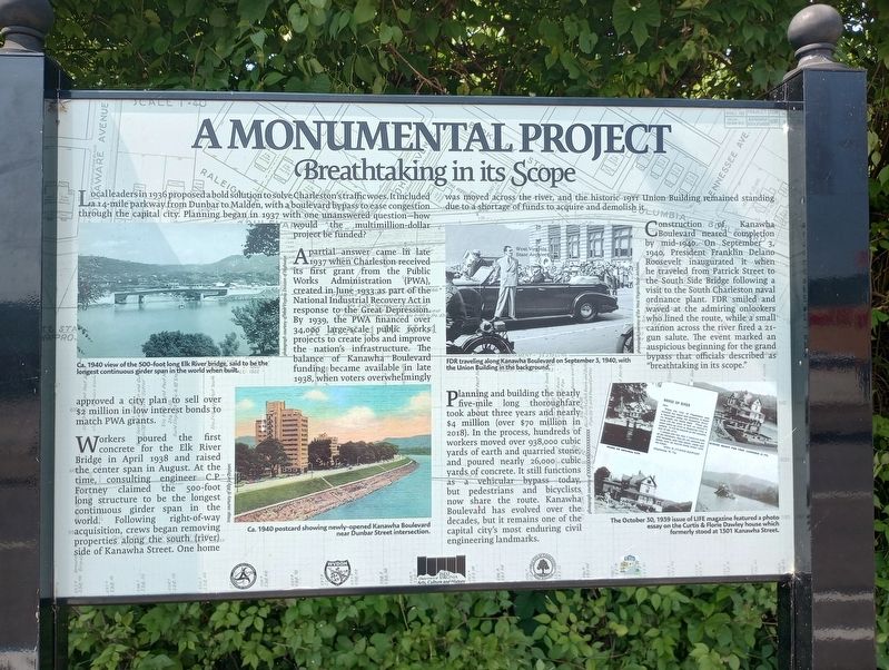
Local leaders in 1936 proposed a bold solution to solve Charleston's traffic woes. It included a 14-mile parkway from Dunbar to Malden, with a boulevard bypass to ease congestion through the capital city. Planning began in 1937 with one unanswered question-how would the multi-million-dollar project be funded?
A partial answer came in late 1937 When Charleston received its first grant from the Public Works Administration (PWA), created in June 1933 as part of the 566 National Industrial Recovery Act in response to the Great Depression By 1939, the PWA financed 34,000 large-scale public works projects to create jobs and improve the nation's infrastructure. The balance of Kanawha Boulevard funding became available in late 1938, when voters overwhelmingly approved a city plan to sell over $2 million in low interest bonds to match PWA grants.
Workers poured the first concrete for the Elk River Bridge in April 1938 and raised the center span in August. At the time, consulting engineer C.P. Fortney claimed the 500-foot long structure to be the longest continuous girder span in the world. Following right-of-way acquisition, crews began removing properties along the south (river) side of Kanawha Street. One home was moved across the river, and the historic 1911 Union Building remained standing due to a shortage of funds to acquire and demolish it.
Construction of Kanawha Boulevard neared completion by mid-1940. On September 3, 1940, President Franklin Delano Roosevelt inaugurated it when he traveled from Patrick Street to the South Side Bridge following a visit to the South Charleston naval ordnance plant. FDR smiled and waved at the admiring onlookers who lined the route, while a small cannon across the river fired a 21- gun salute. The event marked an auspicious beginning for the grand bypass that officials described as "breathtaking in its scope."
Planning and building the nearly five-mile long thoroughfare took about three years and nearly $4 million (over $70 million in 2018). In the process, hundreds of workers moved over 938,000 cubic yards of earth and quarried stone and poured nearly 26,000 cubic yards of concrete. It still functions a vehicular bypass today, but pedestrians and bicyclists now share the route. Kanawha Boulevard has evolved over the decades, but it remains one of the capital city's most enduring civil engineering landmarks.
Topics. This historical marker is listed in these topic lists: Bridges & Viaducts • Charity & Public Work • Roads & Vehicles. A significant historical month for this entry is April 1938.
Location. 38° 21.983′ N, 81° 40.008′ W. Marker is in Charleston, West Virginia, in Kanawha County. Marker is on Kanawha Boulevard West west of Stockton Street, on the right when traveling east. Touch for map. Marker is at or near this postal address: 1620 Kanawha Blvd W, Charleston WV 25387, United States of America. Touch for directions.
Other nearby markers. At least 8 other markers are within walking distance of this marker. A Growing City (here, next to this marker); Alex Schoenbaum (within shouting distance of this marker); Spicer Patrick (approx. 0.2 miles away); Baptism By Fire (approx. 0.3 miles away); William H. Davis (approx. 0.3 miles away); War At The Front Door (approx. half a mile away); Little Page Terrace Public Housing (approx. half a mile away); George W. Summers (approx. 0.7 miles away). Touch for a list and map of all markers in Charleston.
Credits. This page was last revised on July 28, 2023. It was originally submitted on July 24, 2023, by Craig Doda of Napoleon, Ohio. This page has been viewed 48 times since then and 9 times this year. Photos: 1, 2. submitted on July 24, 2023, by Craig Doda of Napoleon, Ohio. • Devry Becker Jones was the editor who published this page.

