
Coalinga in Fresno County, California — The American West (Pacific Coastal)
Coaling Station A
Photographed by Barry Swackhamer, March 22, 2013
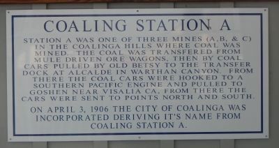
1. Coaling Station A Marker
On April 3, 1906 the City of Coalinga was incorporated deriving it’s name from Coaling Station A.
Topics. This historical marker is listed in these topic lists: Industry & Commerce • Natural Resources. A significant historical month for this entry is April 1934.
Location. 36° 8.27′ N, 120° 21.709′ W. Marker is in Coalinga, California, in Fresno County. It is on West Elm Street just east of 7th Street, on the right when traveling west. Touch for map. Marker is at or near this postal address: 267 West Elm Street, Coalinga CA 93210, United States of America. Touch for directions.

Regionally, this marker is in California’s San Joaquin Valley, specifically in the Central Valley, and in the Sierra Nevada. It is also on the American
this page online
Other nearby markers. At least 8 other markers are within walking distance of this marker: A different marker also named Coaling Station A (a few steps from this marker); Richfield Service Station (within shouting distance of this marker); Cheney Bros. Building (about 300 feet away, measured in a direct line); Premier Creamery (about 300 feet away); Amy Building (about 800 feet away); Crescent Meat Co. (about 800 feet away); Sullivan Hotel (approx. 0.2 miles away); 5th Street, Coalinga 1912 (approx. 0.2 miles away). Touch for a list and map of all markers in Coalinga.
Photographed by Barry Swackhamer, March 22, 2013
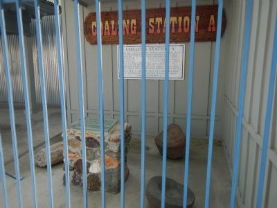
2. Coaling Station A Markers
Photographed by Barry Swackhamer, March 22, 2013
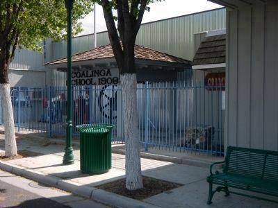
3. Coaling Station A Marker
The marker is mounted on the wall of the building to the right of the Coalinga School 1908 sign.
Credits. This page was last revised on August 19, 2023. It was originally submitted on March 24, 2013, by Barry Swackhamer of Brentwood, California. This page has been viewed 1,057 times since then and 44 times this year. Last updated on July 29, 2023, by Ronald D. (Ron) Trigueiro of Fresno, California. Photos: 1, 2, 3. submitted on March 24, 2013, by Barry Swackhamer of Brentwood, California. • Bill Pfingsten was the editor who published this page.
