Sautee Nacoochee in White County, Georgia — The American South (South Atlantic)
Corncribs & Gear House
Hardman Farm Historic Site
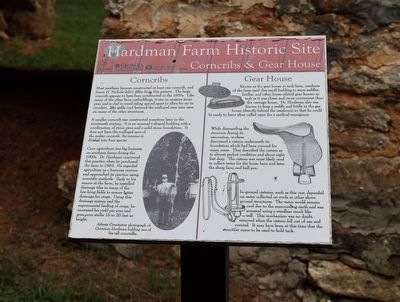
Corncribs
Most southern farmers constructed at least one corncrib, and James H. Nichols didn't differ from this pattern. The large corncrib appears to have been constructed in the 1870s. Like many of the other farm outbuildings, it sits on a massive stone piers and is clad in wood siding spaced apart to allow for air to circulate. The gable roof featured the scalloped eave trim seen on many of the other structures.
A smaller corncrib was constructed sometime later in the nineteenth century. It is an unusual t-shaped building with a combination of stone piers and a solid stone foundation. It does not have the scalloped eave of the earlier corncrib. Its interior is divided into four spaces.
Corn agriculture was big business on southern farms during the 1900s. Dr. Hardman continued this practice when he purchased the farm in 1903. He regraded agriculture as a business venture and approached its practice using scientific methods. Early in his tenure at the farm, he installed drainage tiles in many of the low-lying fields to ensure better drainage for crops. Using this drainage system and the experimental feeding of crops, he increased his yield per acre and grew corn stalks 16 to 20 feet in height.
Gear House
Known as the gear house or tack barn, residents of the farm used this small building to store saddles, bridles, and other horse-related gear known as tack as it was closer and more convenient than the carriage house. Dr. Hardman also was known to keep a saddle and bridle in the gas house (directly behind the residence) so that he could be ready to leave when called upon for a medical emergency.
While dismantling the structure during its renovation, workers discovered a cistern underneath its foundation which had been covered for many years. They described the cistern as in almost perfect condition and about eight feet deep. The cistern was most likely used to collect water for the horse barn and later the sheep and bull pen.
In-ground cisterns, such as this one, depended on water collected on roofs or other above ground structures. The water would remain cool due to the surrounding earth and was accessed using a windlass much like a well. This mechanism was no doubt removed when the cistern fell out of use and covered. It may have been at this time that the structure came to be used to hold tack.
(caption) Atlanta Constitution photograph of Governor Hardman holding one of his tall cornstalks.
Erected by Georgia State Parks & Historic Sites.
Topics. This historical marker is listed in this topic list: Agriculture. A significant historical year for this entry is 1903.
Location. 34° 41.184′ N, 83° 42.5′ W. Marker is in Sautee Nacoochee, Georgia, in White County. Marker can be reached from Hardman Farm Road, one mile north of Unicoi Turnpike (Georgia Route 17). Touch for map. Marker is at or near this postal address: 143 GA-17, Sautee Nacoochee GA 30571, United States of America. Touch for directions.
Other nearby markers. At least 8 other markers are within walking distance of this marker. Sheep Barn & Bull Pen (a few steps from this marker); The Horse Barn (within shouting distance of this marker); Hardman's Dairy Barn (within shouting distance of this marker); The Carriage House (within shouting distance of this marker); Spring and Gas House (about 300 feet away, measured in a direct line); Welcome to Hardman Farm (about 300 feet away); The Unicoi Road (about 300 feet away); Welcome to Hardman Farm State Historic Site (about 400 feet away). Touch for a list and map of all markers in Sautee Nacoochee.
Also see . . . Hardman Farm State Historic Site. Georgia State Parks & Historic Sites (Submitted on July 31, 2023.)
Credits. This page was last revised on July 31, 2023. It was originally submitted on July 29, 2023, by Sandra Hughes Tidwell of Killen, Alabama, USA. This page has been viewed 47 times since then and 9 times this year. Photo 1. submitted on July 29, 2023, by Sandra Hughes Tidwell of Killen, Alabama, USA. • Bernard Fisher was the editor who published this page.
Editor’s want-list for this marker. Wide shot of marker and its surroundings. • Can you help?
